Category Archives: buildings

Elvin

My last blog entry had me digging into some old black and white negatives. Along the way, it opened up some chapters of my life more than 30 years ago. With most of my photography shot in color, the black and white images have been largely unseen.

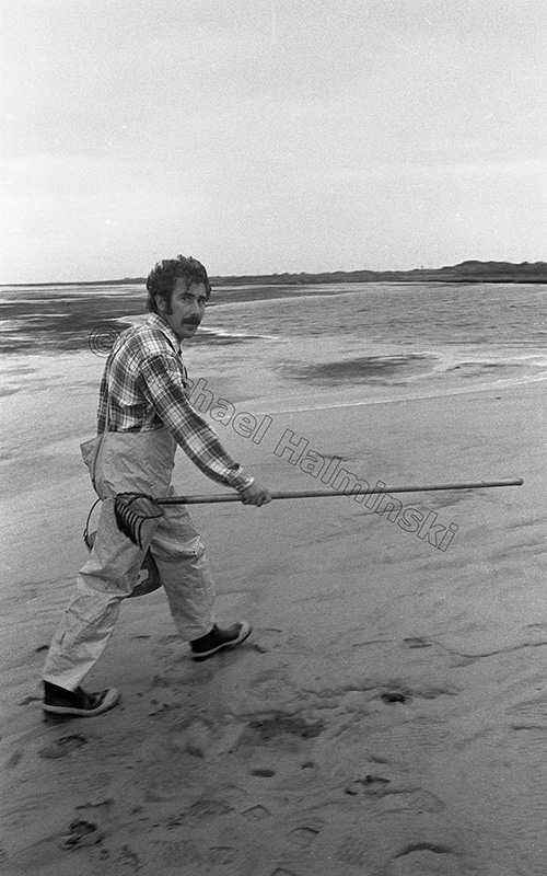
One picture that caught my attention was a negative of my friend, Elvin Hooper. At the time, I was living and working in Elvin’s home town of Salvo. There was a northeaster blowing the sound tide out, and he picked me up to go to Brick Creek to look for clams and oysters. It was rainy so I took my Nikonos waterproof camera loaded with some Tri-X film.

Elvin

I’ve known Elvin ever since I moved here.  Always a gentleman, he grew up in the village of Salvo and is a lifelong Hatterasman. The area was completely different then, he was a part of it and he loves to reminisce. He also writes, and has recently published 2 books.

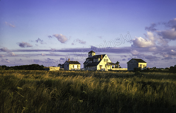
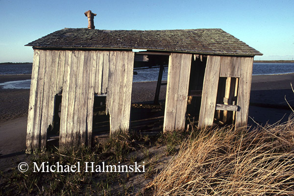
Two years ago, he called me about a cover shot for his first book. Entitled Chicamacomico How it was back then, it’s a fictional piece based on experiences growing up. We chose a Kodachrome slide that I shot of Chicamacomico Coast Guard Station in 1974. It shows a weathered building in an open field with nothing around it. That’s the way it was.

chicamacomico

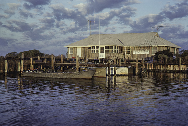
About the same time he had another book in progress, a collection of personal memories called Gull Island and Other Stories. It was just published and launched 2 weeks ago. For me, it has some personal significance in that I spent several years as a hunting guide at Gull Island Gunning Club. For that cover we picked a shot of the club house taken in 1979.

club house

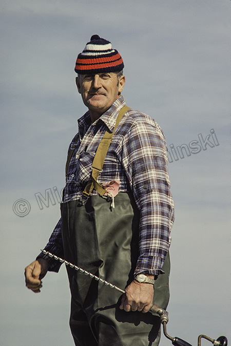
Elvin’s older brother, Burt, also worked as a guide at Gull Island. I got to know him and we became friends. We worked on lots of projects together for the hunt club, and Elvin dedicated the book to him. We used a picture of Burt that I took while we were building a duck blind in 1977.

Burt

Books are available through the author or by contacting Gee Gee at Buxton Village Books, 252-995-2420.

New Inlet

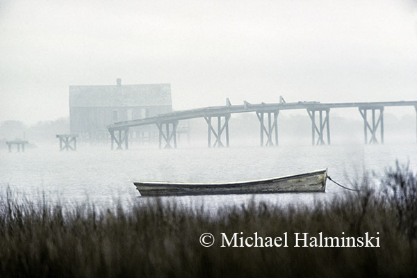
One of the first places I explored on Hatteras Island was New Inlet on Pea Island. The old remnant bridge that’s still there, was built after the storm of ’33 cut an inlet from sound to sea. As a result, traffic was interrupted on the sand road, so the state began construction of a bridge to span the troubled spot. The new inlet filled back in on it’s own, and the state halted construction before it was completed.

I used to walk out precariously on that deteriorating, unfinished bridge to catch hard crabs on baited strings. It wasn’t uncommon to come home with a few dozen nice ones. Since then, New Inlet has always brought me a feeling of wonder and tranquility.

I wasn’t the first one to get enjoyment there. Long before, there were fish camps where locals could hunt and fish for sustenance. It must have been a beautiful, bountiful outpost.

skiffOne of the first photographs that I made at New Inlet was taken in 1979 as I was testing a brand new 400mm Novoflex lens for the first time. I parked my truck on the shoulder of highway 12, stood in the bed and made 4 handheld, identical exposures to see how the lens worked. The shot later became a somewhat iconic image as the cover of Hatteras Journal, written by Jan DeBlieu.

bridgeI took a similar shot in 1982. John Herbert’s sail skiff, once again, served as a crucial element in the composition.

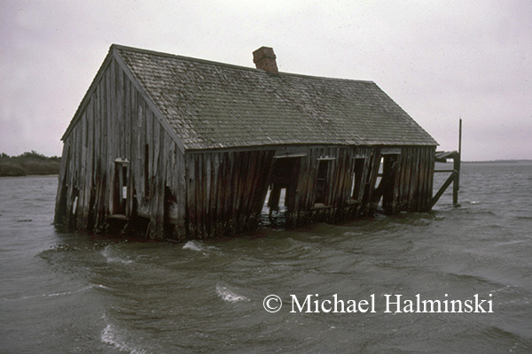
St. ClairBy January of 1985, the fish camp once owned by St. Clair Midgett had dropped from it’s foundation into the water. Later that same year, when Hurricane Gloria blasted through, it took what was left, completely away.

fish campIn May of 1985, I shot this smaller camp just northwest of St. Clair’s. It too was taken out by Gloria.


Moving Toes in the Sand

Last year Magnum photographer David Harvey asked me to help him on an assignment for a National Geographic story about rising sea level. He wanted to shoot the ocean encroaching on the Mirlo Beach subdivision in north Rodanthe, a familiar place.

The oceanfront at Mirlo has had a history of erosion for as long as I can remember, and the wave action there has attracted surfers for years. In 1984 Hurricane Josephine took out a protective dune line, and it has been a more vulnerable spot ever since.

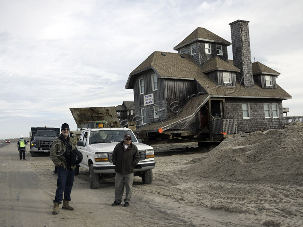
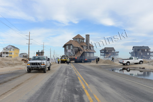
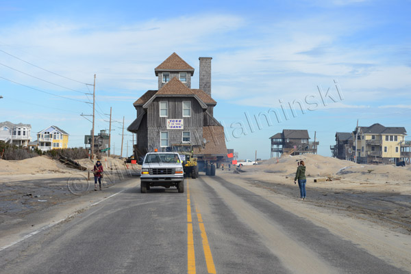
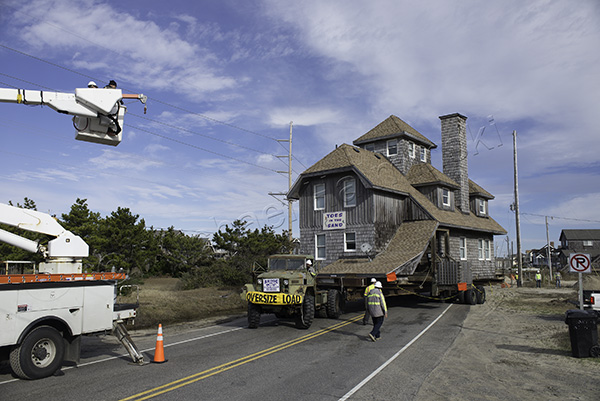
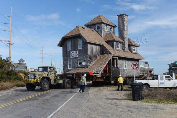
Not only has the paved highway been taken out numerous times, but some homes have fallen into the sea as well. A few homeowners have moved their buildings to somewhat safer ground. The first house to be built on the Mirlo Beach oceanfront was called East Wind. It was built by developer Roger Meekins as a spec house. Later sold to new owners, it was renamed Toes in the Sand. It became the second house to be saved on that ill-fated oceanfront. Serendipity moved in 2009, was the first.

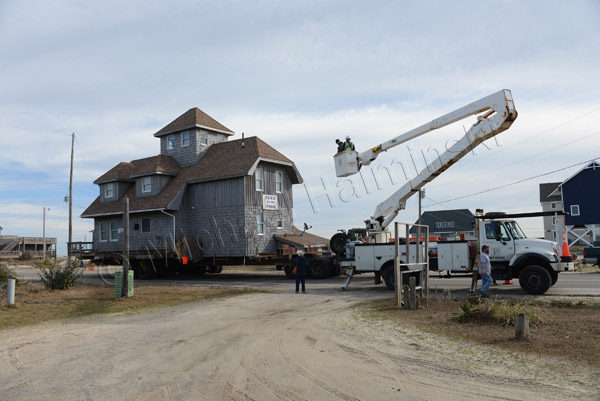
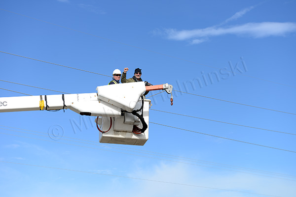
With Toes scheduled for relocation to another lot, David wanted to document it. Knowing that Cape Hatteras Electric Membership Co-op was going to be involved moving power lines, I contacted CHEMC to see if David could use of one of their bucket trucks in the process. Everything fell right into place.

David Just before the house was pulled off the beach, David waited with Carroll Midgett.

coming out With the house was underway, I drove David down the road to the bucket truck.

midwaybucket truck Once up in the air, he got the desired perspective.

up in the airbacking in Backing in was a piece of cake for Abode House Movers.

approval In the end, David was pleased.

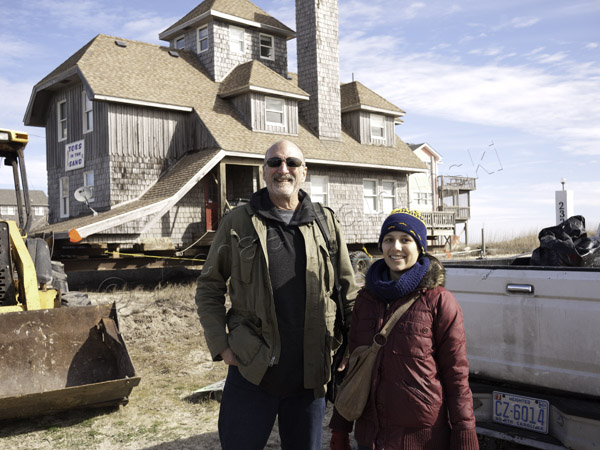
D&C After a job well done, David pauses with Candy, his assistant… before going off to Mac’s for lunch.

For a look at the story, go to this web address:

http://news.nationalgeographic.com/news/special-features/2014/07/140725-outer-banks-north-carolina-sea-level-rise-climate/?utm_source=Facebook&utm_medium=Social&utm_content=link_fb20140725news-outer-banks&utm_campaign=Content&sf3855533=1


Latest Casualty

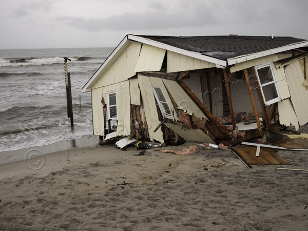
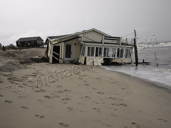
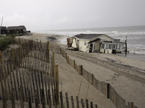
Yesterday morning I heard that the yellow house at the end of Buela O’Neal Road had just fallen on to the beach. Of the latest casualties, this is one of the older ones, a modest beach box. It may have been built in the 70’s or early 80’s. There was a light rain coming down, but I went to look anyway.

The owner had been working with local government and Park Service officials on trying to save the house. His insurance company would not help. In order to collect through the federal flood insurance program, the structure has to have been already damaged or destroyed by flood (encroaching sea) before collecting. I hope this owner was covered.

Now the remnants will be all over the beach, creating an unsightly and potentially dangerous condition. This is nothing new. It happens time and again. There is little incentive to save these imperiled structures.

There is something wrong with the system that repeatedly allows this to happen.

This is the view looking to the south toward the Rodanthe Pier. So much for our pristine beach.

The Grommet House

An accountant from Northern Virginia by the name of Myers, owned a cottage on the oceanfront in Rodanthe. It was a ramshackle place, built at a time when, if there were any building codes, they weren’t enforced much. The Myers family used to spend Summers there. Two of their kids were Worth and Gladys. They partied with the locals. In the winter, two of my friends Carlen and Dave, rented the place.

Robin and I surfed in front of it for years. It had a consistently good breaking wave and the mainstream surfers from Virginia Beach hadn’t discovered it.

A bit of a landmark, I photographed it for a period when I thought it was going to wash away. I saw the Rodanthe oceanfront nearly every day, checking the waves and exploring. What I didn’t realize at the time, was that I was also witnessing a complex process of barrier island dynamics. It fascinated me, how the beach environment reshaped with each storm.

Then the surfers from the north began coming. And as surfers will do, they name a spot after something they can relate to. From then on it was dubbed the grommet house. Grommet is surfing slang for a young or beginning surfer. In the longboard days, they were referred to as a gremmie. The Grommet House became a popular, packed out surf spot, but by then Robin and I moved on to other secret breaks to elude the crowds. We were always one or two steps ahead of the masses.

The Myers cottage gets some weather in March of 1980.

The house was still holding fast in 1982, and the beach made some accretion. The dune line in the background would later shelter a subdivision called Mirlo Beach.

The driveway got pummeled into the sand.

The ocean eventually took over, and the house fell into the sea.