Monthly Archives: September 2017

Epilogue Maria

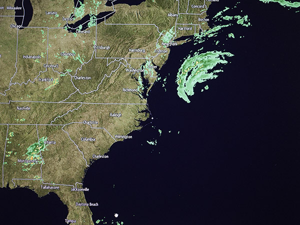
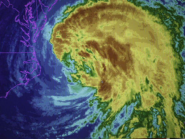
Wednesday morning my barometer was still reading 996 millibars as the center of Maria moved slowly northward offshore over a hundred miles away.

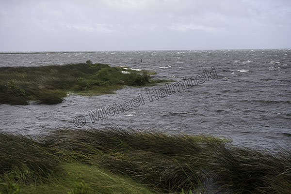
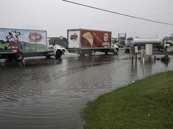
The winds shifted from northeast, north and then northwest. Already high sound tides were getting slightly higher, but not high enough to cause concern. Our neighbors in Hatteras Village and Ocracoke had more storm surge and it flooded some of their streets.

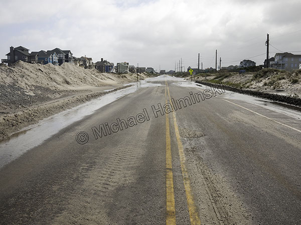
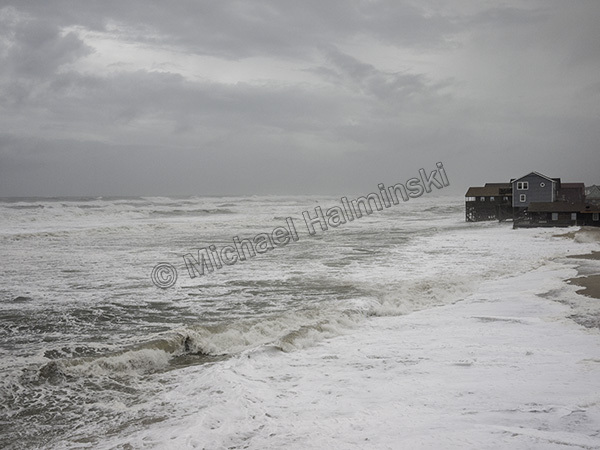
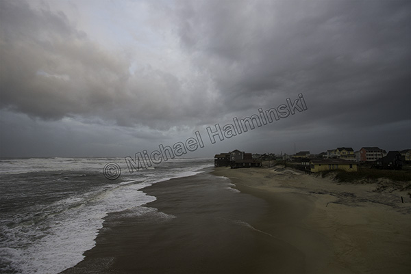
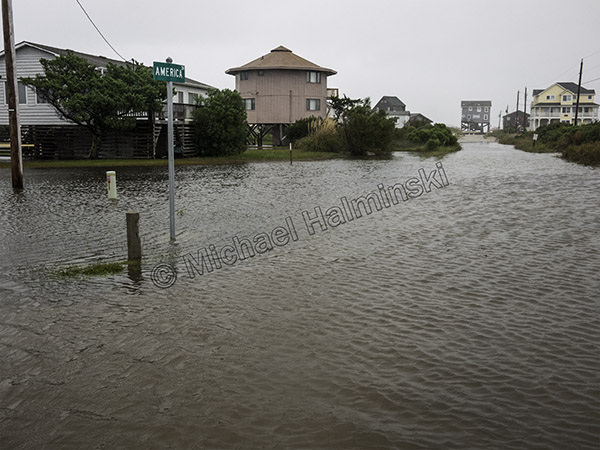
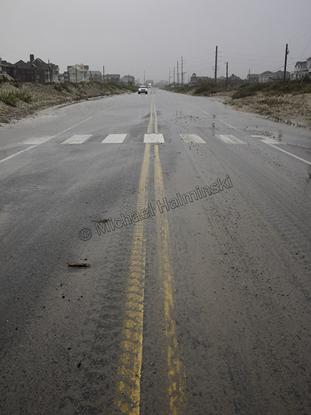
Meanwhile the tumultuous ocean wet the highway through Mirlo Beach.

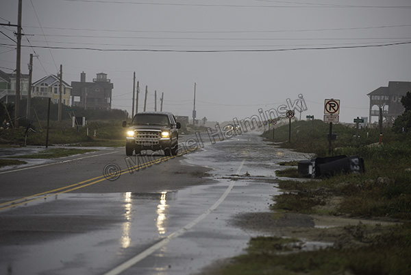
The artificial dune line north of town was keeping the highway passable.

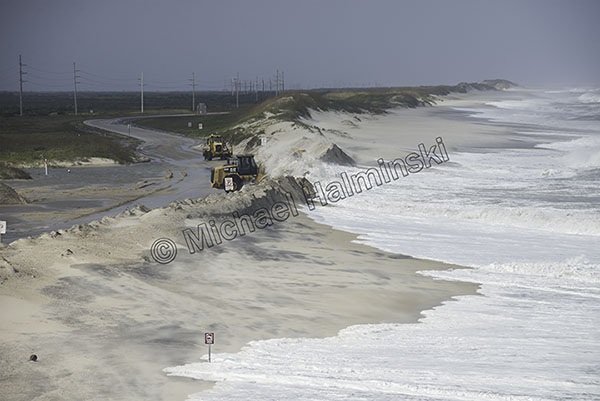
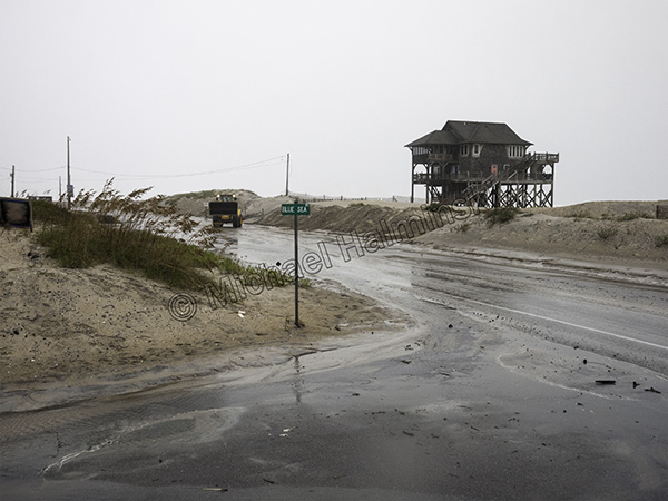
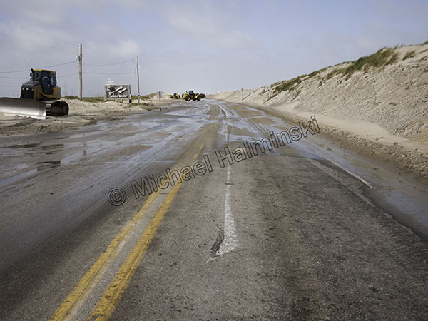
NCDOT worked frantically to keep the water from washing out the road at the S-Curve…. just barely.

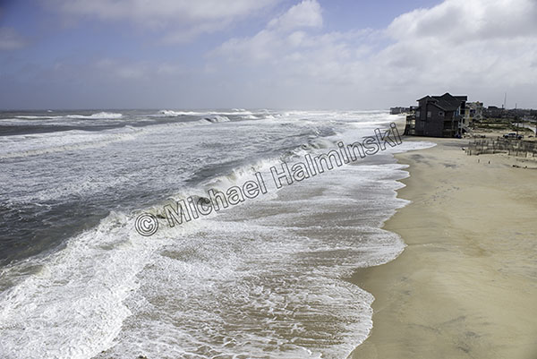
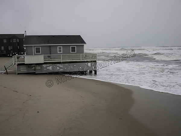
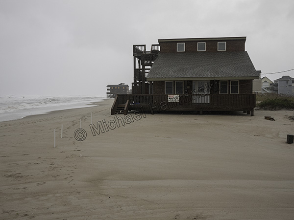
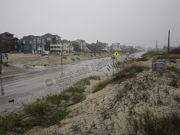
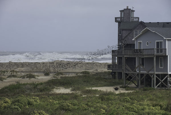
It looks like north Rodanthe survived another one.

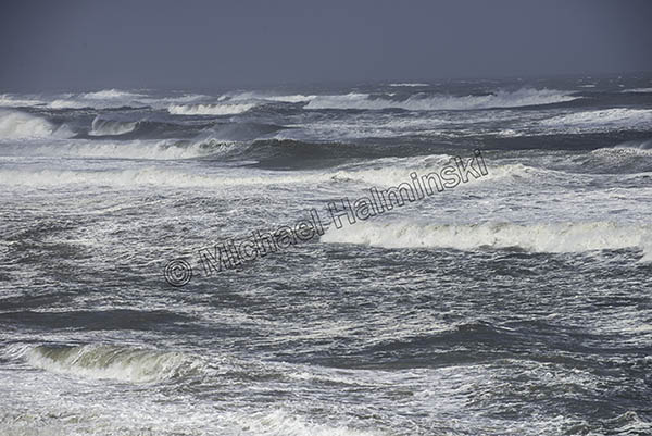
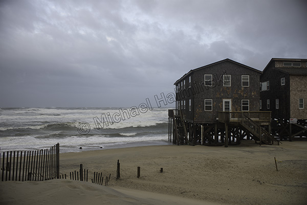
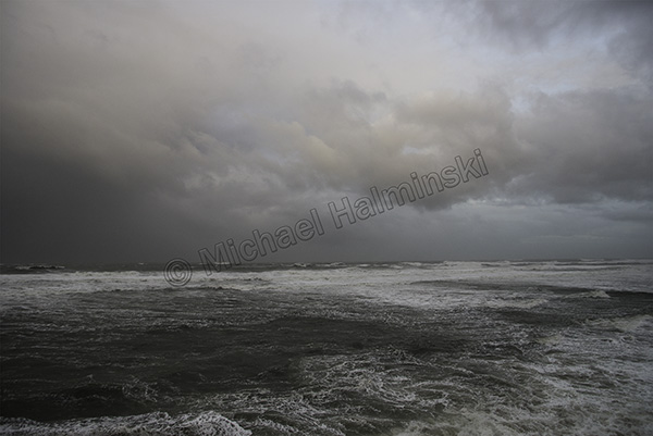
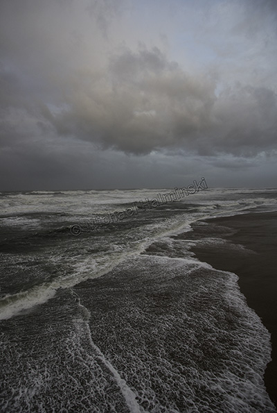
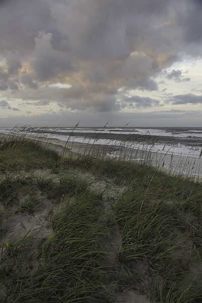
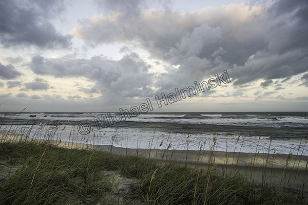
Seas were still intense yet I could see it was beginning to show signs of moderating.

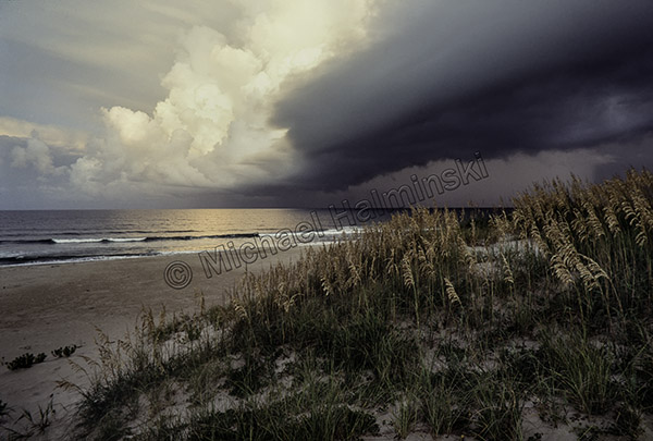
The clouds from Maria kept drifting around.

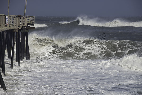
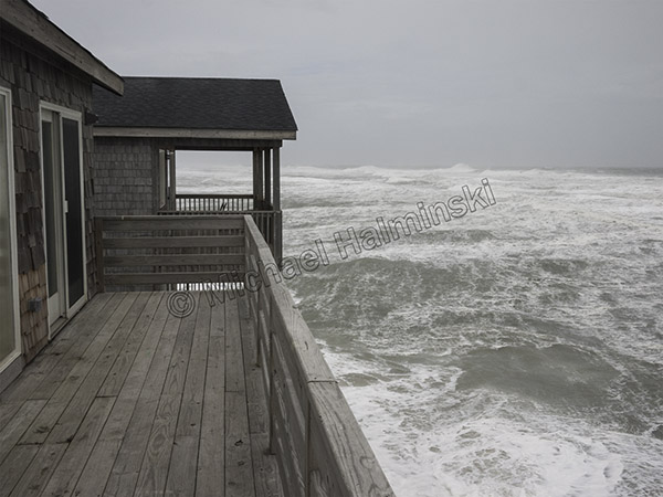
Rodanthe Pier is always a great place to view the excitement.

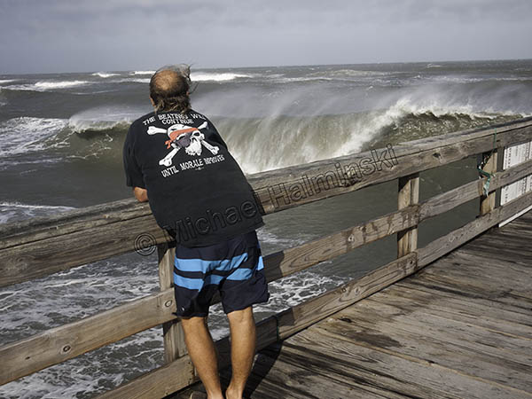
Eric and I ventured out on the shaky deck as a huge set rolled in and broke right in front of us.

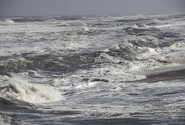
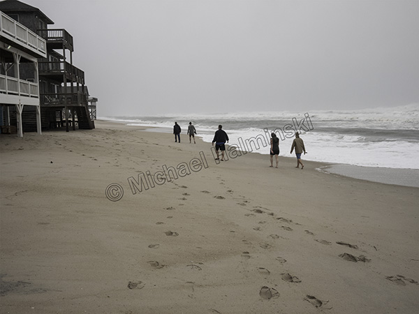
We were astonished to see a couple of teenagers body surfing in the hurricane soup… just craziness.

Having been out on the blowing beach all day, I decided to head home and wash the sand off.

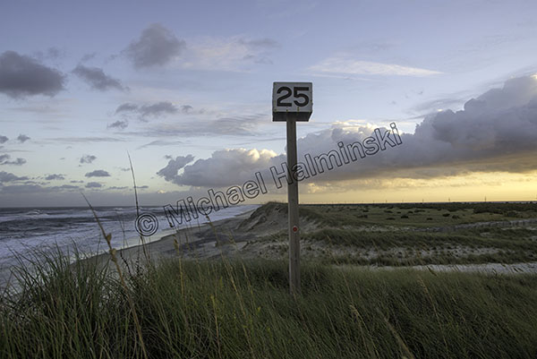
Later I drove to ramp 25 to end my date with Maria. The seas were calming down as the sun set.

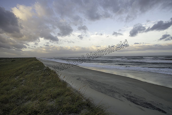
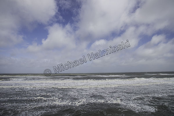
Hurricane clouds loomed in the sky.

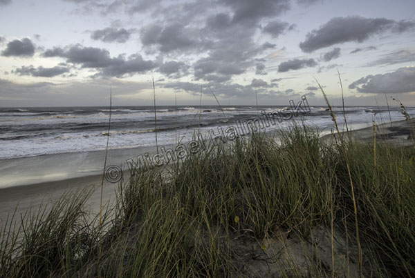
And I kept shooting the awesome environment around me.

The best hurricanes are the ones that keep their distance.


Closer Call Maria

Thankfully Hurricane Maria is forecast to go by out to sea, east of us. It should be about a hundred miles away early tomorrow morning while weakening to a tropical storm.

Nonetheless it’s a blustery day in the villages, with gigantic seas and northeast winds gusting to 40 and higher.  As Maria passes, winds should clock around due north then northwest. The switching wind is usually dramatic.

At noon the ocean off Rodanthe was already in turmoil.

The main concern on Hatteras Island will be flooding from the Pamlico Sound. I’ll post more as conditions allow.

continued…. At sundown, I went to check the north end of town again. That’s where the action is.

This evening the S-Curve is still passable at low tide.

There were some breaks in the cloud cover with intermittent rain squalls.

It was a chore holding the camera steady in wind gusts.

For maximum sky coverage, I used a 20mm lens.

In the quickly fading light, I made sure to get a vertical shot.

Tonight I’ll have my truck parked on higher ground. Tomorrow will be different.

So far, so good!

Close Call Jose

Late Summer through Fall has long been my favorite time to be on Hatteras Island. Crowds thin and weather conditions become more tropical. There are so many pluses, then tropical influences can develop into hurricanes.

I’ve always relished waves spawned from a distance. Sitting well offshore last week Jose generated some of the best surf in years. For a few of those days however, seas washed over the highway in spots and even shut it down for a tide cycle. I went to Rodanthe to investigate.

During road closures, north Rodanthe becomes a staging area for exiting traffic.

Sea water flows in from the beach and because of it’s salinity is highly corrosive for automobiles splashing through.

At the end of Surfside Drive sits another imperiled cottage.

In 1980 this beach house was 4 lots back from the oceanfront. Now look at it.

With NCDOT shutting down the main road, Mirlo Beach looked pretty empty and bleak.

NCDOT was busy working in the usual places, like S-Curves.

The oceanfront at Mirlo Beach has long been an area of high erosion rates. Homeowners there are certainly in a real estate bind, and with another storm named Maria coming, things are likely to get much worse.

I couldn’t resist a self portrait opportunity and wondered if this porch swing would still be intact next week, after Maria sweeps by the Outer Banks.

Hurricanes are a fact of life here and although we tend to compare some storms to others, they are unique unto themselves. The ones that pass well off the coast can be beautiful and dramatic, with spectacular skies.

In 1991, I made this photograph of the leading edge of Hurricane Bob as it approached Cape Hatteras. An evacuation had been ordered and the following day we experienced gusts near a hundred with the eye going by about 25 miles offshore.

With Hurricane Maria, about 300 miles to the southeast, we’re under an evacuation order. Tropical storm and storm surge warnings are up. Now it’s a waiting game.