Monthly Archives: July 2009

A Fascination for Flight


I grew up in a Navy family that traveled to new tours of duty every couple of years. Many of those stations required transportation in propeller powered military aircraft. So my fascination for flight began at an early age. I always wanted the window seat. As a nine year old, I distinctly remember flying across the Pacific Ocean to the island of Guam. How I loved peering out of the window at the ocean and islands below!

Today I still hold that same fascination for flight with aerial photography. After Hurricane Isabel in 2003, I made seven flights over Hatteras, Ocracoke and Portsmouth Islands. I wasn’t interested in the destructive power of the storm. Instead I wanted to see and document how nature constantly shapes the Outer Banks.

Last year, parts of the beaches of our National Seashore Park were closed due to bird nesting, including the Cape Point of Hatteras Island. I’ve photographed the Point from the air before, but only with off-road vehicles on it. My intention last Summer was to fly and shoot it’s more natural, pristine state, but I procrastinated and suddenly the point was opened to traffic and I missed my chance.

This year I put it off again until July 26th when I called my good friend and pilot Dwight Burrus. Dwight and his wife Debbie operate Burrus Flying Service out of Billy Mitchell Airport in Frisco. I’ve flown in his beautiful red and white 1971 Cessna on numerous occasions, and I can’t say enough about his expertise. I tell him what I’m looking for and he takes me there, every time. It’s almost as if I’m flying the plane myself. Dwight was raised on Hatteras, and knows the coast and it’s steeped history well. I highly recommend the tours of Burrus Flying Service. Call them at (252) 986-2679 or visit the web site for more information. Tell them I sent you.

Let me show you what I saw on this latest flight, looking down on the scenery below.
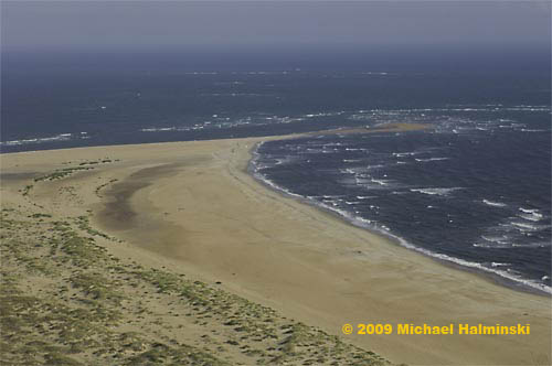
 

cp-south                      Looking out to Cape Point from the south or “the hook” side.
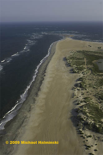
 

cpnorth                                                         Looking toward the point from the north beach.
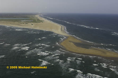
 

cpsoutheast3

cpsoutheast22                                                            Looking toward the Cape Hatteras Lighthouse from over the Point.
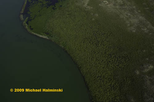
 

cppond                                The shoreline of the pond at Cape Point.
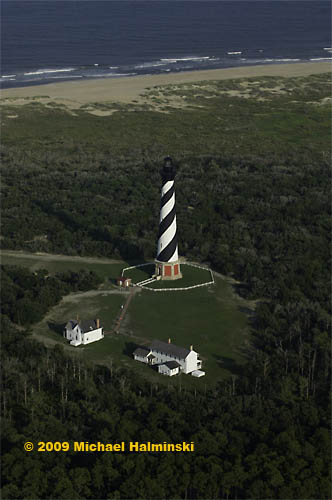
 

lighthouse2                                                          No flight is complete without a lighthouse fly-by.
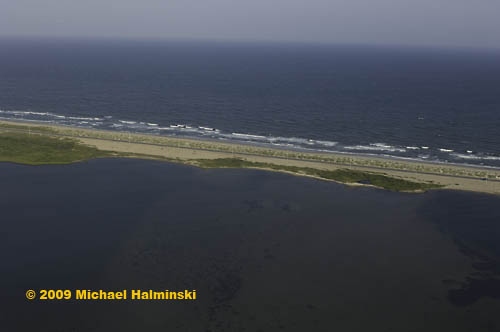
 

isabel-inlet                       This is the site of the inlet that was cut by Hurricane Isabel.
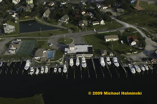
 

marlin-club                          The famous Hatteras Marlin Club in Hatteras Village.
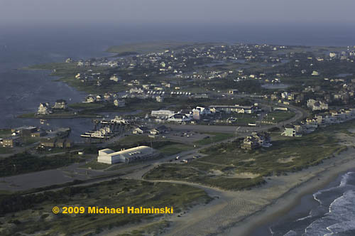
 

hatterasvillage                The south end of Hatteras Village at the ferry terminal to Ocracoke Island.
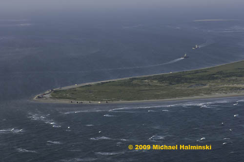
 

hattsouthpoint                   The south point of Hatteras Island at Hatteras Inlet looking to Pamlico Sound.
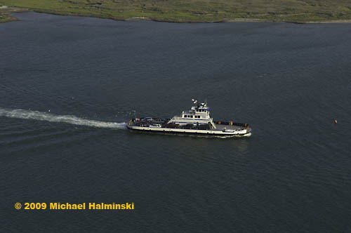
 

ocracoke-ferry                 The ferry, Chicamacomico, en route to Ocracoke from Hatteras.
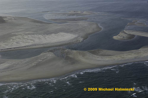
 

uscgstation                     The north end of Ocracoke Island at the site of the former Hatteras Inlet                    Coast Guard Station. The station was destroyed in storms. All that remains                    are the pilings. This illustrates the lack of stability of barrier island systems.
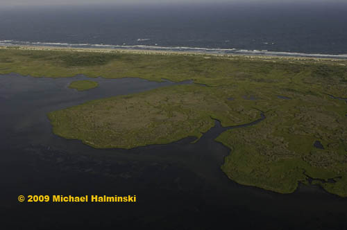
 

oislandbackside                                       Ocracoke Island from the sound side.


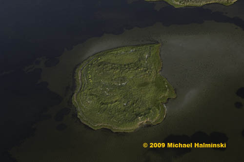
island-marsh                               An island in the sound behind Ocracoke Island.
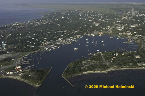
 

silver-lake                             Silver Lake surrounded by scenic Ocracoke Village.
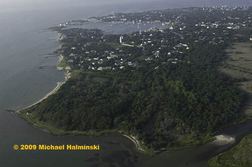
 

springers-point                            The beautiful maritime forest at Springer’s Point on Ocracoke.
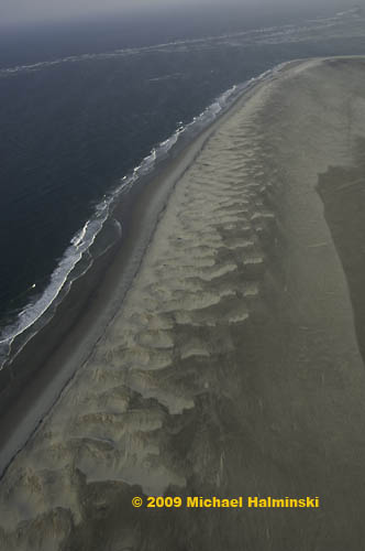
 

o-beach                                                       The untouched beach at Ocracoke’s South Point.
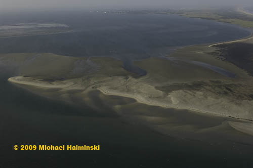
 

o-inlet-bar                       A sandbar where Ocracoke Inlet meets the Pamlico Sound.
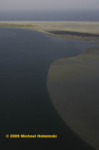
 

o-inletbackridge                                                       An underwater sand ridge extending into Pamlico Sound from Ocracoke Inlet.
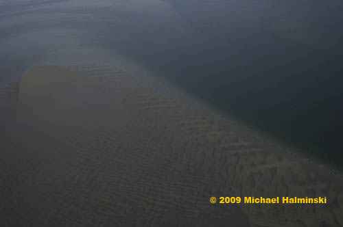
 

o-sandbar                            A sandbar in the Pamlico Sound near Ocracoke Inlet.
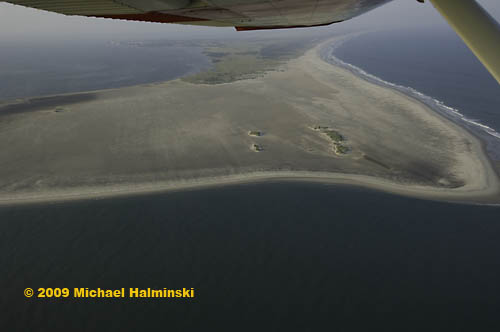
 

o-inletwing                              Dwight’s Cessna banking over Ocracoke Inlet for a shot at the                                                 untouched South Point.
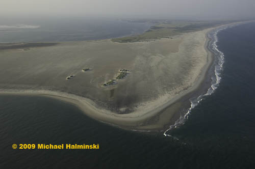
 

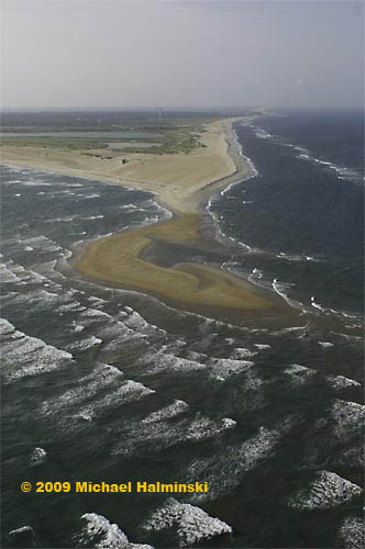
o-inlet-mouth                    The South Point of Ocracoke in a pristine state from 1,000 feet.
Elusive Beachscapes

I’ve been struggling with photography most of my adult life. Don’t get me wrong. Making photographs has brought me a lot of satisfaction, not to mention a livelihood. But working to get better at any skill requires repetition and, pardon the pun, focus. From the very beginning, my approach was to be personally involved in the entire process from visualization, clicking the shutter, and ultimately hand-developing the print. I wasn’t formally educated as a photographer, but instead chose to deal with it on my own terms… teaching myself, getting inspired, going out and shooting, making mistakes, reshooting, printing…. making mistakes, printing again. 

Take beachscapes for example. It’s a hit or miss. I can’t count the number of times that I’ve gone out in search of a great shot on the beach, only to be disappointed when editing later. Circumstances are never the same, never repeating. There are so many aspects in the equation…. the weather, the light, foreground and background, composition, not to mention the perspective that different lenses allow. It’s difficult, if not impossible to convey the reality that I feel, into a two-dimensional image. The scenery can be emotionally overwhelming. And all I can do is try to get as close as I can. It can’t be forced. It just has to happen.


dunes-storm-surf

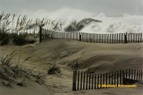
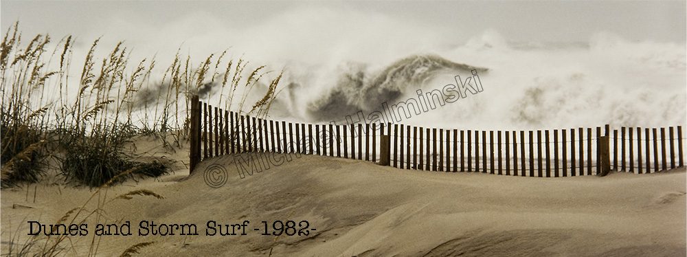
Dunes and Storm Surf  is one of my favorite shots taken in 1982. I’ve frequently used this as a model for other attempts at stormy beachscapes, but I’ve never even come close to this kind of impact. Here I learned to compress the background wave energy into the foreground, using a small telephoto lens. In this case, it was a Nikkor 135mm lens and my preferred film, Kodachrome.


sea-oatsss

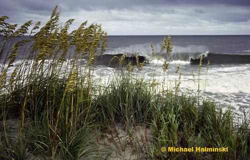
A second example of bringing the wave energy close to the viewer was shot from on top of a dune at the infamous “S-Curves” north of Rodanthe. This time, the wave was actually breaking close to the dunes, so I only needed my trusty, super sharp 55mm Micro-Nikkor to make this image. Again shot on Kodachrome, I have always loved the texture and color in the foreground. This image was made in 1984, when there was still a relatively natural dune line in place. It was only a few weeks later, I was shooting huge waves generated from Hurricane Josephine from this very same vantage point. Unbeknownst to me at the time, a big one struck the base of the dune, surged upward 15 feet and engulfed me and my Nikon F2 with sea water. The camera survived somehow, but the photomic meter and viewfinder had to be replaced.  This image sold very well for me, and is called Sea Oats and Storm Surf .


sea-oatscold-front

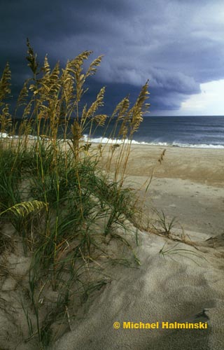
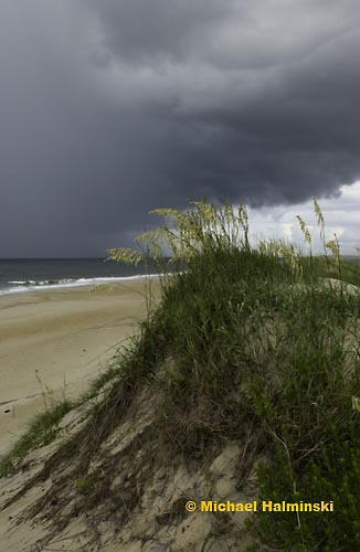
Most of my beachscapes are horizontally composed, but sometimes it’s good to rotate the camera 90 degrees for a vertical shot. Successful verticals can be very strong visually, so it’s always worth a try. I call this image Sea Oats and Cold Front. It was taken in 1986 when I began to experiment with Fujichrome Velvia. I used a 28mm lens for this one.


before-the-storm

In 1991, Hurricane Bob was heading up the coast. An evacuation was executed on Hatteras Island. As I recall, it was packing winds of nearly 120 mph, and I decided to ride this one out. As I drove north in the fleeing traffic to Pea Island, the sun was setting and the leading edge of the storm clouds was beginning to close in. The sky was spectacular. As I photographed this image, the cars on highway 12 were lined bumper to bumper trying to get off the island. The eye wall of Bob ended up passing us only about 15 miles offshore, and our winds gusted to 100. The folks in New England didn’t fare as well as we did. They got slammed. This one is called Before the Storm. It was taken using my 28mm Nikkor on an F3 body and Velvia film.


october-beach

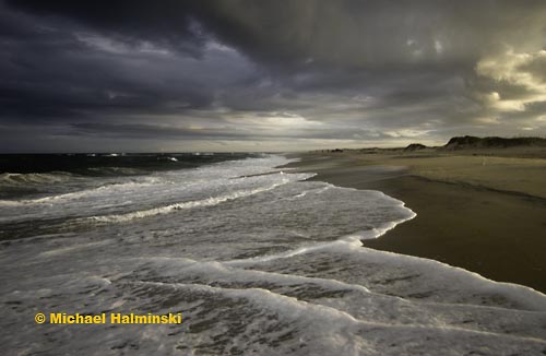
October Beach is one of  my more serene beachscapes. It was taken in 2004 with no film. I had entered the digital photography age in 2003. After trying to master image processing for 30 years, I had to re-teach myself the basics of  imaging once again.


summer-squall

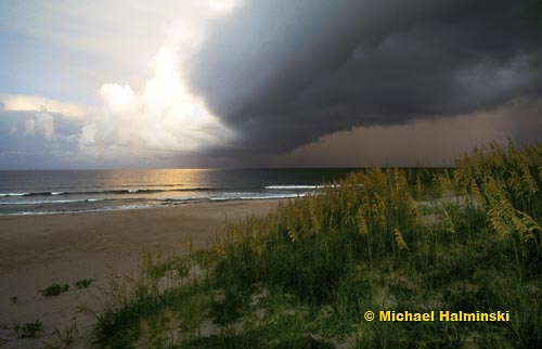
On August 8 of 2005, I peered out of my studio to see some unusually interesting cloud formations moving in from the southeast. This is also a month when the tassels on the sea oats are fresh and new. Most of the out-take photos of this scene were shot as horizontals. However I remembered my rule of turning the camera to a vertical position, and liked what I saw. This is called Summer Squall.


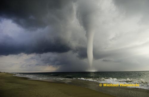
waterspout

It always helps to have a waterspout offshore. On the morning of August 23 of 2005, I stepped out on the deck of my studio/home in Waves and saw a column of water reaching into the sky. I’ve seen this before, but never in my many years living on Hatteras was it so well presented.

For my photograph to be successful, the image has to satisfy me, nothing more. I’ve tried replicating some favorite shots, and it usually doesn’t seem to work as well as the original model. So I keep trying, and eventually something good happens. 

For many years in the darkroom, and now on a computer screen, I transfer that image to a print, still another “make or break” step in the process. If I didn’t make my own prints, I’d feel like I was short changing myself. I have to complete the entire process myself, in order to be the photographer that I am.