I’ve lost track of time since Irene struck and flooded our villages more than six weeks ago.
There’s been a lot of cleaning up, and that should continue into the coming months and throughout the winter.
It’s been an emotional roller coaster, and I’ve been preoccupied with multiple tasks while trying to document life here, as I go. Of course, the newly cut inlet at Pea Island has had my curiosity the entire time.
So on Saturday, I saw the affected areas for the first time with my favorite pilot, Dwight Burrus of Hatteras. He owns and operates Burrus Flying Service, and I highly recommend his expertise in flight as well as his knowledge in local lore and history.
Here is some of what we saw the other day.
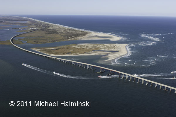
Bodie Island spit on the north side of Oregon Inlet has been split in two, while the navigation channel has been scoured to an increased depth.
The west dike at the north pond impoundment of the Pea Island refuge was breached by the storm surge.
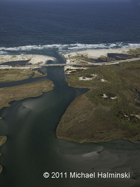
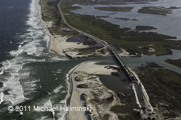
Of course, Irene Inlet has been the talk of the town. This is one of the key spots where the pressure of the surge from Pamlico Sound was released.
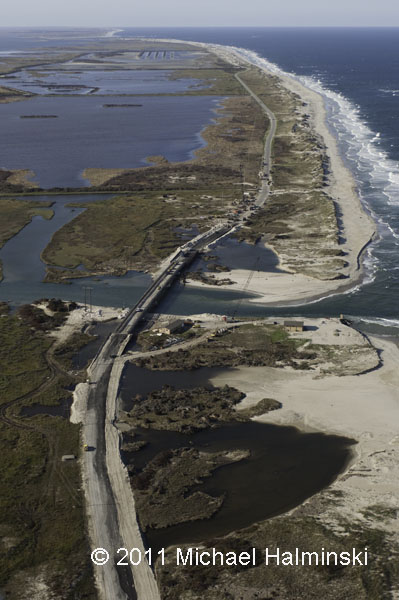
HIghway 12 looking north towards the wildlife refuge impoundments and Oregon Inlet.
Looking west toward Pamlico Sound. Before the inlet was cut this coastal marsh was a prolific haven for marine life. With the flow of water in and out, it will be interesting to see how it adapts.
A quarter mile to the south of Irene Inlet is New Inlet cut in the storm of 1933. Still visible in the top of the picture are the remnants of the bridge that was never completed, as that inlet naturally filled back in.
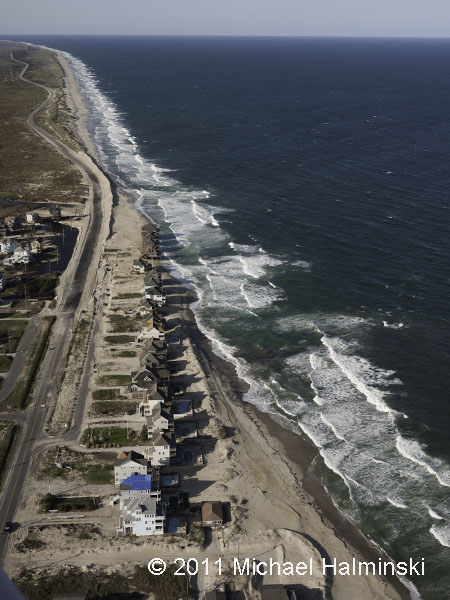
My advice is not to buy oceanfront property at Mirlo Beach. It’s a loosing battle, for sure.
Looking north to Pea Island, the Mirlo Beach oceanfront is very unstable. The long, winding road beyond runs through the wildlife refuge.
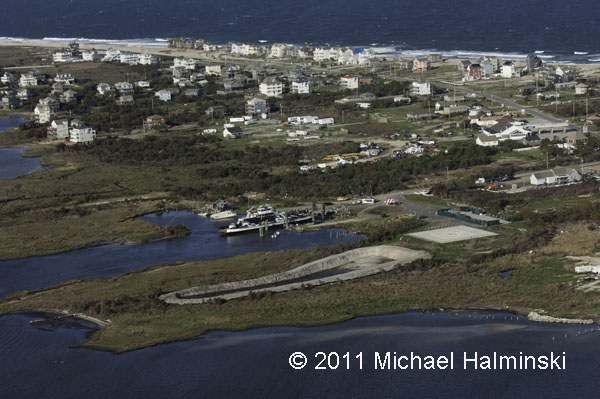
The NC Ferry System has been the only link to the mainland for several weeks. Next to the ferry terminal on the right side of the picture is the community building that became instrumental in providing for the needy citizens of the Rodanthe, Waves and Salvo.
The National Park Service Day Use Area south of Salvo has become the landfill for all the debris collected since the storm. The Farrow family cemetery, which was damaged by the storm, is at the lower left. The road at the top of the photo is the entrance to ramp 23 beach access.
The debris piles are much larger than most of the houses in the villages.
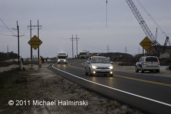
This afternoon about 6:00 they opened the new temporary bridge, allowing visitors to enter the island once again. There was relatively little fanfare, some media coverage, and I could hear some vehicle occupants cheering as they rolled across the new bridge.
It’s going to be interesting to see how well this works out in time. What will the natural elements throw at highway 12 next….. and when?
