Category Archives: aerial photography

Down Under Down

Over the years I’ve seen restaurants here come and go. Some fail faster than others, and it’s not an easy business to achieve success. It’s about quality, quantity and customer satisfaction, among other things.

One of the most successful restaurants in our town was started at a location where several other restaurants had come and gone. The Rodanthe pier complex had reincarnations of restaurants in the same building with names like Cross Currents, Under Currents, JL Seagull and Down Under. There were others prior whose names have escaped me.

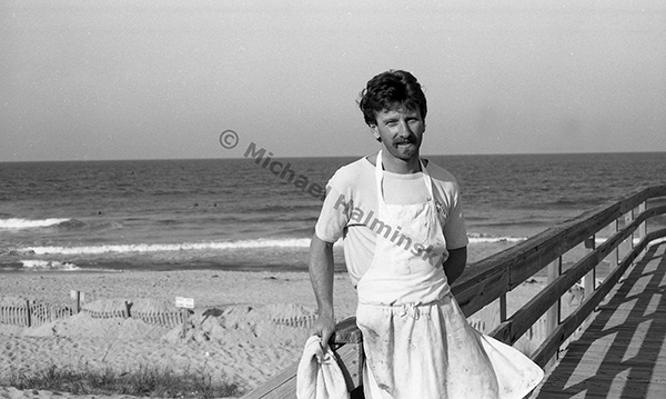
Undoubtedly the most successful was the Down Under, founded by Skip and Sheila Skiperdene. The name was coined by Australian ex-pat surfer Skip, who married Sheila a North Carolinian, and they began the Aussie-themed restaurant. It took a year or so to catch on, but with planning and hospitality it became hugely popular. Most summer evenings had dozens of patrons lined up outside the front door waiting to be seated. This went on for about ten years, when personal circumstances ended the epic run of Down Under circa 1999.

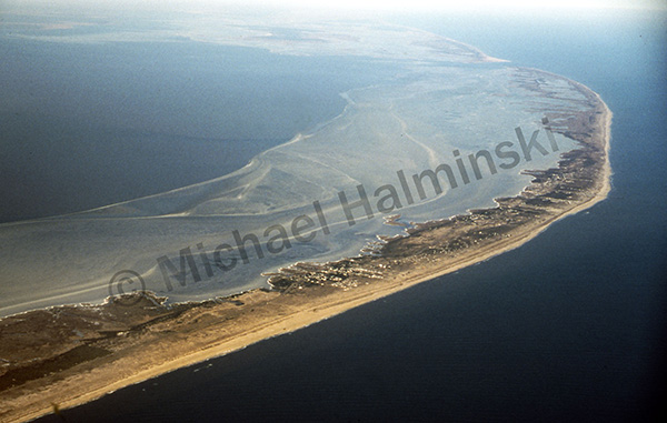
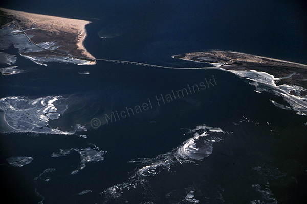
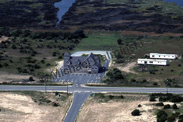
This 1989 aerial photograph shows the pier complex, including the restaurant building under the arrow. The proximity to the ocean made a dramatic venue for diners, but also contributed to it’s demise.

An aspiring restauranteur then bought the trademarked name and stepped in to continue to operate the business. Something however was missing and the restaurant was not quite the same. A few years later, things really went south when Hurricane Isabel pummeled the property.

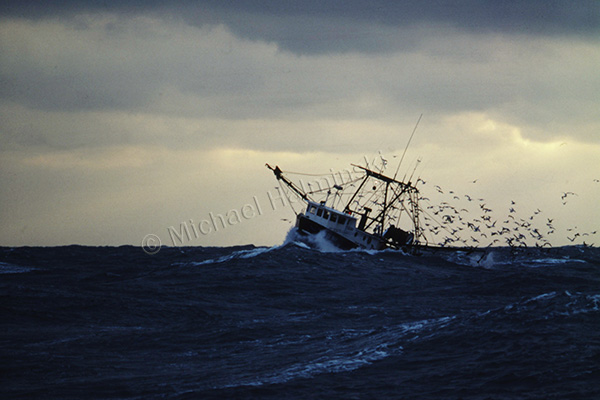
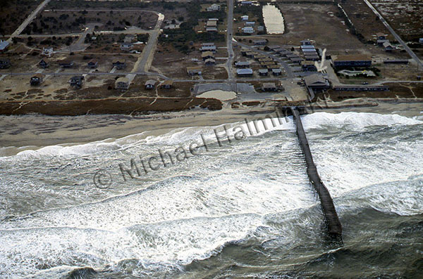
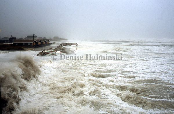
After continuous battering from high seas, storm surge from Hurricane Isabel finally took it out in 2003. This photograph taken by my wife, was probably the last shot ever taken from the upper deck of the restaurant. It was a harrowing experience.

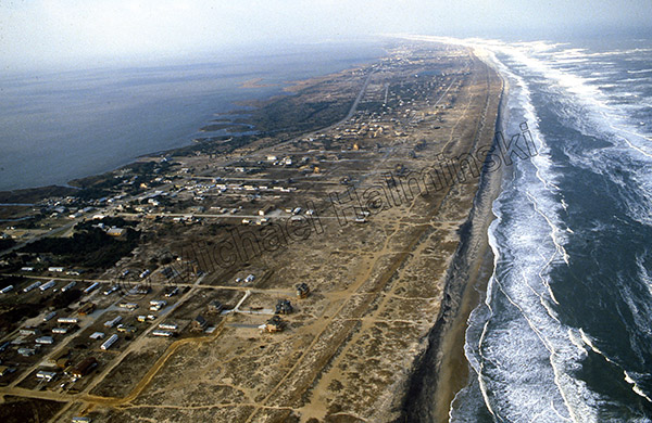
An aerial image shows the newly built Gallery restaurant circa late 1980’s. It featured local art, and a home-grown herb garden. The Gallery made national news when a man died from eating bad tuna there, ending that venture.

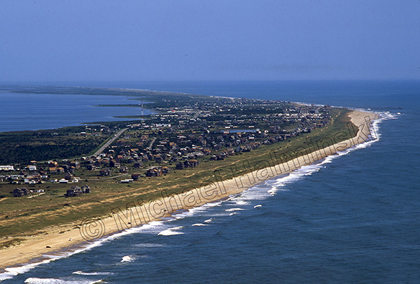
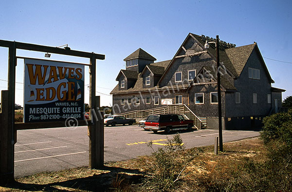
The Gallery was sold to a new owner and renamed Waves Edge. They employed local chefs preparing great meals. This 1991 photo was taken during their hey-day. It was popular with locals and visitors alike. That lasted until personal issues forced another sale, this time it was changed to Blue Water Grill, featuring an upstairs wine bar.

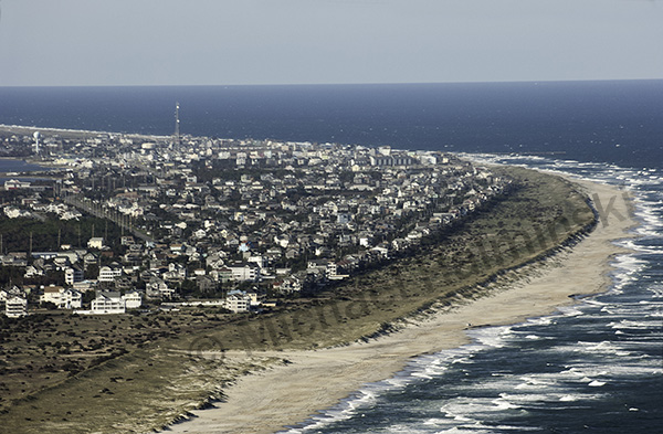
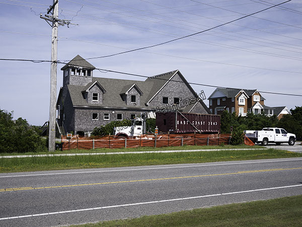
The new Down Under owner wanting to sustain the business, bought the building in Waves that had previous lives as The GalleryWaves Edge, and Blue Water Grill.

The new Down Under struggled for several years and eventually landed in foreclosure. It sat vacant and unmaintained a few years until it was bought by an adjacent property owner then demolished on June 27, 2017.

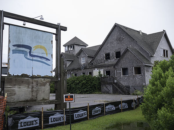
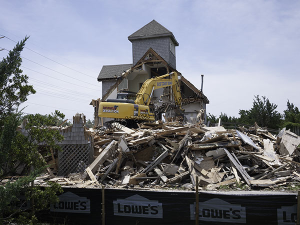
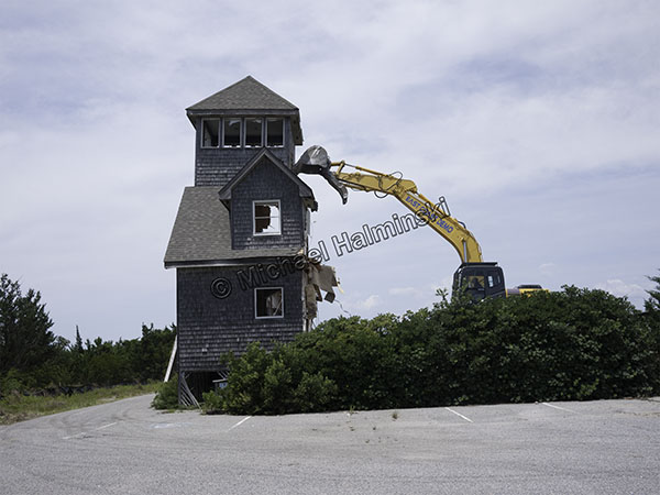
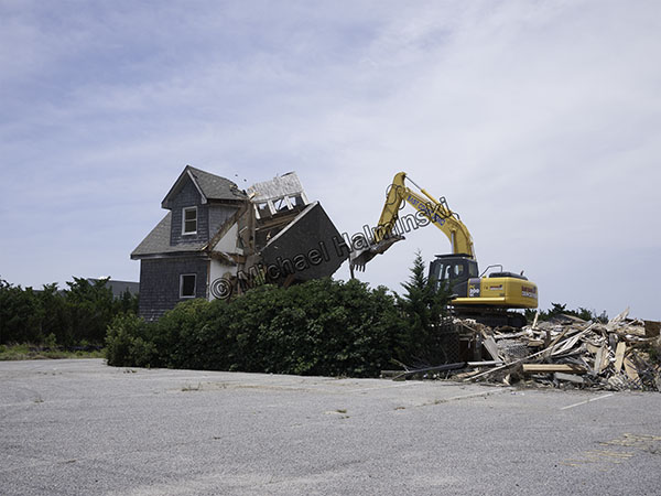
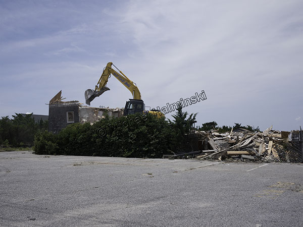
Going, going… pretty much gone!

Down Under is history. And it all began with Skip.

Bird’s Eye View of the Tri-Villages

Last month I had a request for an aerial photograph of the tri-village area. That got me digging into some old images. Views from above are dramatic and show how isolated we are, surrounded with water.

In January of 1985, we had a severe cold snap, and the Pamlico Sound froze out as far as one could see. It was frustrating to photograph from land, so I hired a pilot to take me up to an elevated vantage point. That was the first time I did any aerial photography.

1985The spectacular view of Rodanthe, Waves and Salvo from 7,000 feet showed the massive ice flows in Pamlico Sound.

1989Later during a 1989 northeaster, I shot from 1,000 feet over Salvo.

1991While airborne in 1991, I made some fair weather photographs of the village.

2011My latest aerial shot with a similar perspective was taken in the Fall of 2011.

My how this place has grown!

Wettest Place on Earth

At times I’ve thought I live in one of the wettest places on the planet. That’s when we have flooding from storm surges, and not so much from rainfall.

With over 450 inches of measured annual rainfall, a place I visited recently is arguably the wettest place on earth. There was a good reason to be there and that’s another story.

On this trip Denise and I flew in a helicopter around the stunningly scenic island of Kauai. Ben, our pilot took us into the huge three sided crater of Mount Wai’ale’ale’. Billed locally as the wettest spot on earth, there were clouds hovering all around, and we could feel the cool moisture inside the cockpit.

Entering the crater was dramatic.

going in waterfall

Vertical walls were streaming with water.

wall

waterfalls

On the side where multiple waterfalls drop thousands of feet, is The Wall of Tears.

wall of tears

Mahalo.

Oregon Inlet

We hear a lot about Oregon Inlet, and the bridge spanning it. Nowadays you can hardly talk about one without mentioning the other. It’s nothing new and has been an issue for a long time.

When I first came here, driving over that beautifully curved bridge across the inlet was an awesome experience, the vistas remarkable. It was sort of an environmental work of art that served a purpose, getting to and from Hatteras Island. I would eventually learn that it was a bit more than that.

trawlers

In April of 1977, while driving to Nags Head, I watched 4 trawlers coming in through the well-marked channel. There was no traffic and I had just gone over the peak of the bridge. I stopped overlooking Bodie Island spit, got out and took one shot with a 400mm lens on a fairly new Nikon F2.

aerial

In January of 1985, we had a severe cold snap. Temperatures were low enough to freeze portions of the Pamlico Sound. I was so impressed that I hired a pilot to take me up and shoot the ice flows from above. We ascended to 7,000 feet, and the view was spectacular.

bailey boy

December of that same year, I was shooting a story on commercial fishing for Outer Banks Magazine. Arrangements were made for me to spend 3 days on a trawler from Wanchese, where Captain Terry Saunders welcomed me aboard the Richard Wayne”. There were 2 days of fair weather, but when a northeaster set in on the third day, the boats decided to come in early. Crossing the bar at the mouth of the inlet was rough, and Captain Stevie Daniels maneuvered “Bailey Boy”  through, right behind us.

station

I flew during a northeaster in 1989 and made shots along Hatteras Island. There was no jetty in place at the inlet yet, and the Coast Guard Station was beginning to wash away. At the time, they were abandoning the station and moving to a newly built facility on the north side, next to the Oregon Inlet Fishing Center.

bridge

No recollections of Oregon Inlet would be complete without mentioning the October 1990 incident of a dredge taking out 400 feet of Bonner Bridge. I made this shot that December riding the ferry across the inlet when repairs were being made.

aerial '05

On an overcast September day in 2005, I went airborne with a videographer shooting a documentary on rising sea level. The section of the bridge that was taken out in 1990 is noticeable as a darker shade of gray in the pavement.

Irene

Hurricane Irene radically reshaped Oregon Inlet in 2011.

The only inlet on the east coast facing northeast, Oregon Inlet was originally formed in 1846. Since then, it has migrated over 2 miles south. Watching the area change and shift over the years continues to be fascinating. It’s a display of man’s engineering prowess in the face of some of nature’s most powerful forces. It’s also very expensive.


Toes in the Sand

This almost looks like the remains of a relic village from a past civilization. The sands of Cape Hatteras hide many old secrets, like the Lost Colony, shipwrecks and ancient forests. In reality, this is the severed foundation of the first house built on the oceanfront at Mirlo Beach.

As I recall, it was constructed around 1985 and was named East Wind Station. There was a healthy dune in place, and life was good.

It was renamed Toes in the Sand when it was sold recently to a new owner. My 1991 aerial photograph shows East Wind Station sitting behind a lush dune. It’s the house with the brown roof, just left of center.

Today, life is not so good at Mirlo Beach. Property continues to wash away, and Toes in the Sand is being prepared to be pulled to a location that is a little more secure. It’s fate rests on steel I-beams with wheels, on the side of highway 12 .

In the meantime, stormy seas sweep over the beach with regularity. The road is often impassable at times of high water. So when you drive down, it’s best to come at low tide.