Category Archives: storms

Jim Cantore Sighting

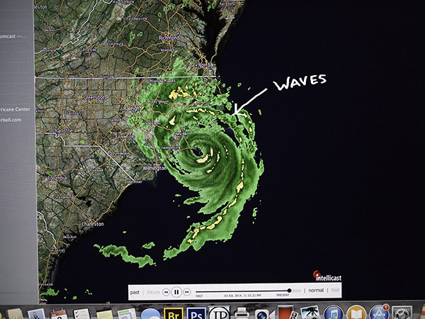
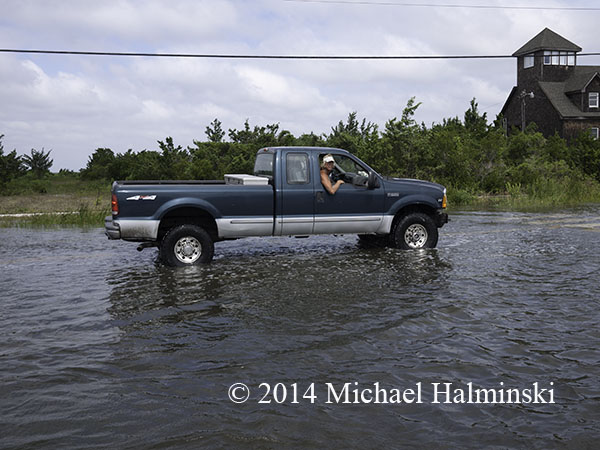
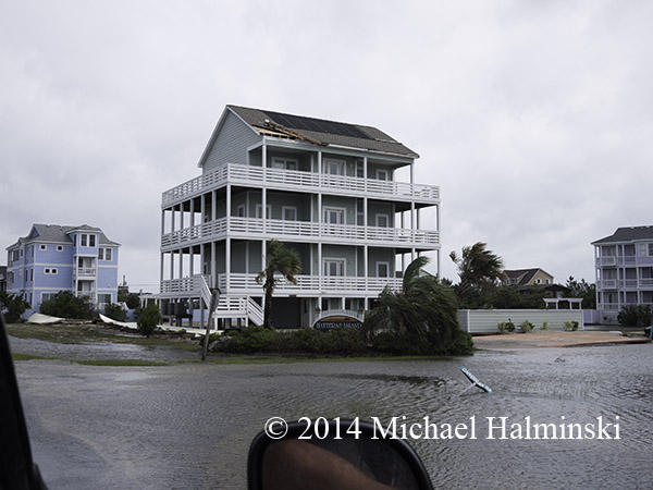
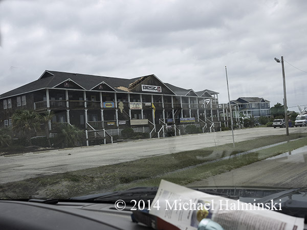
I’ve never had a 4th of July celebration quite like this year. It came with a big bang. Hurricane Arthur was a little too much, too soon. Winds began to really wail at around 2 in the morning, and by 4 or so they were approaching, possibly exceeding 100 mph. I drifted in and out of sleep, winds buffeting the roof over my head.

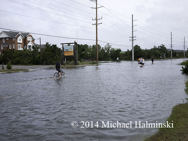
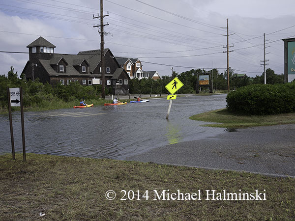
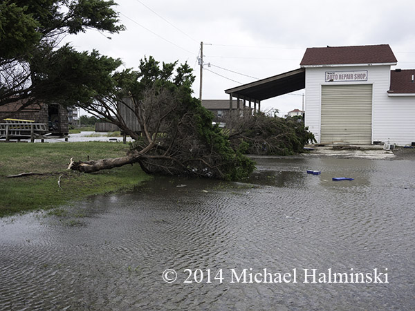
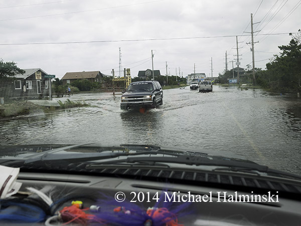
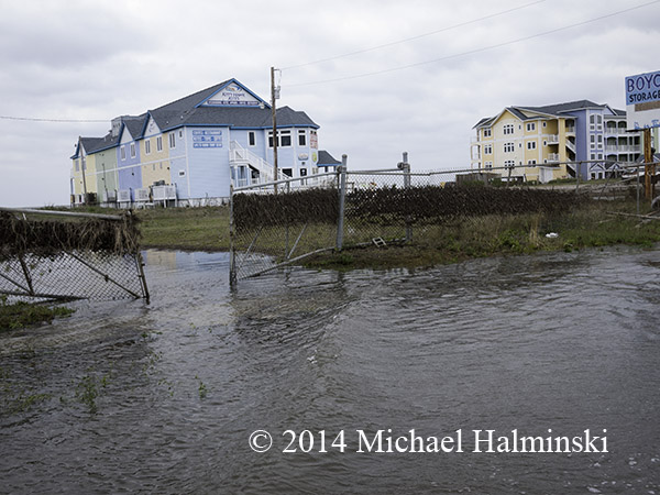
The wind fell out briefly then switched back to hurricane force, pushing the Pamlico Sound waters across our vulnerable village. My barometer read 978 millibars and gradually began to rise around 5:00 or so.

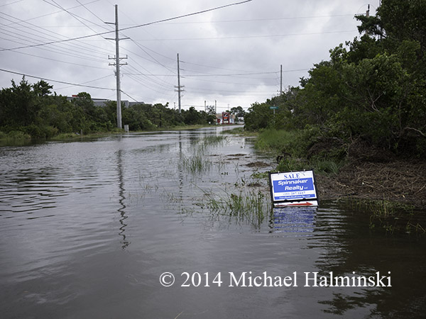
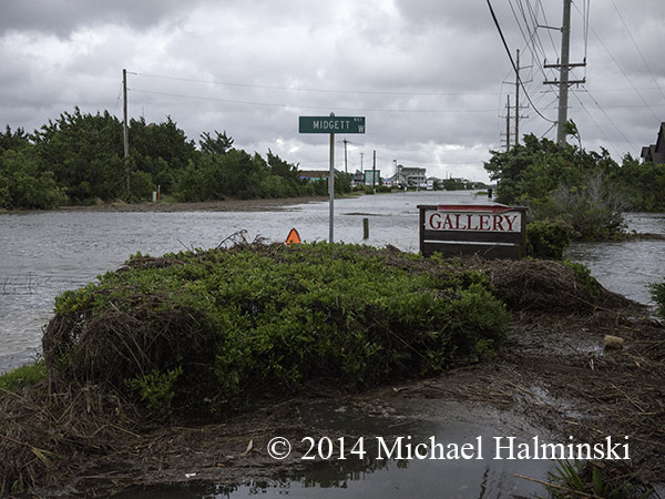
Midgett Way

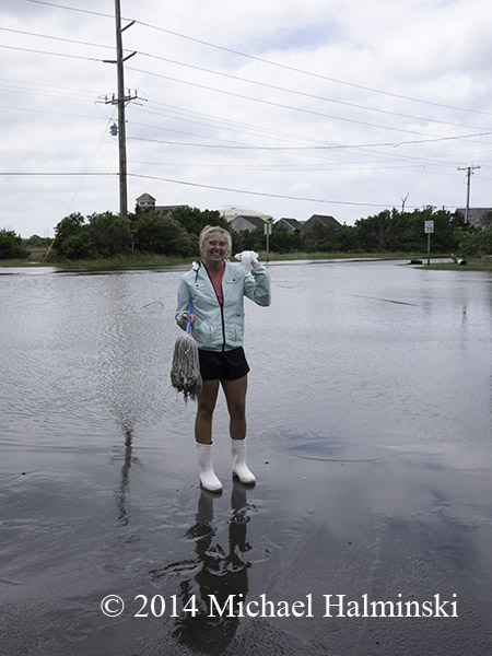
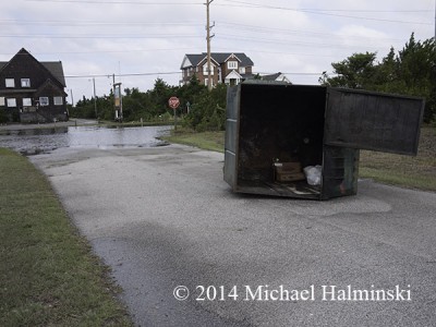
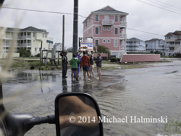
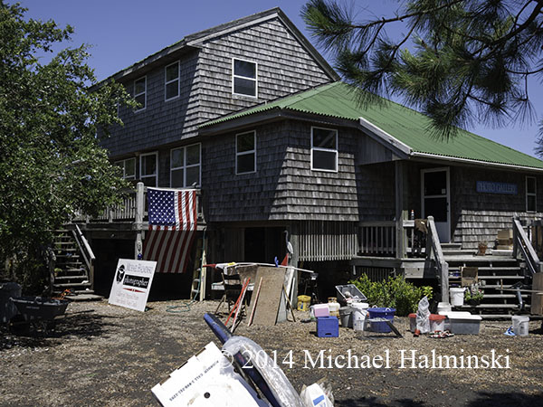
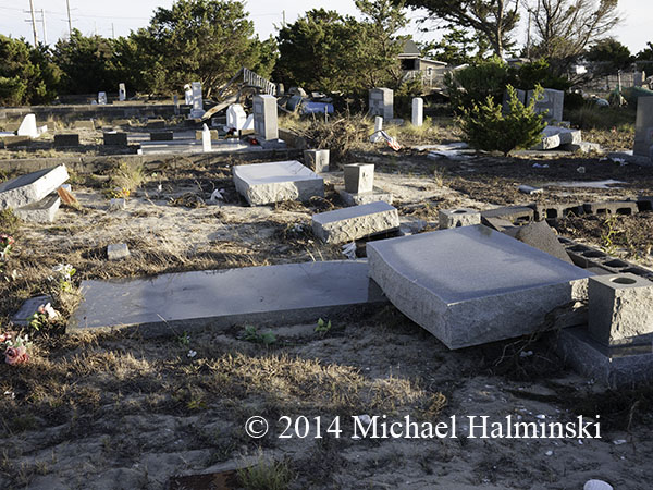
At dawn Arthur revealed her wrath. It was a wind and storm surge flooding event, and I knew from experience this would make for an arduous clean up. I’ll continue this blog after I’ve had time to pick up the pieces and regain my composure.

broadcast

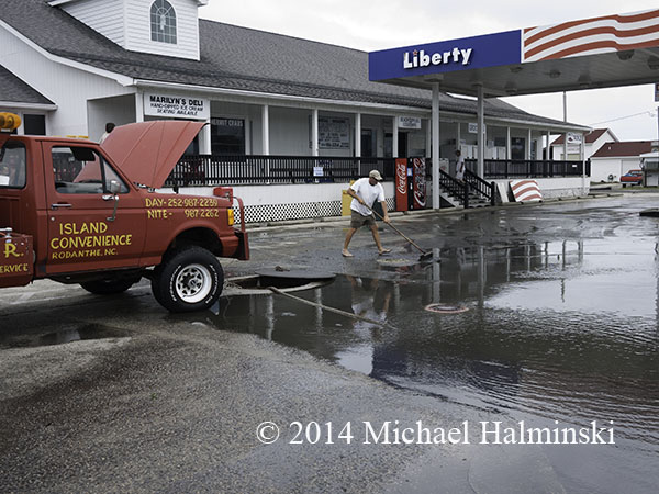
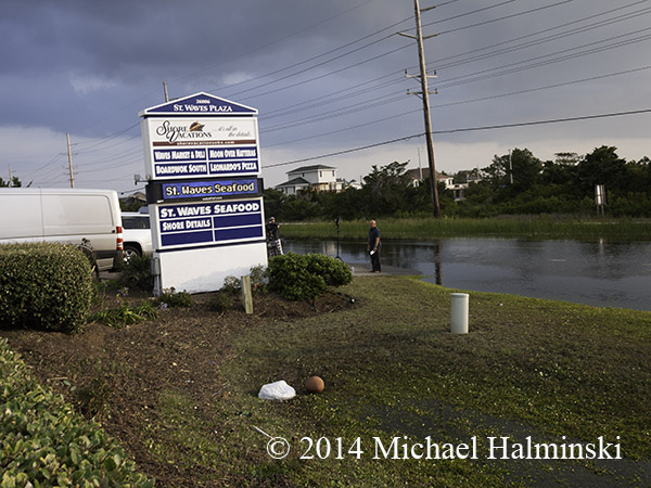
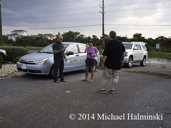
The day after the storm, Denise and I went to the Waves Market for a sandwich from their Deli. The Weather Channel was out front preparing for a broadcast. I spoke to an assistant as meteorologist Jim Cantore walked up to say hello. Denise came over and said she had placed our order at the Deli. Jim replied that he’d just eaten there and that “their sandwiches are phenomenal”. That’s an endorsement we agree with.

Cantori

We spoke of storm surges and flooding.  Cantore added that this time the hurricane’s speed of movement was our friend. I couldn’t agree more with him. It made the effects much less than it could have been.

To Be Continued…


The Grommet House

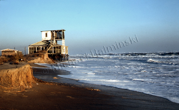
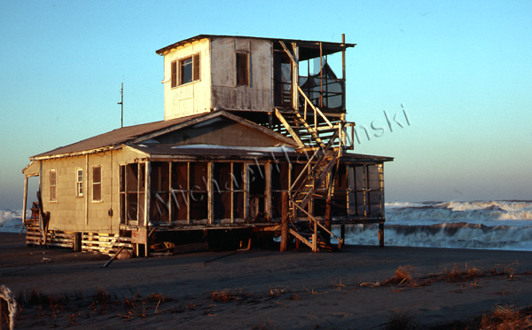
An accountant from Northern Virginia by the name of Myers, owned a cottage on the oceanfront in Rodanthe. It was a ramshackle place, built at a time when, if there were any building codes, they weren’t enforced much. The Myers family used to spend Summers there. Two of their kids were Worth and Gladys. They partied with the locals. In the winter, two of my friends Carlen and Dave, rented the place.

Robin and I surfed in front of it for years. It had a consistently good breaking wave and the mainstream surfers from Virginia Beach hadn’t discovered it.

A bit of a landmark, I photographed it for a period when I thought it was going to wash away. I saw the Rodanthe oceanfront nearly every day, checking the waves and exploring. What I didn’t realize at the time, was that I was also witnessing a complex process of barrier island dynamics. It fascinated me, how the beach environment reshaped with each storm.
Then the surfers from the north began coming. And as surfers will do, they name a spot after something they can relate to. From then on it was dubbed the grommet house. Grommet is surfing slang for a young or beginning surfer. In the longboard days, they were referred to as a gremmie. The Grommet House became a popular, packed out surf spot, but by then Robin and I moved on to other secret breaks to elude the crowds. We were always one or two steps ahead of the masses.

The Myers cottage gets some weather in March of 1980.

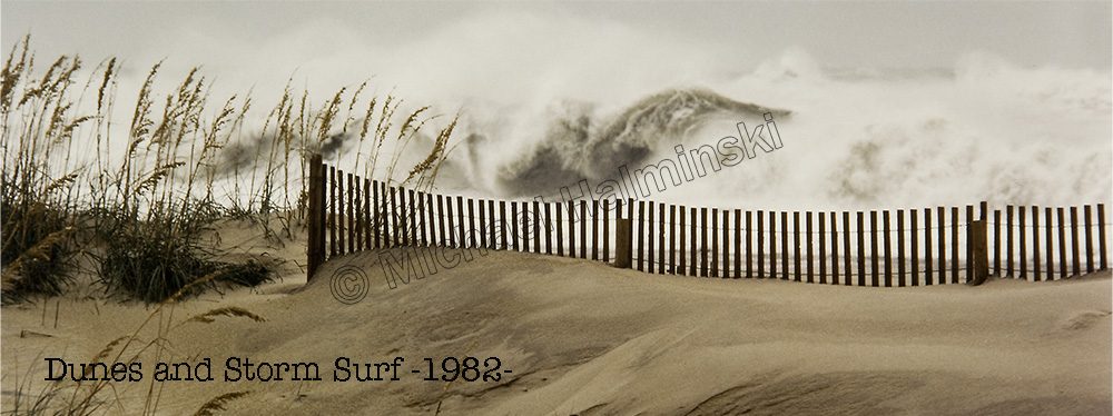
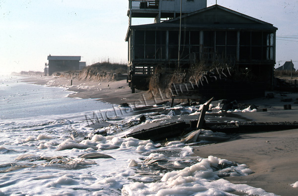
The house was still holding fast in 1982, and the beach made some accretion. The dune line in the background would later shelter a subdivision called Mirlo Beach.

The driveway got pummeled into the sand.

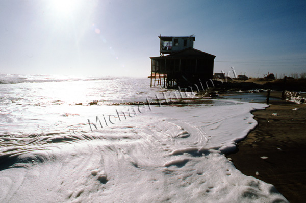
The ocean eventually took over, and the house fell into the sea.


Mirlo Madness

The road conditions at Mirlo Beach continue to plague NCDOT, as well as residents of Hatteras Island. It’s an issue that has been ongoing during the decades that I’ve lived here, and longer.

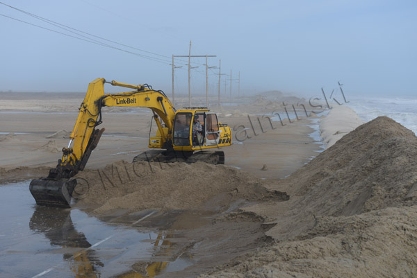
In the past several years the problem has accelerated and occurs more frequently. NCDOT’s reaction has been to perform the same repairs over and over again. They dig overwashed sand from the road surface, and pile it seaward to build a dune. Storms wash over the dune, moving the sand back onto the road.

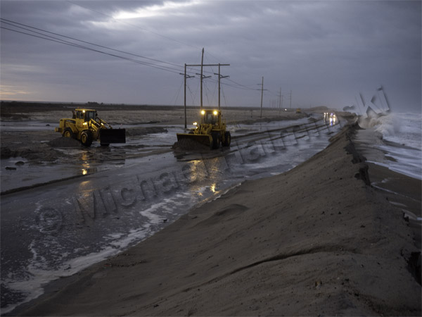
The recent storm that moved off the coast buried the road and left standing water on the surface. I put my boots on and walked there to document the scene in photographs… again.

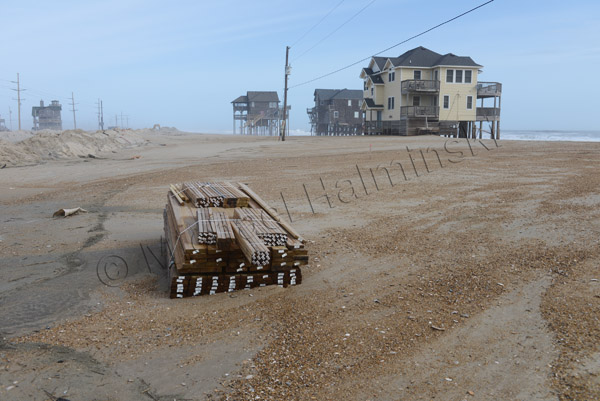
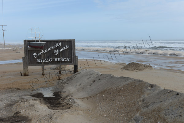
A number of homeowners in the Mirlo Beach subdivision have been trying to repair their condemned rental properties in hopes generating income. A pile of newly delivered lumber lies washed up in the sand. The approach taken to save Mirlo and highway 12 is not working.

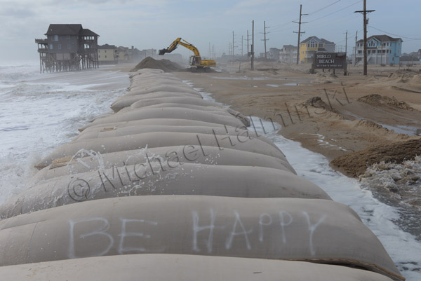
The sign at Mirlo has become a contradiction.

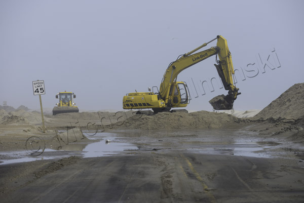
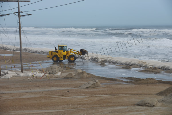
NCDOT’s tools of preference for a fix is heavy equipment, but it’s no match against the power of the sea.

A front end loader is dwarfed in the environment.

An excavator removes sand from the road surface, and piles it on top of a huge sandbag barrier.

A bit of optimism is expressed in adversity.

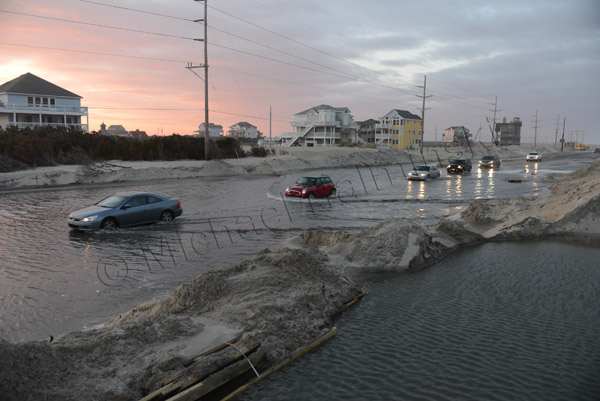
Vehicles endure the salt water to access the island. During periods of high storm tides, the road is impassable.

The loosing battle continues.

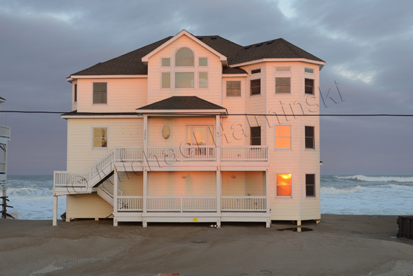
A fixer upper stands tall in a setting sun.


Toes in the Sand

This almost looks like the remains of a relic village from a past civilization. The sands of Cape Hatteras hide many old secrets, like the Lost Colony, shipwrecks and ancient forests. In reality, this is the severed foundation of the first house built on the oceanfront at Mirlo Beach.

As I recall, it was constructed around 1985 and was named East Wind Station. There was a healthy dune in place, and life was good.

It was renamed Toes in the Sand when it was sold recently to a new owner. My 1991 aerial photograph shows East Wind Station sitting behind a lush dune. It’s the house with the brown roof, just left of center.

Today, life is not so good at Mirlo Beach. Property continues to wash away, and Toes in the Sand is being prepared to be pulled to a location that is a little more secure. It’s fate rests on steel I-beams with wheels, on the side of highway 12 .

In the meantime, stormy seas sweep over the beach with regularity. The road is often impassable at times of high water. So when you drive down, it’s best to come at low tide.

Holiday Interlude

Christmas is unlike any other time of the year here. I’m often torn between traveling to see my family or staying home on Hatteras, to enjoy the solitude and nature of this wonderful place.

Holiday business was down and other than the dump trucks pummeling highway 12, there was little human activity. I got caught up on everything, sent out greeting cards and finished a small photography job.

With some time on my hands, I decided to stay on the island, relax and look for things to photograph.

One of the last times I used the 4×4 section of highway 12, I took a shot to record the moment.

With new pavement in place, workers were busy installing a barrier of sandbags, in hopes of protecting the highway. Seas have since washed over it, and sand is constantly being trucked in, to maintain a beach buffer.

Asphalt rubble from the old road was stockpiled, until it could be taken away.

To allow for construction, the S-Curve has been open to one lane traffic only. During the holidays, this was the view heading north.

The view looking south didn’t look any more promising.

As long as the road is passable, we can receive essential supplies.

The “corridor” just south of Oregon Inlet has also been an ongoing battle. Heavy equipment removes sand blown onto the road, only to have it blown right back. One could hardly find a better example of a vicious cycle.

It was predicted that the world was ending on December 21st. I celebrated by driving out to Cape Point during a gale. I was all alone to enjoy the place completely enveloped by nature.

Leaving my truck in the distance, I walked out to the point.

The wind and waves coming together, gave me a spectacular show.

Surfers were calling this “The Doomsday Swell”.

The most interesting spot was right on the point looking east. This is where two powerful forces meet. The south bound Labrador Current collides with the north bound Gulf Stream. Due to seas washing over the beach, I had to walk a quarter mile with a rising tide, to access the point.

One nice thing about coastal storms is experiencing the aftermath of clearing weather.

Rainbows are common yet elusive.

On January 5th, the Old Christmas celebration in Rodanthe marked the end of our holiday season. Larry Midgett joined me in bidding adieu to Old Buck, led by John Edgar.

As caretaker, John Edgar will put Old Buck out to pasture until next year.