Category Archives: Pamlico Sound

Spawning

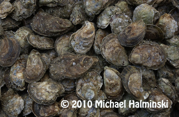
This is a time of year when new life is born to maintain a continuance of species. Signs are all around us. Much of it is obvious, as in nesting birds or budding plants. But much of it we cannot see, unless we look closely. Take the eastern oyster, for example.

For as long as I’ve lived on Hatteras Island, oysters have been a fascination to me. Whenever I go collecting, it’s apparent that they grow in certain areas more than others. I notice that even in those more prolific spots, that the oyster population has generally been in a steady decline. This is attributed to over-harvesting, water pollution, parasites and lack of substrate material for new oysters to attach and grow.

Mature brood stock oysters emit egg and sperm into the water column, which in turn combine to produce eyed larvae, the beginning of becoming a true oyster. A scientific collection permit has allowed me to gather brooders for my own oyster garden spawning. I also donate collected brood stock to the aquaculture program at Carteret Community College and to the University of North Carolina Coastal Studies Institute at Cape Hatteras School.

Several years ago I attended an oyster conference in Morehead City, where I saw a number of scientists and people like myself looking for answers. It was here where I met Dr. Kemp. He runs the aquaculture program at Carteret Community College. A number of us got together and founded Shellfish Gardeners of North Carolina. We are interested in growing oysters, not only as a recreational activity, but also as a way to help the environment. We have had workshops to learn more about life cycles, water quality and to educate others.
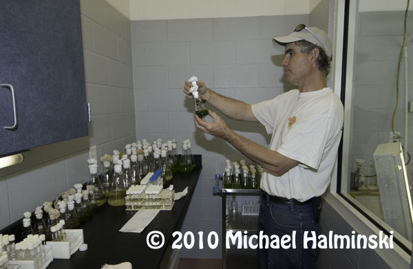
For oyster gardening in eastern Pamlico Sound, Skip Kemp has been my mentor.

This has evolved into a network of people compiling and studying data. I collect water quality data for the Citizen’s Monitoring Network out of East Carolina University, and also compile information for the Oyster Spat Monitoring Project based at University of North Carolina in Wilmington.

Past data indicates that now is a prime time for local oysters to be spawning, so I have to keep a sharp eye out to see if there are any new oyster spat.

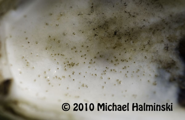
These eyed larvae have attached to an oyster shell and are 1 day old oysters.

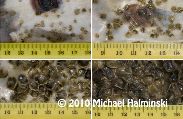
This composite image shows new oyster spat at weekly intervals beginning with 1 week old at the upper left and 4 weeks old on the lower right. The initial growth rates are dramatic. The ruler scale is in centimeters.


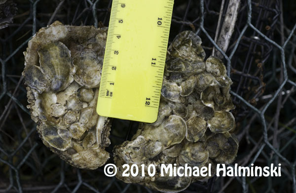
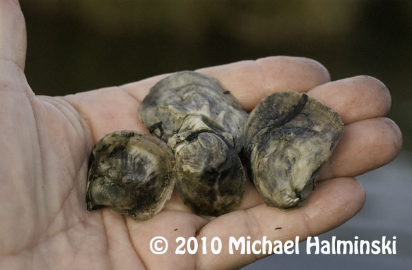
These are almost 5 months old.

Yearlings can come in different sizes, depending on environmental conditions.

Portsmouth Village Homecoming

For me, the most intriguing town on the Outer Banks is the village of Portsmouth. Situated on the northeast tip of Portsmouth Island, it played a significant role in local maritime history for well over one hundred years. It’s geographic location next to Ocracoke Inlet was important in making it a major port of commerce when wooden ships still sailed the seas. Deep draft ocean going vessels could offload goods there, and smaller boats would come from inland river towns to pick it up. From the 1750’s to the 1850’s, Portsmouth was a thriving seaport. According to an 1860 census, the town had a population of 685 residents.

But by then, things were beginning to change. A series of storms opened other inlets, and at the same time Ocracoke Inlet began to shoal. Shipping routes changed, commerce dropped off, and gradually the town dwindled to only a few people. With the death of Henry Pigott in 1971, the last man to live at Portsmouth, the last two residents, Elma Dixon and Marion Babb reluctantly left the island.

Today the 250 acre historic district of Portsmouth Village is a part of the Cape Lookout National Seashore. The remains of the town have been left intact and maintained.

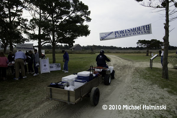
Since 1992, the Friends of Portsmouth Island have sponsored a homecoming every 2 years. I went in 2008, and looked forward to this April 24, 2010 event. Again I was not disappointed. Here are a few things that caught my eye.

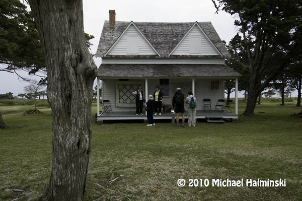
Descendants of village residents pose for a photographer in front of the Dixon/Salter house.

The Robert Wallace house.

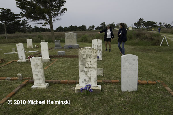
The Dixon family cemetery.

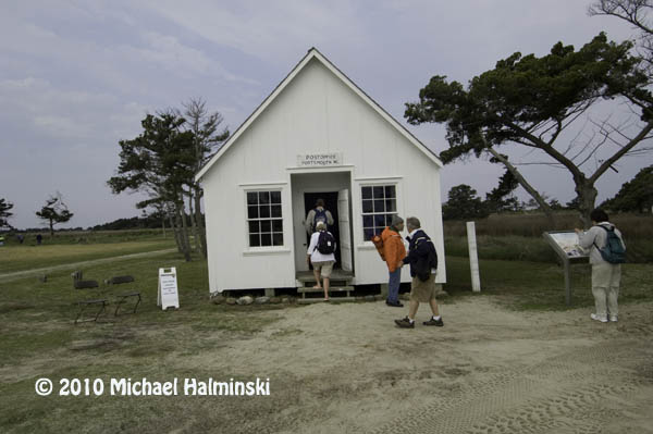
The post office opens every other year for this event, including canceling postage stamps.

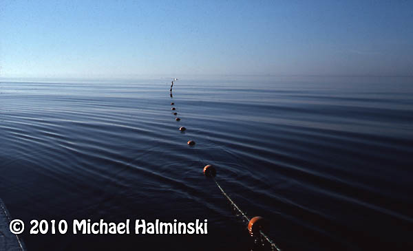
Ocracoke fisherman Gene Ballance demonstrates the art of net mending.

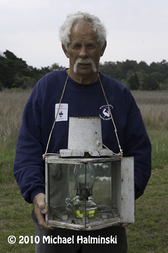
James Gaskill wears a device once used for fire-lighting waterfowl. He is also a commercial fisherman from Ocracoke.

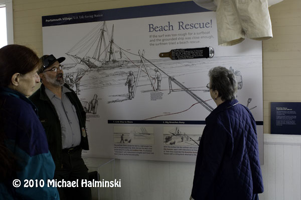
At the old Coast Guard Station, Dave Frum explains the beach apparatus method for rescuing shipwreck survivors.

The Methodist Church was always a focal point of the community and still is.

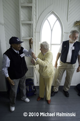
88 year old Rudy Carter and Mil Hayes ring the bell to begin a church service. Rudy is a descendent of Henry Pigott, the last man to live at Portsmouth.

Get to the church on time if you want to get a seat.

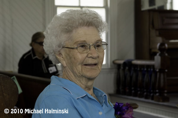
Born in 1921, Dot Willis affectionally known as “Miss Dot”, is the last surviving resident that was born at Portsmouth Village. The light coming in the translucent windows of the church was very nice so I took the opportunity to speak with her, and make this available light portrait.

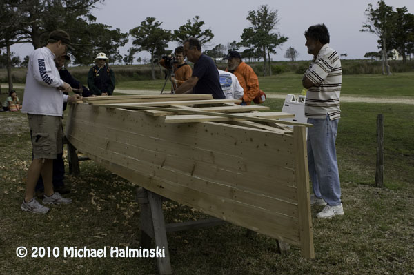
Back in the day, the flat-bottomed skiff was a preferred mode of transportation. These guys were fastening the bottom planks in a boat building demonstration.

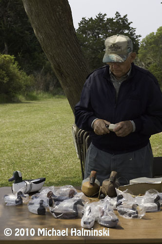
Roy Willis from Stacy, NC was showing his waterfowl carvings.

Roy made and hunted over these green winged teal decoys last season.

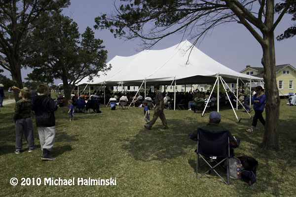
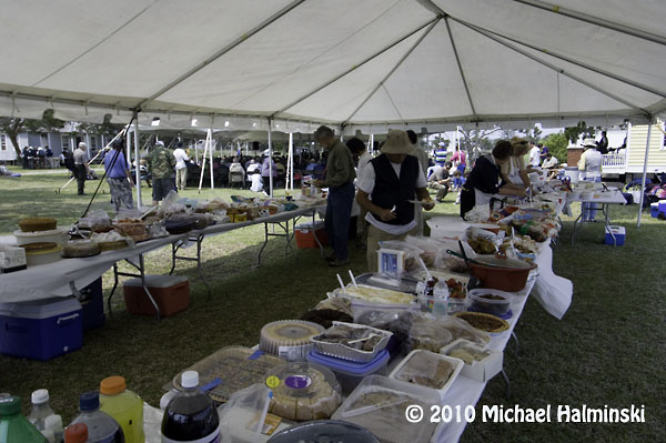
The main tent provides seating for up to 500 people.

Then there’s the covered dish dinner with plenty for everyone. And the mosquitoes weren’t even that bad. If you go in 2012, I’ll see you there.

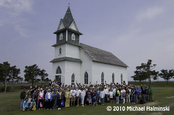
Group shot of attendees at the 2010 homecoming.


Sound-side Flooding

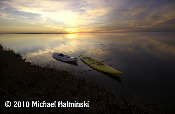
The oceanside beaches and waves are what originally attracted me to Hatteras Island. But once I got established as a resident, I realized there was more to this barrier island. The Pamlico Sound, or bay side, is a unique and precious resource. I was really impressed by it’s bounty for the commercial fishermen navigating those waters. The Pamlico Sound, one of the largest estuaries in the country, is tranquil and beautiful. But I soon learned that it could also turn stormy and treacherous. It has claimed the lives of three of my personal friends, all commercial fishermen.

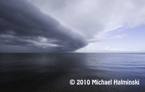
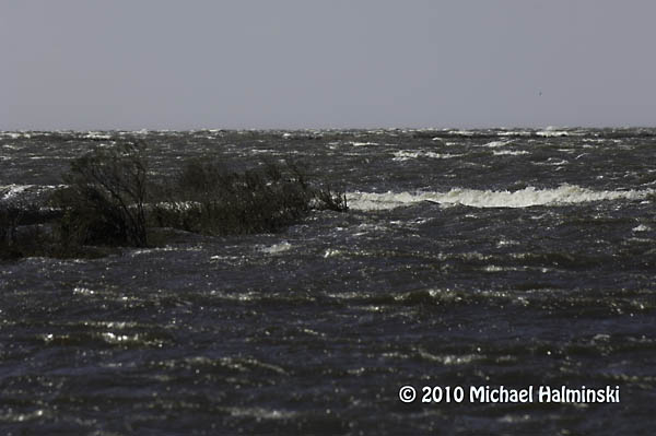
A cold front coming up the Pamlico Sound is a sure sign of changing weather.

Tides are generally driven by the gravitational pull of the moon. This is true, but the Pamlico Sound tides are mainly generated by wind. Winds blow the relatively shallow water from one side to the other. Here in the Rodanthe, Waves and Salvo township, winds from a westerly direction push the higher tides in our direction, while depleting the waters on the mainland side of the sound. Whenever we have a substantial west wind, we can get inundated by tides so high, that roads and properties get flooded. It’s times like this that a little elevation means everything.

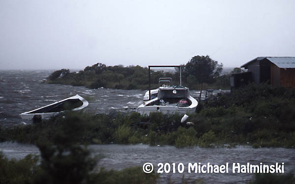
In 1986, Charley went right up the middle of Pamlico Sound. Fortunately it was a minimal hurricane with winds of only about 80. The above image shows the commercial fishing harbor in Rodanthe with seas coming over the bulkhead and on to the roadway.

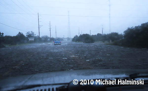
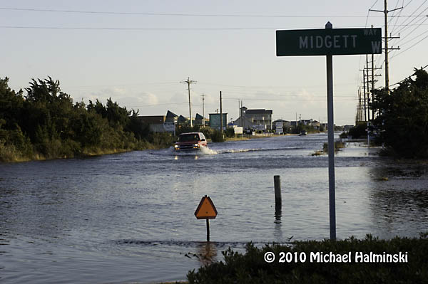
In 1999 a category 5 hurricane, named Floyd, made landfall in South Carolina. It wreaked havoc on the mainland to our west, but spared us with minor flooding and winds of only about 50 mph. Here I drive my old sacrificial Dodge truck through high tide near my home in Waves.

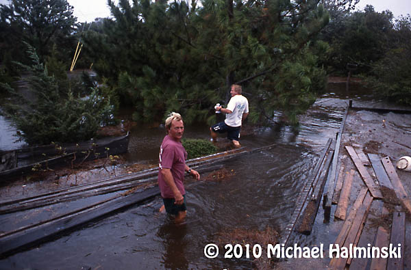
My yard during Floyd was under 2 feet of water. Here my neighbors, CE Midgett and Dale Midgett wade through the floating debris.

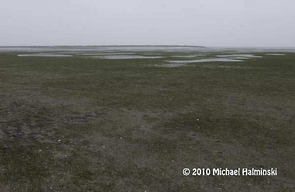
Conversely when winds wail from an easterly direction, the water on our sound side falls, sometimes enough to expose the bottom for a mile out, like during this northeaster in May of 2005.

The most severe tide that I’ve seen in over 36 years was during the March storm of 1993, when we experienced westerlies of 100 miles an hour. This was caused by a powerful low pressure system advancing up the east coast, not off shore, but centered to our west. We had tides driven 8 to 10 feet above normal. That day the sound waters met the ocean dunes. Cars were ruined and homes damaged by flood.  I had 4 feet of water in my yard, not to mention the breaking waves. Old timers say it was the worst flooding since the storm of 1944. Our worst case scenario is to have the eye of a powerful hurricane going right up the Pamlico Sound.

Just last week we had westerlies of 35 to 50, with higher gusts. The water came up quickly, although not with the ferocity that I’ve seen before. It was just enough to disrupt business as usual, and cause a nuisance. The tides were about 4 feet above normal. So I had several inches of tide in my yard. Portions of highway 12 were under 1 to 2 feet of salt water, not good for the life of transiting vehicles.

This last storm brought about 8 inches of sound tide in my yard. Home sweet home! The drill starts with vacating vehicles from the premises and parking them on higher ground.

My west property border meets the sound. As you can see, the vegetated wetland absorbs much of the wave action. I don’t understand it when people building on the Outer Banks clear cut, remove this buffer or fill the marsh. It’s really all that holds this sandbar island together.

This shot was taken last week, February 10. I wonder if this driver has a captain’s license.

Excessive tides have always been a way of life on Hatteras. It’s something that requires readiness and preparation. Sometimes it’s predictable. Other times it’s more of a surprise. It’s not a matter of if, but when the next one will occur.

Gull Island Gunning Club

You often hear about how people in the arts have to survive early on in their careers. Some work in restaurants or construction. I’ve been there… done that, but I also had some other interesting lines of work to make ends meet.

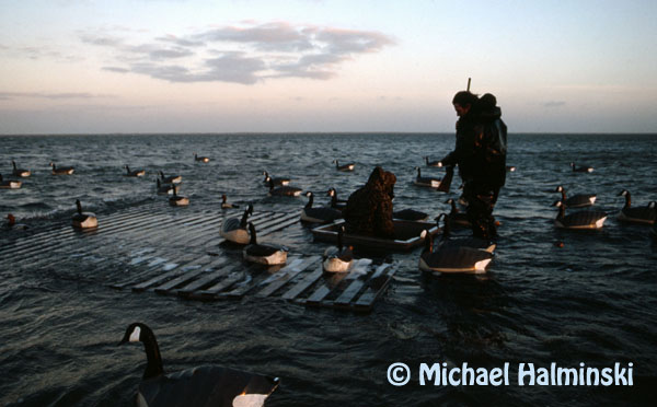
Back around 1975, when there was still considerable waterfowl hunting here, a neighbor asked if I wanted to earn some extra money. It turned out that they needed another waterfowl hunting guide, with no experience necessary. Uneasy at first, I quickly learned to emulate what the experienced guides did. They prepared boats, blinds and decoys among other things.

The work was tough, cold and wet. Hunting trips required 24 hour service, plus awakening at 4 AM to get hunters ready. But as with many things in retrospect, it was a pretty valuable and unique experience. I was a licensed guide at Gull Island for 5 years.


The lodge at Gull Island had four bunk rooms, a mud room for gear and guns, a kitchen and dining area, a rec room with television, and a separate privy with generator room on the north side. It was a particularly comfortable building, especially considering its location, miles out in the Pamlico Sound.

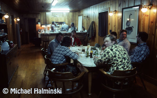
The interior was equipped with heaters, wall lamps and a refrigerator all run on propane. In the above photo, I am at the head of the table in red shirt. We were treated to some first-class hearty meals out there.

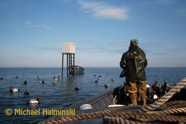
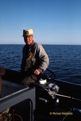
Raymond Midgett was one of the hunting guides that I worked with. Here he runs the 24 foot skiff, that used a reliable 4 cylinder air-cooled Wisconsin engine for power. It was slow, but got the job done. Thus it was named Anytime. It was built in Avon by Willy Austin.

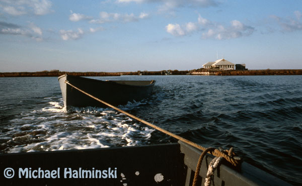
Here Anytime tows one of the decoy skiffs to pick up a hunting rig.

Mark McCracken and Burt Hooper pick up after a day of hunting. Burt amazed me with his sharp vision. He could spot a flock of ducks a mile away and tell you what type of fowl they were, before you could even see them.

Raymond Midgett throws out a stake blind rig, while I drag the skiff through the thigh deep water.

This image was made of the same stake blind, taken from the north deck of the club house. I used a Nikon F2 with a Century 650mm lens attached. It shows shot hitting the water while the hunters fired at the “cripples”.

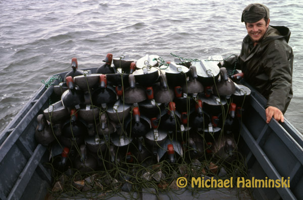
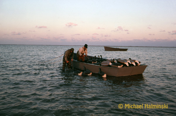
Michael Peele is a native of Hatteras, and was a regular hunter at Gull Island. Here he poses with a skiff full of redhead decoys that I painted and rigged with lines and lead weights. Gull Island is where I learned to tie a bowline knot.

Manson Meekins of Avon was also a regular visitor to Gull Island.

The sink box, also called a battery box, required a lot of work to install, maintain and rig. We hunted three different sink boxes around the island. They lured waterfowl and worked extremely well.

Alex Kotarides (standing on deck) was the owner of Gull Island Gunning Club. He also owned a huge bakery in Norfolk. Here he stands with nephew Chris (far left) and bakery employee Fred Keitch (far right). Alex was a very generous man. Every Christmas he would bring some local villagers turkeys and hams for the holidays. He also loaned me $1100 so that I could buy my first high quality telephoto lens. 
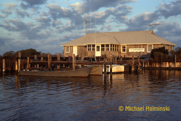
This is a shot of Gull Island Gunning Club taken during it’s glory days. I used the 400mm Novoflex lens (mentioned above) mounted to my F2 while standing in the marsh of Bay Landing on Hatteras. Gull Island is two miles away. Around 1990 while being renovated, the house accidentally burned to the ground. Today all that remains is the island, an old dock and a lot of memories.
A Fascination for Flight


I grew up in a Navy family that traveled to new tours of duty every couple of years. Many of those stations required transportation in propeller powered military aircraft. So my fascination for flight began at an early age. I always wanted the window seat. As a nine year old, I distinctly remember flying across the Pacific Ocean to the island of Guam. How I loved peering out of the window at the ocean and islands below!

Today I still hold that same fascination for flight with aerial photography. After Hurricane Isabel in 2003, I made seven flights over Hatteras, Ocracoke and Portsmouth Islands. I wasn’t interested in the destructive power of the storm. Instead I wanted to see and document how nature constantly shapes the Outer Banks.

Last year, parts of the beaches of our National Seashore Park were closed due to bird nesting, including the Cape Point of Hatteras Island. I’ve photographed the Point from the air before, but only with off-road vehicles on it. My intention last Summer was to fly and shoot it’s more natural, pristine state, but I procrastinated and suddenly the point was opened to traffic and I missed my chance.

This year I put it off again until July 26th when I called my good friend and pilot Dwight Burrus. Dwight and his wife Debbie operate Burrus Flying Service out of Billy Mitchell Airport in Frisco. I’ve flown in his beautiful red and white 1971 Cessna on numerous occasions, and I can’t say enough about his expertise. I tell him what I’m looking for and he takes me there, every time. It’s almost as if I’m flying the plane myself. Dwight was raised on Hatteras, and knows the coast and it’s steeped history well. I highly recommend the tours of Burrus Flying Service. Call them at (252) 986-2679 or visit the web site for more information. Tell them I sent you.

Let me show you what I saw on this latest flight, looking down on the scenery below.


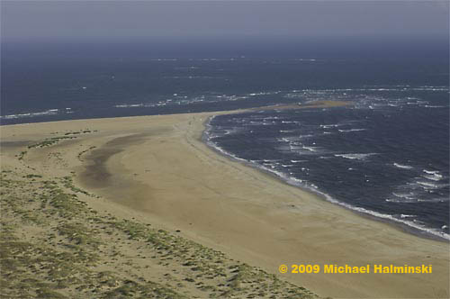
cp-south                      Looking out to Cape Point from the south or “the hook” side.
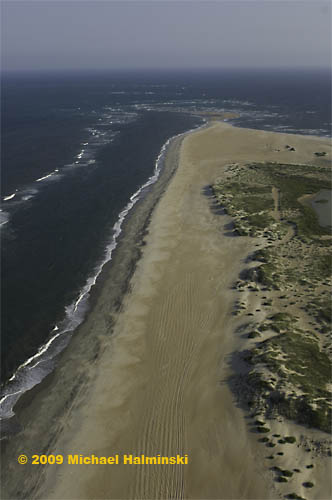
 

cpnorth                                                         Looking toward the point from the north beach.
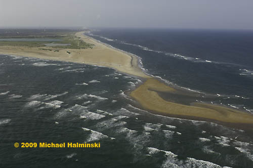
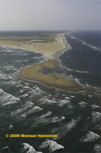
 

cpsoutheast3

cpsoutheast22                                                            Looking toward the Cape Hatteras Lighthouse from over the Point.
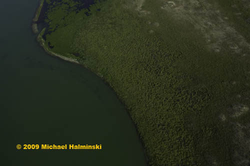
 

cppond                                The shoreline of the pond at Cape Point.
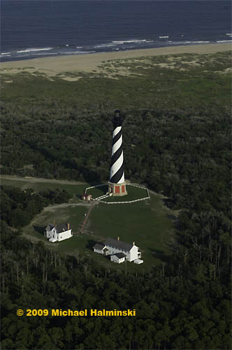
 

lighthouse2                                                          No flight is complete without a lighthouse fly-by.
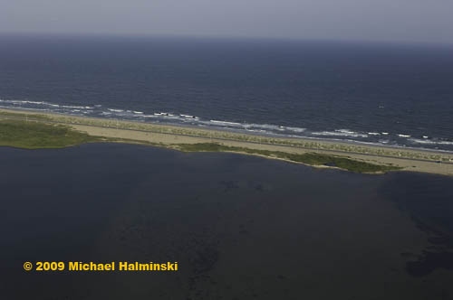
 

isabel-inlet                       This is the site of the inlet that was cut by Hurricane Isabel.
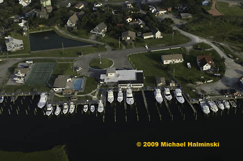
 

marlin-club                          The famous Hatteras Marlin Club in Hatteras Village.
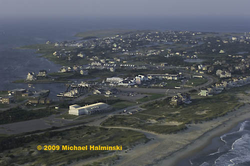
 

hatterasvillage                The south end of Hatteras Village at the ferry terminal to Ocracoke Island.
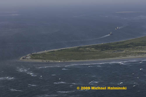
 

hattsouthpoint                   The south point of Hatteras Island at Hatteras Inlet looking to Pamlico Sound.
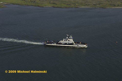
 

ocracoke-ferry                 The ferry, Chicamacomico, en route to Ocracoke from Hatteras.
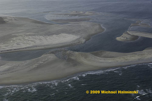
 

uscgstation                     The north end of Ocracoke Island at the site of the former Hatteras Inlet                    Coast Guard Station. The station was destroyed in storms. All that remains                    are the pilings. This illustrates the lack of stability of barrier island systems.
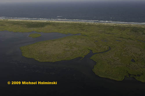
 

oislandbackside                                       Ocracoke Island from the sound side.


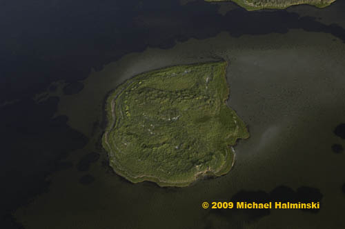
island-marsh                               An island in the sound behind Ocracoke Island.
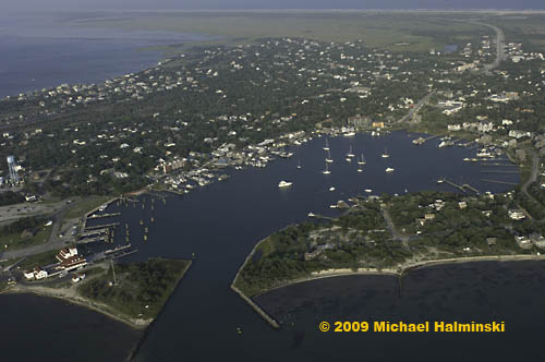
 

silver-lake                             Silver Lake surrounded by scenic Ocracoke Village.
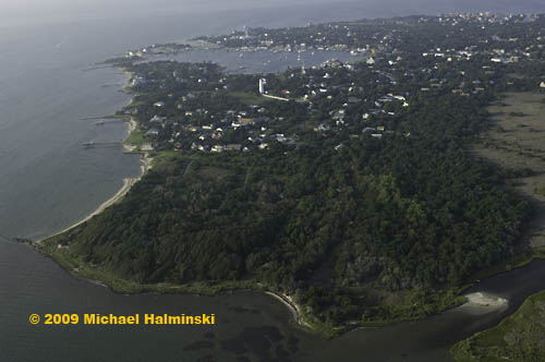
 

springers-point                            The beautiful maritime forest at Springer’s Point on Ocracoke.
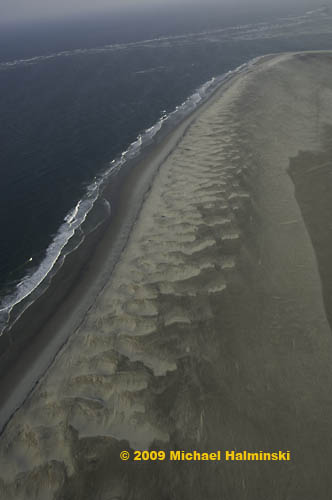
 

o-beach                                                       The untouched beach at Ocracoke’s South Point.
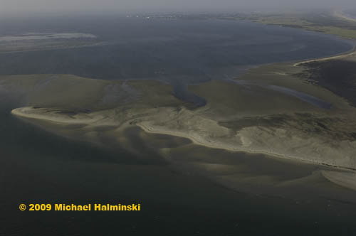
 

o-inlet-bar                       A sandbar where Ocracoke Inlet meets the Pamlico Sound.
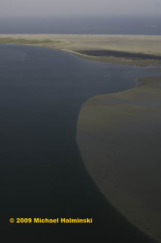
 

o-inletbackridge                                                       An underwater sand ridge extending into Pamlico Sound from Ocracoke Inlet.
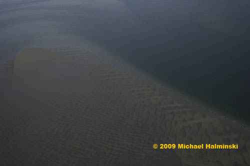
 

o-sandbar                            A sandbar in the Pamlico Sound near Ocracoke Inlet.
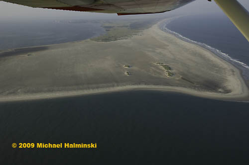
 

o-inletwing                              Dwight’s Cessna banking over Ocracoke Inlet for a shot at the                                                 untouched South Point.
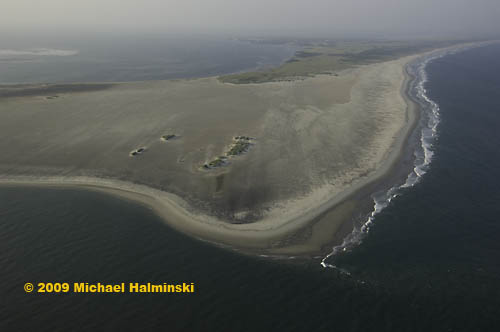
 

o-inlet-mouth                    The South Point of Ocracoke in a pristine state from 1,000 feet.