Category Archives: inlets and sandbars

Oregon Inlet

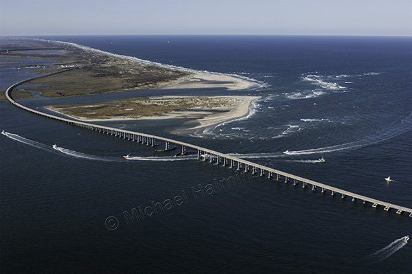
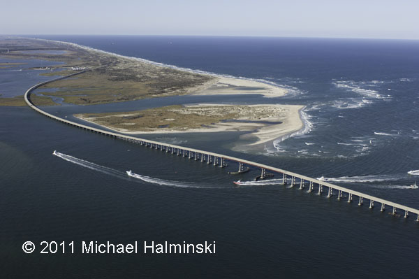
We hear a lot about Oregon Inlet, and the bridge spanning it. Nowadays you can hardly talk about one without mentioning the other. It’s nothing new and has been an issue for a long time.

When I first came here, driving over that beautifully curved bridge across the inlet was an awesome experience, the vistas remarkable. It was sort of an environmental work of art that served a purpose, getting to and from Hatteras Island. I would eventually learn that it was a bit more than that.

trawlers

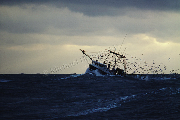
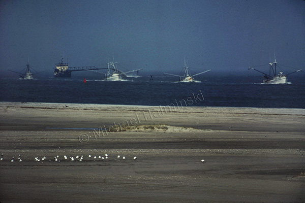
In April of 1977, while driving to Nags Head, I watched 4 trawlers coming in through the well-marked channel. There was no traffic and I had just gone over the peak of the bridge. I stopped overlooking Bodie Island spit, got out and took one shot with a 400mm lens on a fairly new Nikon F2.

aerial

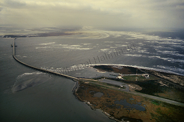
In January of 1985, we had a severe cold snap. Temperatures were low enough to freeze portions of the Pamlico Sound. I was so impressed that I hired a pilot to take me up and shoot the ice flows from above. We ascended to 7,000 feet, and the view was spectacular.

bailey boy

December of that same year, I was shooting a story on commercial fishing for Outer Banks Magazine. Arrangements were made for me to spend 3 days on a trawler from Wanchese, where Captain Terry Saunders welcomed me aboard the Richard Wayne”. There were 2 days of fair weather, but when a northeaster set in on the third day, the boats decided to come in early. Crossing the bar at the mouth of the inlet was rough, and Captain Stevie Daniels maneuvered “Bailey Boy”  through, right behind us.

station

I flew during a northeaster in 1989 and made shots along Hatteras Island. There was no jetty in place at the inlet yet, and the Coast Guard Station was beginning to wash away. At the time, they were abandoning the station and moving to a newly built facility on the north side, next to the Oregon Inlet Fishing Center.

bridge

No recollections of Oregon Inlet would be complete without mentioning the October 1990 incident of a dredge taking out 400 feet of Bonner Bridge. I made this shot that December riding the ferry across the inlet when repairs were being made.

aerial '05

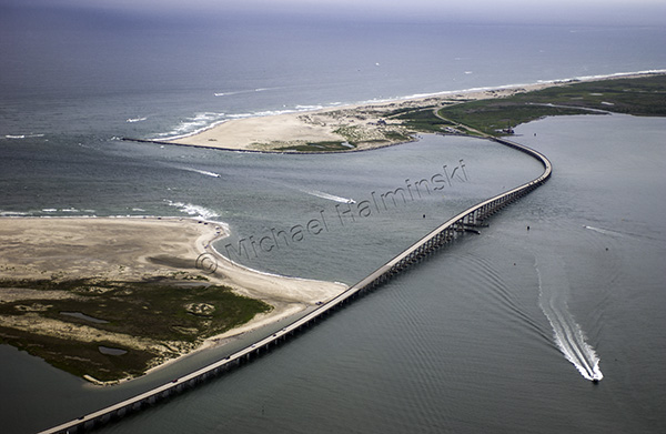
On an overcast September day in 2005, I went airborne with a videographer shooting a documentary on rising sea level. The section of the bridge that was taken out in 1990 is noticeable as a darker shade of gray in the pavement.

Irene

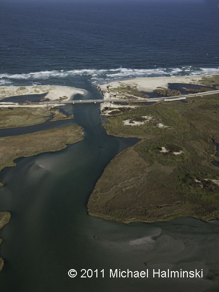
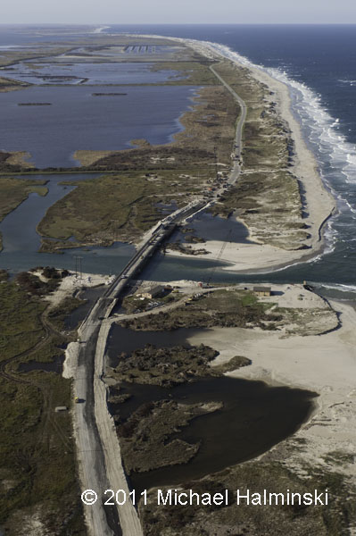
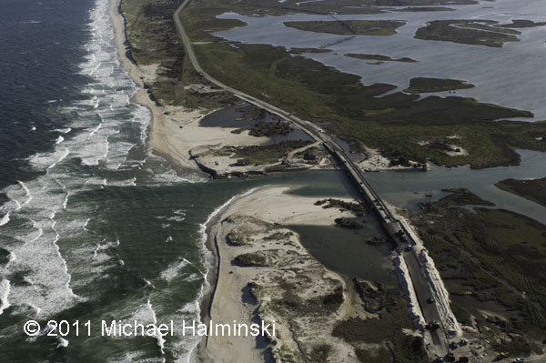
Hurricane Irene radically reshaped Oregon Inlet in 2011.

The only inlet on the east coast facing northeast, Oregon Inlet was originally formed in 1846. Since then, it has migrated over 2 miles south. Watching the area change and shift over the years continues to be fascinating. It’s a display of man’s engineering prowess in the face of some of nature’s most powerful forces. It’s also very expensive.


Terns Turning

Last week I had a chance to get a boat ride out on Pamlico Sound to a spoil island near Hatteras Inlet.
Spoil islands are man made from sand dredged to maintain the ferry channel between Hatteras and Ocracoke.
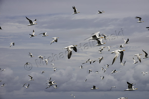
These “engineered” islands make good habitat for nesting terns and other colonial waterbirds, like Black Skimmers.
With the Summer season drawing to a close, nesting is done.


Lots of activity still prevails, and the mature birds continue to catch fish for growing juveniles.

The adults are loosing their handsome breeding appearance in favor of less dramatic winter plumage.


An adult sandwich tern, in non-breeding plumage, brings its catch in for a family member.


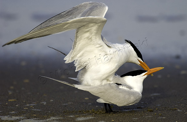
This island has a mix of Royal Terns and Sandwich Terns.
Adult Royal Terns have orange bills, and their juveniles have yellow bills.
Mature Sandwich Terns have black bills with yellow tips.
Their corresponding juvenile’s bills are dark and less distinctive.

Next Spring the tern population will renew the species once again,
looking their best in bright breeding plumage.

Barrier Island Transformation

I’ve lost track of time since Irene struck and flooded our villages more than six weeks ago.

There’s been a lot of cleaning up, and that should continue into the coming months and throughout the winter.

It’s been an emotional roller coaster, and I’ve been preoccupied with multiple tasks while trying to document life here, as I go. Of course, the newly cut inlet at Pea Island has had my curiosity the entire time.

So on Saturday, I saw the affected areas for the first time with my favorite pilot, Dwight Burrus of Hatteras. He owns and operates Burrus Flying Service, and I highly recommend his expertise in flight as well as his knowledge in local lore and history.

Here is some of what we saw the other day.

Bodie Island spit on the north side of Oregon Inlet has been split in two, while the navigation channel has been scoured to an increased depth.

The west dike at the north pond impoundment of the Pea Island refuge was breached by the storm surge.

Of course, Irene Inlet has been the talk of the town. This is one of the key spots where the pressure of the surge from Pamlico Sound was released.

HIghway 12 looking north towards the wildlife refuge impoundments and Oregon Inlet.

Looking west toward Pamlico Sound. Before the inlet was cut this coastal marsh was a prolific haven for marine life. With the flow of water in and out, it will be interesting to see how it adapts.

A quarter mile to the south of Irene Inlet is New Inlet cut in the storm of 1933. Still visible in the top of the picture are the remnants of the bridge that was never completed, as that inlet naturally filled back in.

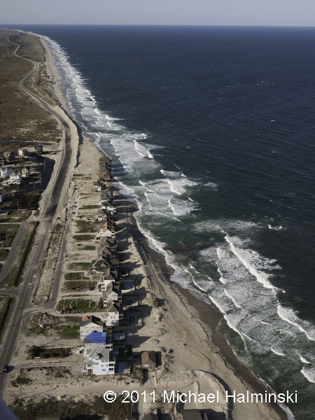
My advice is not to buy oceanfront property at Mirlo Beach. It’s a loosing battle, for sure.

Looking north to Pea Island, the Mirlo Beach oceanfront is very unstable. The long, winding road beyond runs through the wildlife refuge.

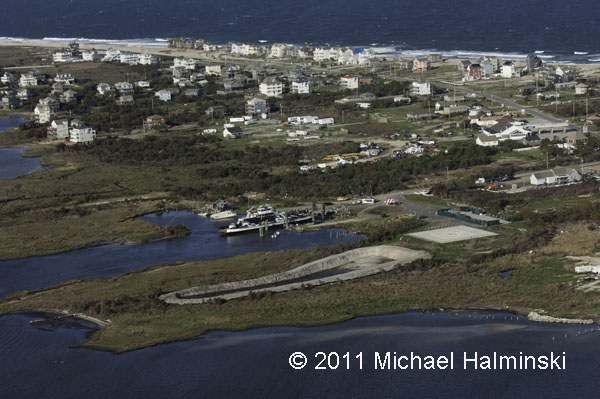
The NC Ferry System has been the only link to the mainland for several weeks. Next to the ferry terminal on the right side of the picture is the community building that became instrumental in providing for the needy citizens of the Rodanthe, Waves and Salvo.

The National Park Service Day Use Area south of Salvo has become the landfill for all the debris collected since the storm. The Farrow family cemetery, which was damaged by the storm, is at the lower left. The road at the top of the photo is the entrance to ramp 23 beach access.

The debris piles are much larger than most of the houses in the villages.

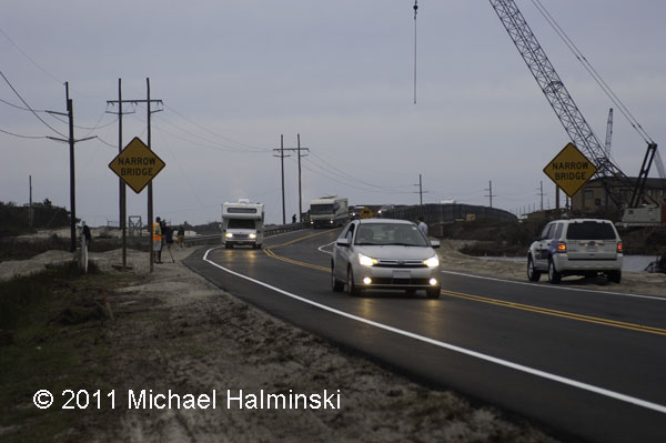
This afternoon about 6:00 they opened the new temporary bridge, allowing visitors to enter the island once again. There was relatively little fanfare, some media coverage, and I could hear some vehicle occupants cheering as they rolled across the new bridge.

It’s going to be interesting to see how well this works out in time. What will the natural elements throw at highway 12 next….. and when?

Portsmouth Village Homecoming

For me, the most intriguing town on the Outer Banks is the village of Portsmouth. Situated on the northeast tip of Portsmouth Island, it played a significant role in local maritime history for well over one hundred years. It’s geographic location next to Ocracoke Inlet was important in making it a major port of commerce when wooden ships still sailed the seas. Deep draft ocean going vessels could offload goods there, and smaller boats would come from inland river towns to pick it up. From the 1750’s to the 1850’s, Portsmouth was a thriving seaport. According to an 1860 census, the town had a population of 685 residents.

But by then, things were beginning to change. A series of storms opened other inlets, and at the same time Ocracoke Inlet began to shoal. Shipping routes changed, commerce dropped off, and gradually the town dwindled to only a few people. With the death of Henry Pigott in 1971, the last man to live at Portsmouth, the last two residents, Elma Dixon and Marion Babb reluctantly left the island.

Today the 250 acre historic district of Portsmouth Village is a part of the Cape Lookout National Seashore. The remains of the town have been left intact and maintained.

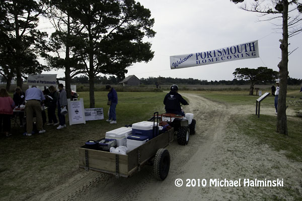
Since 1992, the Friends of Portsmouth Island have sponsored a homecoming every 2 years. I went in 2008, and looked forward to this April 24, 2010 event. Again I was not disappointed. Here are a few things that caught my eye.

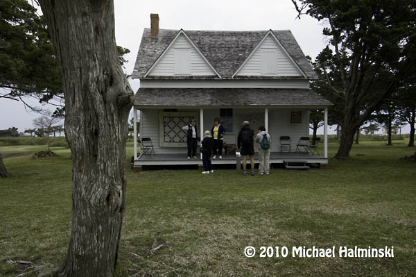
Descendants of village residents pose for a photographer in front of the Dixon/Salter house.

The Robert Wallace house.

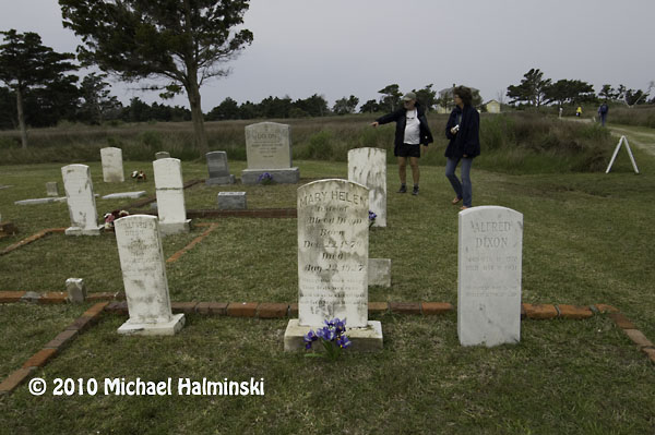
The Dixon family cemetery.

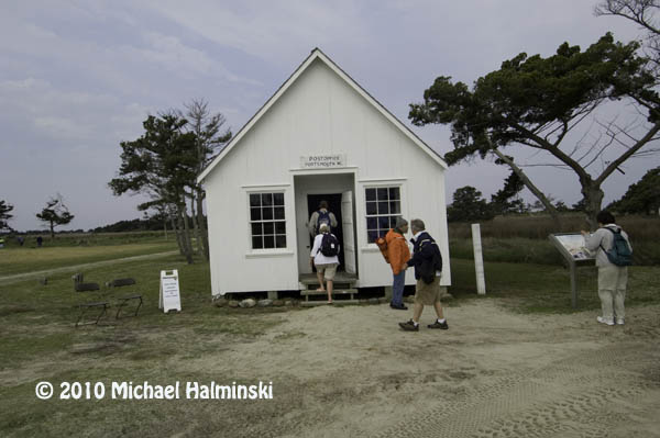
The post office opens every other year for this event, including canceling postage stamps.

Ocracoke fisherman Gene Ballance demonstrates the art of net mending.

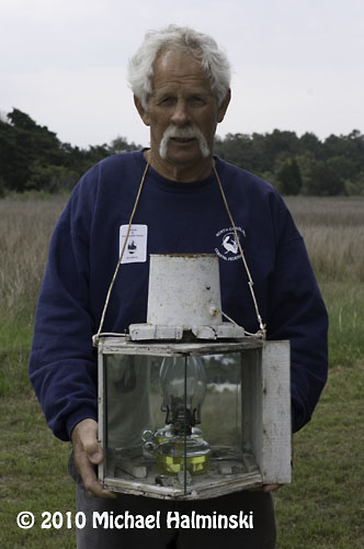
James Gaskill wears a device once used for fire-lighting waterfowl. He is also a commercial fisherman from Ocracoke.

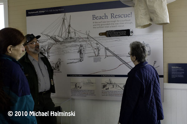
At the old Coast Guard Station, Dave Frum explains the beach apparatus method for rescuing shipwreck survivors.

The Methodist Church was always a focal point of the community and still is.

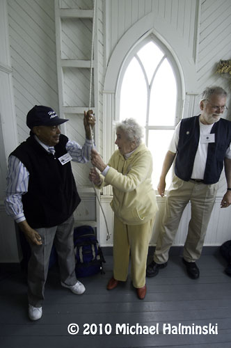
88 year old Rudy Carter and Mil Hayes ring the bell to begin a church service. Rudy is a descendent of Henry Pigott, the last man to live at Portsmouth.

Get to the church on time if you want to get a seat.

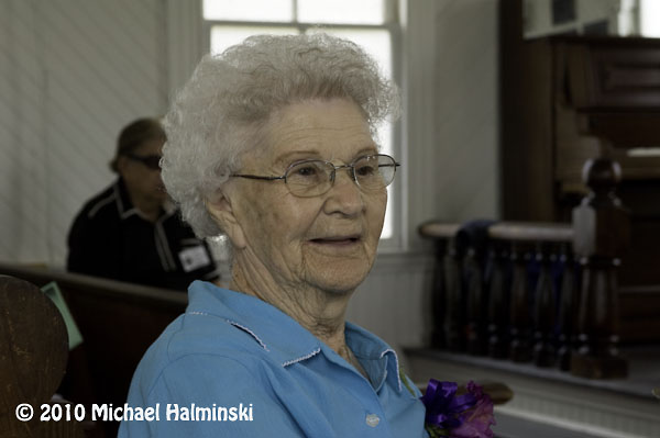
Born in 1921, Dot Willis affectionally known as “Miss Dot”, is the last surviving resident that was born at Portsmouth Village. The light coming in the translucent windows of the church was very nice so I took the opportunity to speak with her, and make this available light portrait.

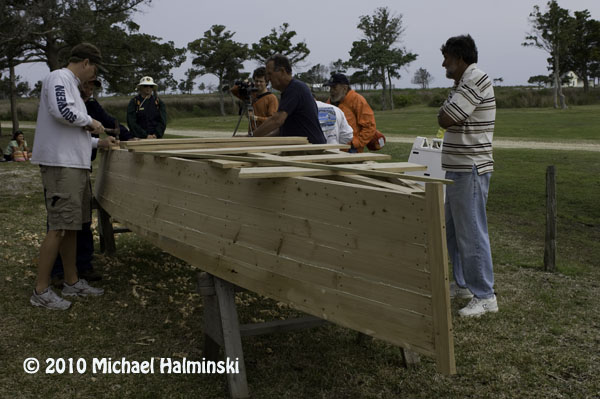
Back in the day, the flat-bottomed skiff was a preferred mode of transportation. These guys were fastening the bottom planks in a boat building demonstration.

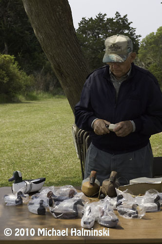
Roy Willis from Stacy, NC was showing his waterfowl carvings.

Roy made and hunted over these green winged teal decoys last season.

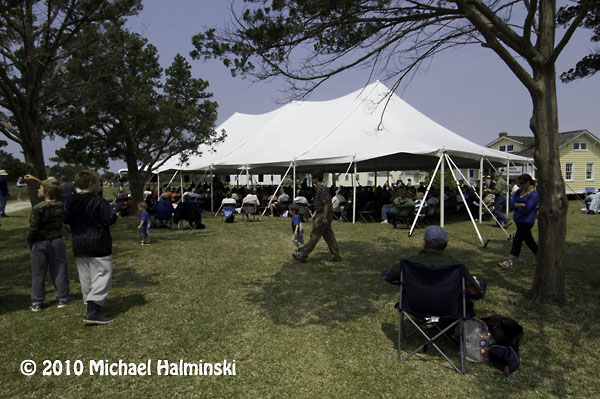
The main tent provides seating for up to 500 people.

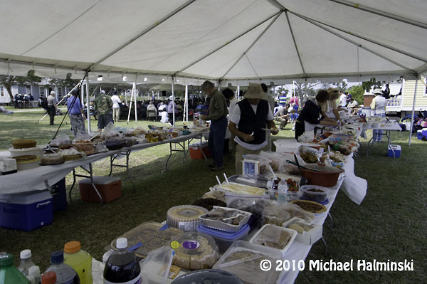
Then there’s the covered dish dinner with plenty for everyone. And the mosquitoes weren’t even that bad. If you go in 2012, I’ll see you there.

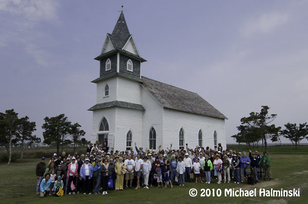
Group shot of attendees at the 2010 homecoming.


Modern Day Shipwrecks

Often referred to as the Graveyard of the Atlantic, the ocean off the coast of the Outer Banks is  littered with hundreds, if not thousands of shipwrecks. Before modern modes of sailing, navigation and weather forecasting, commercial shipping was a more dangerous proposition than it is today.  Vessels transiting these waters however, still encounter problems.

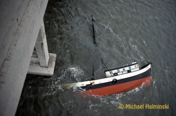
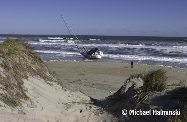
I was reminded of this as I wrote a previous blog entry about the Sheila Rene running aground at Oregon Inlet. Similarly in October of 1977, as I was driving over the Bonner Bridge, south to Hatteras Island, I noticed a capsized trawler in the water next to the bridge. It was the fishing vessel Tosco. It was coming in the inlet with a 10,000 pound catch of flounder, when it ran aground and crashed into one of the bridge’s concrete piers. With a gaping hole in the hull, it sank right there on the spot. The boat was an estimated $100,000 loss, and the bounty of fish was also lost.

The Tosco at Oregon Inlet in 1977.

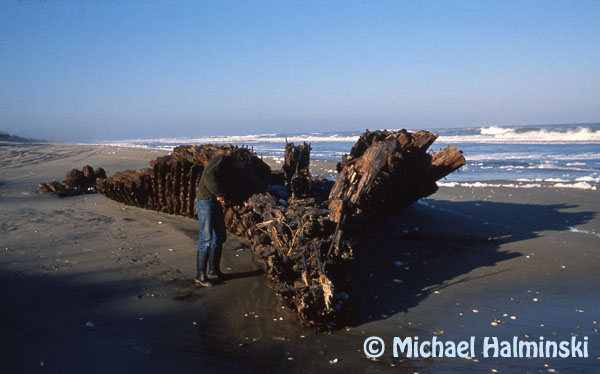
When most people think of shipwrecks along our shores, they think of the wooden sailing ships of the distant past. One of the last such wrecks was that of the GA Kohler. Built in Delaware in 1919, it was a 4-masted schooner, just over 200 feet long. Washing up in a 1933 storm, it is significant as marking the end of an era. It lay upright on the beach and was stripped in the war effort for materials, and subsequently burned. Some of the old artifacts, like wooden timbers, compass and even dinnerware, are in local homes today. The remains of the GA Kohler are currently buried beneath the beach sands near Ramp 27, but on rare occasions the remnants are uncovered by the ocean.

This photo from 1989 shows my friend Robin Gerald inspecting the stern section of the GA Kohler.

Since then, maritime mishaps have become less likely, and rare. Most of the activity on coastal waters nowadays pertains to sport or commercial fishing boats, and private yachts, among others. 

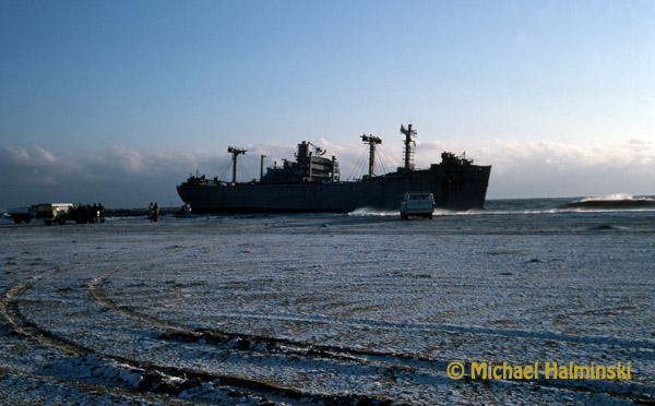
One exceptional event though, occurred in January of 1976 . It was during a freezing northeaster. I awoke in a bitter cold mobile home and couldn’t open the north door to get out. It had been frozen shut during an ice storm. The entire north side of the trailer was coated solid with 2 inches of ice. Once I got outside, I looked toward the beach and saw a sight that I could not believe. A 500 foot World War II liberty ship, Betelgeuse was washed up and towering on the beach. The moth-balled ship was being towed by a tug offshore when the storm hit with a vengeance. The tug, unable to handle the situation was forced to cut it loose. The ship sat on the beach for over a month until salvagers managed to move it, but not before Mac Midgett tied a line to it, claiming salvage rights. It was said that he made a few thousand bucks for his effort.
The World War II Liberty Ship washed in during an ice storm in 1976.

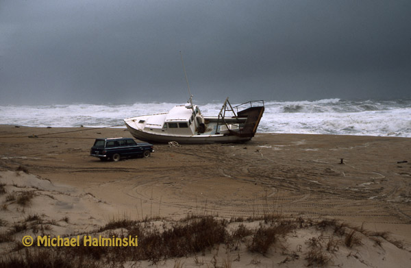
1987 was a banner year for stranded fishing boats. Here the Sweet Lady sits on the beach at Rodanthe, just yards from the pier. It was abandoned offshore during a storm as the crew evacuated via Coast Guard helicopter. It came short of hitting the pier, and was eventually salvaged.

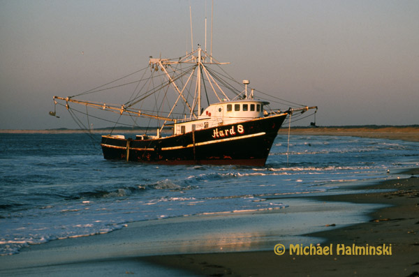
The Hard 8 came ashore in “the hook” at Cape Point that same year.

When the Miss Manhattan washed ashore in 2000, it had hit the Rodanthe pier, and was dismasted in the process. It was salvaged.

The Sly Fox came ashore on Pea Island around Christmas of 2004… not so sly any more.

They say that one problem on the water, especially during severe weather, can turn into multiple problems very quickly. With distressed vessels in the Graveyard of the Atlantic this seems to be a common denominator.