Category Archives: buildings

Barrier Island Transformation

I’ve lost track of time since Irene struck and flooded our villages more than six weeks ago.

There’s been a lot of cleaning up, and that should continue into the coming months and throughout the winter.

It’s been an emotional roller coaster, and I’ve been preoccupied with multiple tasks while trying to document life here, as I go. Of course, the newly cut inlet at Pea Island has had my curiosity the entire time.

So on Saturday, I saw the affected areas for the first time with my favorite pilot, Dwight Burrus of Hatteras. He owns and operates Burrus Flying Service, and I highly recommend his expertise in flight as well as his knowledge in local lore and history.

Here is some of what we saw the other day.

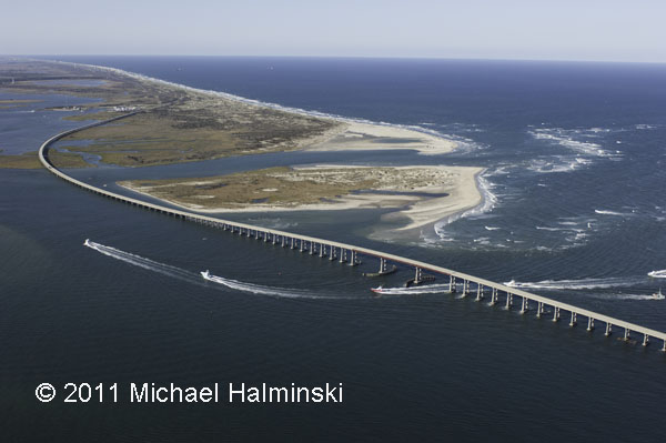
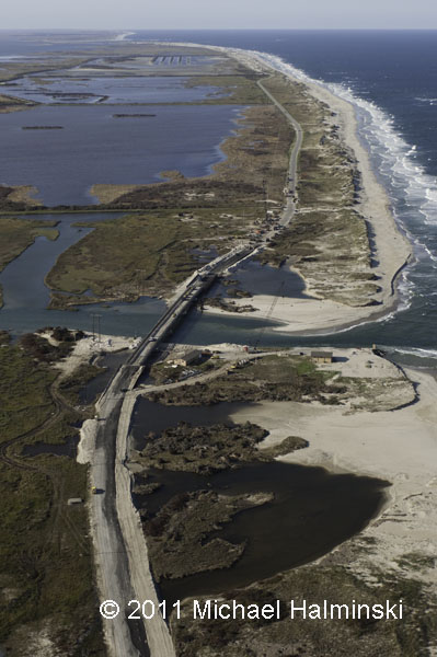
Bodie Island spit on the north side of Oregon Inlet has been split in two, while the navigation channel has been scoured to an increased depth.

The west dike at the north pond impoundment of the Pea Island refuge was breached by the storm surge.

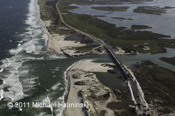
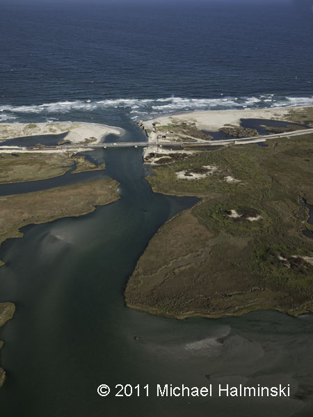
Of course, Irene Inlet has been the talk of the town. This is one of the key spots where the pressure of the surge from Pamlico Sound was released.

HIghway 12 looking north towards the wildlife refuge impoundments and Oregon Inlet.

Looking west toward Pamlico Sound. Before the inlet was cut this coastal marsh was a prolific haven for marine life. With the flow of water in and out, it will be interesting to see how it adapts.

A quarter mile to the south of Irene Inlet is New Inlet cut in the storm of 1933. Still visible in the top of the picture are the remnants of the bridge that was never completed, as that inlet naturally filled back in.

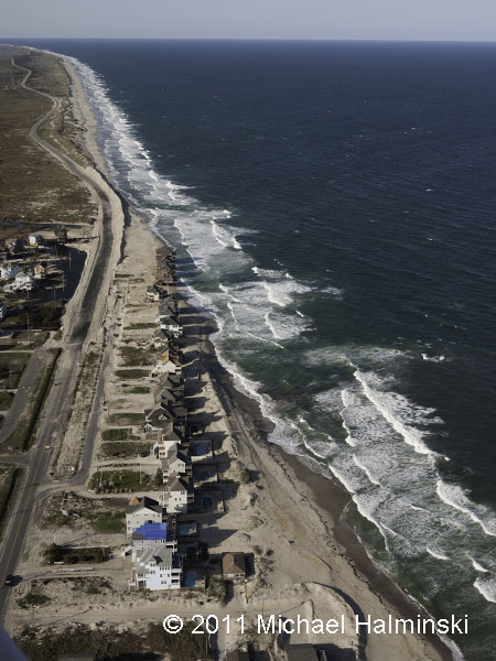
My advice is not to buy oceanfront property at Mirlo Beach. It’s a loosing battle, for sure.

Looking north to Pea Island, the Mirlo Beach oceanfront is very unstable. The long, winding road beyond runs through the wildlife refuge.

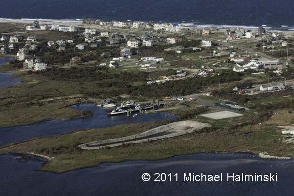
The NC Ferry System has been the only link to the mainland for several weeks. Next to the ferry terminal on the right side of the picture is the community building that became instrumental in providing for the needy citizens of the Rodanthe, Waves and Salvo.

The National Park Service Day Use Area south of Salvo has become the landfill for all the debris collected since the storm. The Farrow family cemetery, which was damaged by the storm, is at the lower left. The road at the top of the photo is the entrance to ramp 23 beach access.

The debris piles are much larger than most of the houses in the villages.

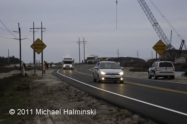
This afternoon about 6:00 they opened the new temporary bridge, allowing visitors to enter the island once again. There was relatively little fanfare, some media coverage, and I could hear some vehicle occupants cheering as they rolled across the new bridge.

It’s going to be interesting to see how well this works out in time. What will the natural elements throw at highway 12 next….. and when?

Irene, the New Benchmark

Despite our well intentioned preparations, hurricane Irene took everyone in our villages by surprise. I knew we were going to have a significant storm surge from the Pamlico Sound, as in storms of the past, but not to the extent that we got. In 2003, Isabel brought in 18 inches of water on my property. Floyd in 1999 was 24 inches. Bonnie in 1998 had 26 inches. The March storm of 1993 flooded with 50 inches of tide, and Irene came in with a whopping 66 inches. According to some of the old timers, the storm of 1944 was a benchmark by which other storms were compared. Flooding back then was apparently somewhere between the March storm and Irene. Hurricane Irene brought in more storm surge from the sound than any storm for the last 75 years. It is now the new benchmark for soundside flooding in our villages on this part of Hatteras Island.
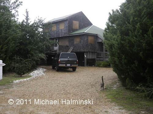
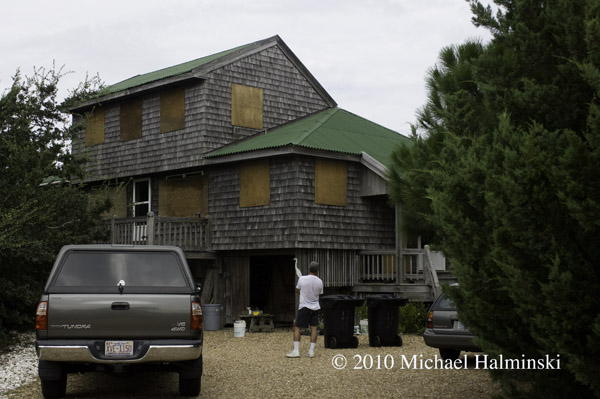
Boarded up, an all too familiar sight.
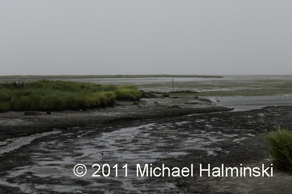
Pamlico Sound tide blown out upon Irene’s approach.
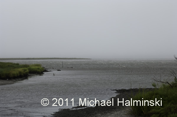
Tide coming in ahead of the wind shift.
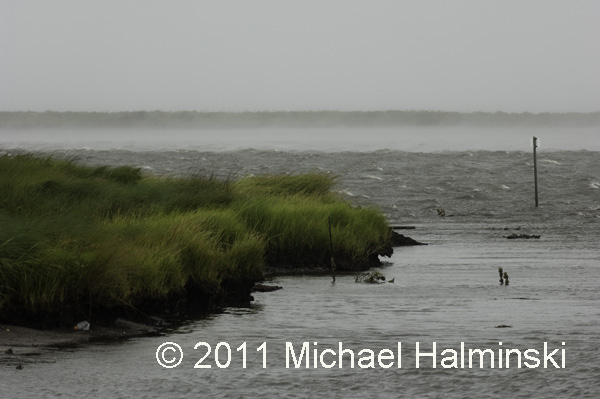
Smoke on the water as the shifted southwest wind picks up, blowing 50 to 60.
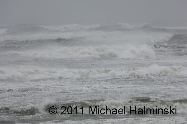
During a lull, I ventured to the beach for a shot at the ocean.
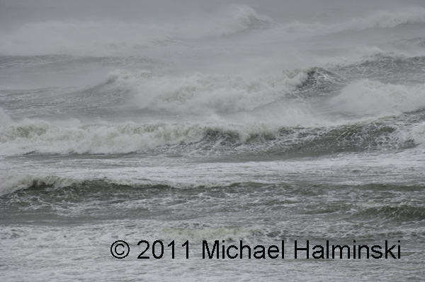
It was pure chaos, and I had trouble making it back to the house.
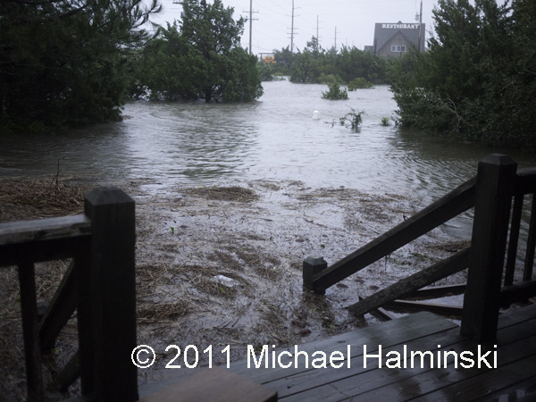
Good thing I wore my chest waders. 3 feet of water had already entered my yard, and I had 5 cats to rescue from the rising water. The barometer had dipped to 964 millibars and in the end dumped 6 feet of sound tide around my house. The water had risen to within a fraction of an inch from coming inside. We were extremely lucky.
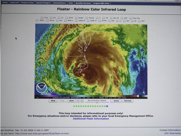
I took this screen shot of my computer, using a battery backup, right after the power went off.
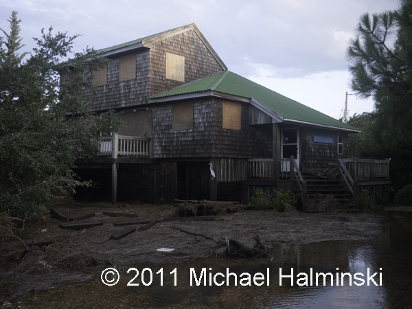
The next morning after the storm, the yard was a mess with debris.
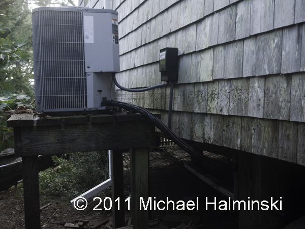
The tide had gone right up to my heat pumps, and then some.
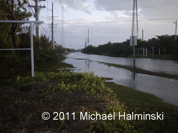
This is highway 12 in front of my house after the storm. It was eerily quiet, warm and damp. I would soon find out that many residents did not fare as well as I did. The road down the island had also been washed out.

There were many homes damaged or lost.
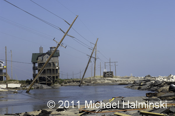
And of course, the electricity was cut off.
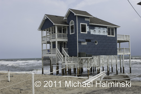
Also as a result, the cottage Tailwinds eventually fell into the sea.
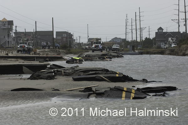
The road at Mirlo Beach was destroyed.
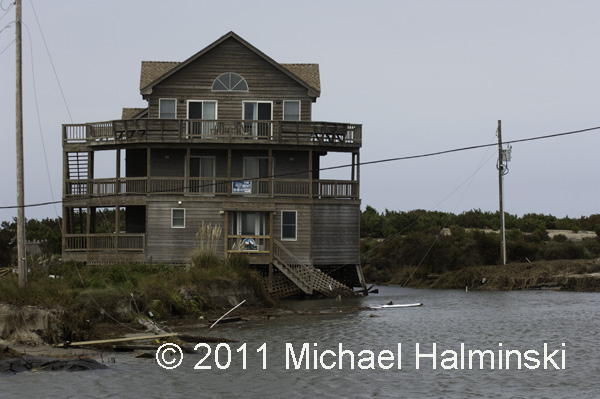
A leaner at Mirlo Beach.
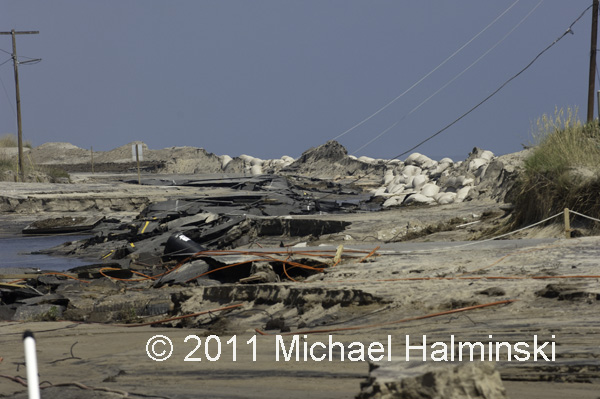
Highway 12 at the S-Curve.
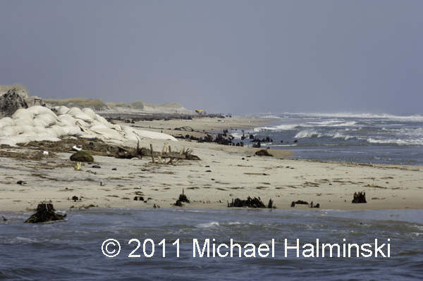
A new inlet had been cut at the S-Curve, exposing cypress stumps of a forest nearly a thousand years old.
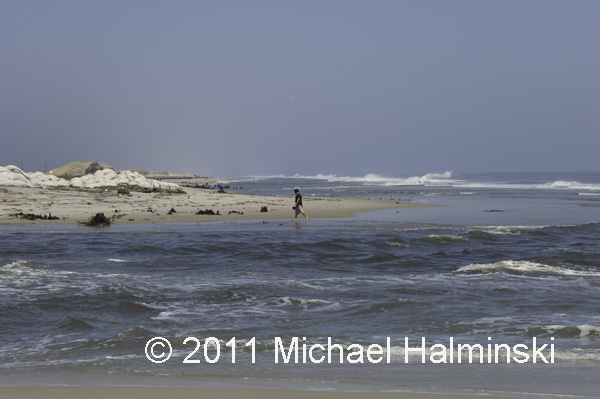
The inlet is actually an outlet caused from the sound rushing into the sea.
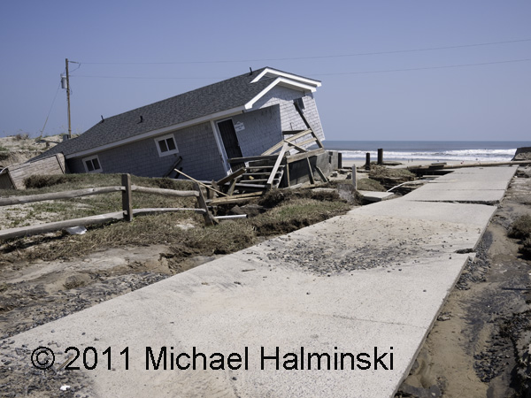
Another outlet was carved through North Beach Campground in Rodanthe.
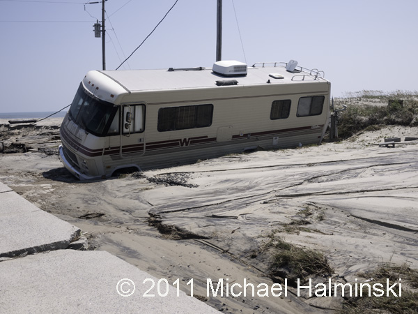
A motor home at North Beach.
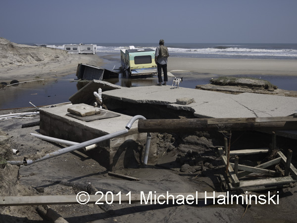
Gerald O’Neal surveys the mess at his family-run campground.

The campground’s general store was inundated with sound tide.
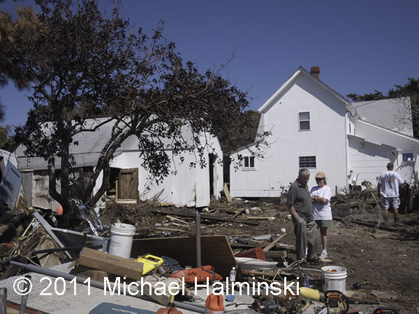
Lance Midgett’s house is over 100 years old. This is the first time a tide from Pamlico Sound has gone inside. His cleanup and rebuilding will take a long time.
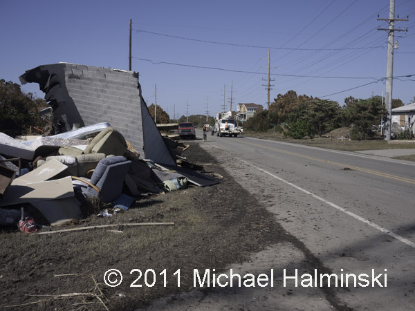
As residents take on the daunting effort of rebuilding, debris is piling up along highway 12.

Since the day after Irene left, the Salvation Army has been there to help those in need.

They are providing 3 hot meals every day,as well as lifting our spirits.
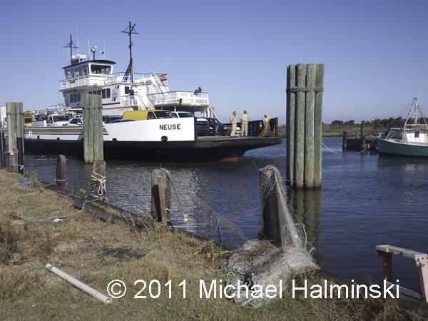
Now the ferry system is the only way on and off the island.
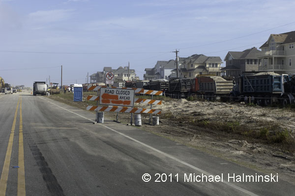
For days, trucks have been running around the clock to deliver sand from a borrow pit in Avon. NCDOT hopes to fill in the gap at S-Curve cut by the storm surge.
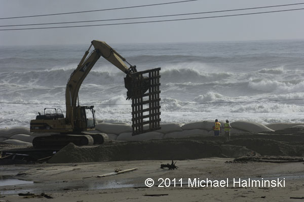
Pallets are moved into place to enable trucks to dump sand for a new roadway. In the meantime, huge swells from Hurricane Katia threaten the shoreline.
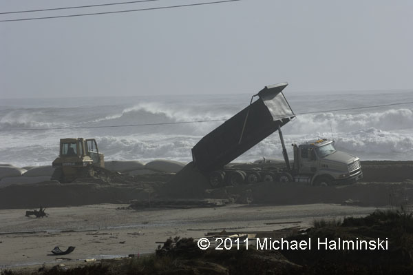
Do you think this is really going to work? This is a classic “man against nature” scenario.
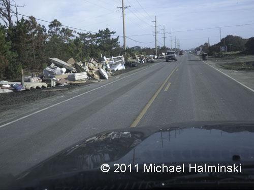
Meanwhile the debris continues to pile up along highway 12. This is far from over.



Epilogue to Earl


The final situation here was not nearly as bad as we were anticipating. Over wash on the oceanside was minimal, as was the moderate 4 foot surge from the sound. Other than some broken branches and debris in the yard, most everything is okay.

Everywhere are signs of the power of nature, and it could have been so much different had Earl been any closer.

Serendipity is still snug on its new location.

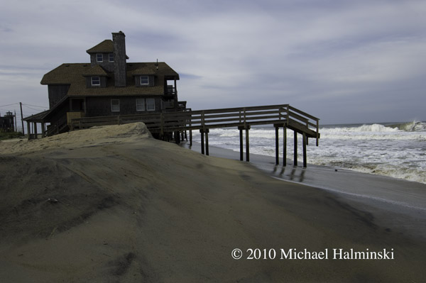
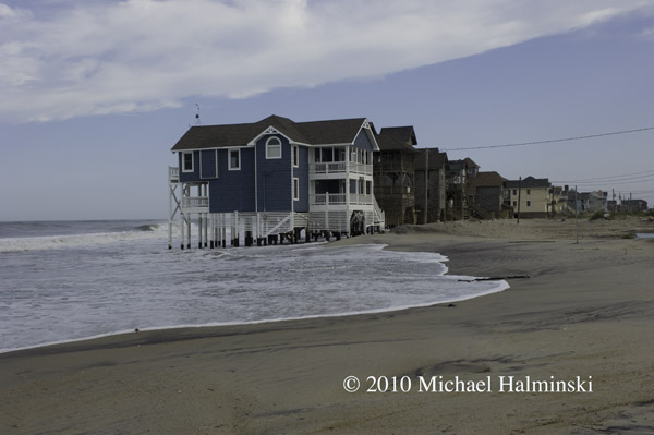
Before the storm, these steps at Mirlo Beach were touching the sand.

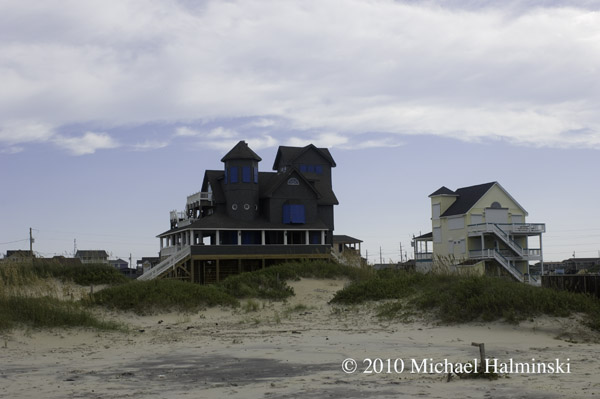
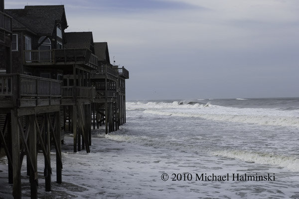
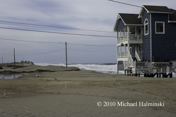
The oceanfront at Mirlo Beach almost always receives the highest impact. With one of the highest erosion rates in the state, it’s probably not long before these homes succumb to the ocean’s power. Yesterday the county just re-condemned three more properties.

The northern-most cottage, Tailwinds is nearly on it’s last legs.

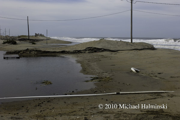
Looking at the S-Curve area, the scene is not as bad as anticipated.

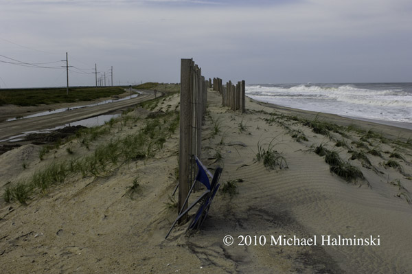
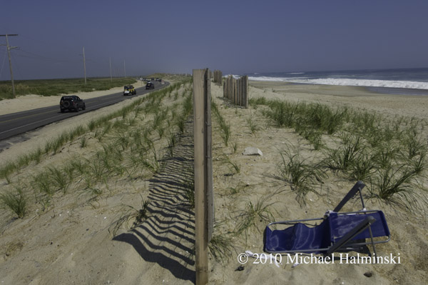
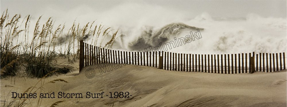
Two days ago, I would have bet money that this sand fence and dune would be completely washed away, along with some highway pavement. This being intact sums up our good fortune with Hurricane Earl.

NCDOT did not waste any time going to work clearing the highway. This morning at 7 AM, the road was opened to traffic for the big Labor Day weekend.

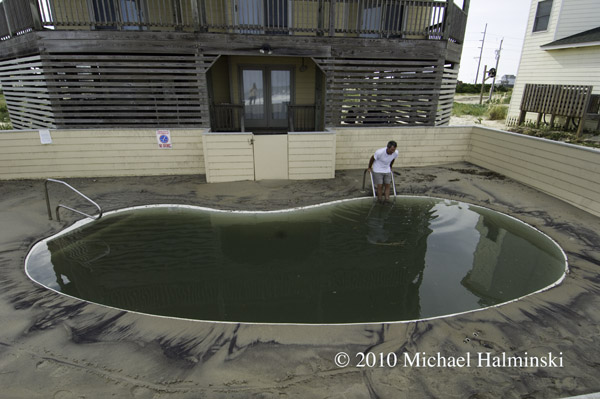
But be careful about which salt water swimming pool you dive into…..


Watching and Waiting

Years ago, before there was cable television and the internet on Hatteras Island, I relied a lot on weather radios. I also had my dad, a career meteorologist, for tracking and updates of tropical systems. With an approaching hurricane my dad would look at surrounding pressure systems and could plot a course using his protractor and a set of parallels. He had an uncanny sense of predicting where the storms were headed, and a detached calmness even about a major hurricane bearing down on one of his sons.

Today of course, we have the world wide web of information. And that’s a good thing, because my dad is gone, and it’s helpful to know what we’re in for. Hurricane Earl is forecast to head our way and veer off slightly to the north northeast just south of the Cape. And that would be a good thing. Hopefully we can dodge this storm, like many others.

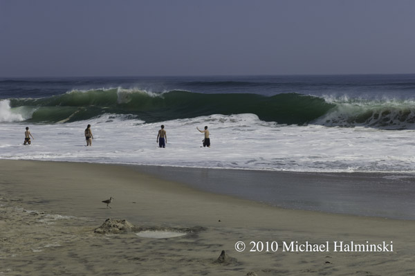
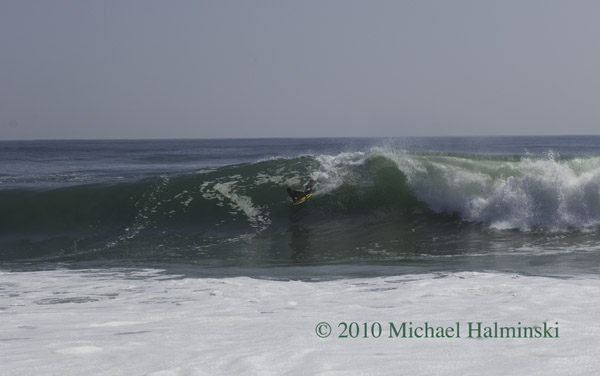
Yesterday morning I drove up to the S-Curve to check the swell, and it had definitely picked up. There were a few brave souls playing near the shore break, and even some body boarders getting some thrilling rides. From the beautiful weather, you’d hardly know that there was an approaching storm.

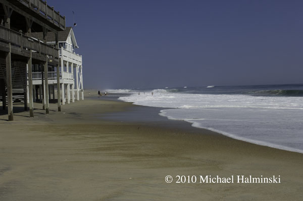
Rodanthe oceanfront on Wednesday.

Playing close to the shorebreak at S-Curve.

Body boarding on a big glassy face.

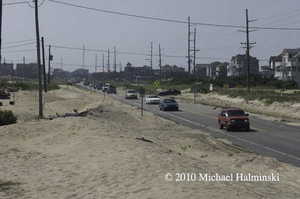
Evacuees leaving town through Mirlo Beach.

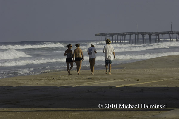
Making the most of the last day of gorgeous weather near Rodanthe Pier.

The end of Wednesday with swirling high clouds.

Next morning, after a restless sleep, I wonder what the next 24 hours will have in store. It’s hot and humid, and light northeast winds. The house is boarded up with plywood that I bought 28 years ago.

All boarded up and ready to move vehicles to higher ground.

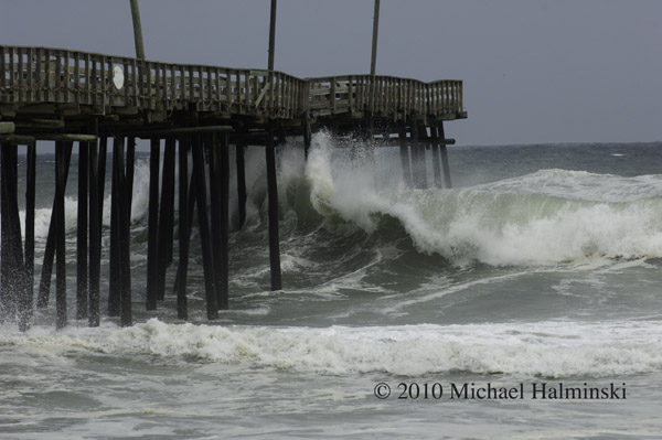
Thursday brings in rough surf at Rodanthe Pier.

The artificial dune at S-Curve on Wednesday morning.

Same location on Thursday. Hurricane Earl will pass in several hours, and like many hurricanes, at night. I can’t tell you how hot and humid it is, and I’m worn out from all the preparations. It’ll be a long night.

I intend to expand this blog entry as time goes on. So stay tuned.


Portsmouth Village Homecoming

For me, the most intriguing town on the Outer Banks is the village of Portsmouth. Situated on the northeast tip of Portsmouth Island, it played a significant role in local maritime history for well over one hundred years. It’s geographic location next to Ocracoke Inlet was important in making it a major port of commerce when wooden ships still sailed the seas. Deep draft ocean going vessels could offload goods there, and smaller boats would come from inland river towns to pick it up. From the 1750’s to the 1850’s, Portsmouth was a thriving seaport. According to an 1860 census, the town had a population of 685 residents.

But by then, things were beginning to change. A series of storms opened other inlets, and at the same time Ocracoke Inlet began to shoal. Shipping routes changed, commerce dropped off, and gradually the town dwindled to only a few people. With the death of Henry Pigott in 1971, the last man to live at Portsmouth, the last two residents, Elma Dixon and Marion Babb reluctantly left the island.

Today the 250 acre historic district of Portsmouth Village is a part of the Cape Lookout National Seashore. The remains of the town have been left intact and maintained.

Since 1992, the Friends of Portsmouth Island have sponsored a homecoming every 2 years. I went in 2008, and looked forward to this April 24, 2010 event. Again I was not disappointed. Here are a few things that caught my eye.

Descendants of village residents pose for a photographer in front of the Dixon/Salter house.

The Robert Wallace house.

The Dixon family cemetery.

The post office opens every other year for this event, including canceling postage stamps.

Ocracoke fisherman Gene Ballance demonstrates the art of net mending.

James Gaskill wears a device once used for fire-lighting waterfowl. He is also a commercial fisherman from Ocracoke.

At the old Coast Guard Station, Dave Frum explains the beach apparatus method for rescuing shipwreck survivors.

The Methodist Church was always a focal point of the community and still is.

88 year old Rudy Carter and Mil Hayes ring the bell to begin a church service. Rudy is a descendent of Henry Pigott, the last man to live at Portsmouth.

Get to the church on time if you want to get a seat.

Born in 1921, Dot Willis affectionally known as “Miss Dot”, is the last surviving resident that was born at Portsmouth Village. The light coming in the translucent windows of the church was very nice so I took the opportunity to speak with her, and make this available light portrait.

Back in the day, the flat-bottomed skiff was a preferred mode of transportation. These guys were fastening the bottom planks in a boat building demonstration.

Roy Willis from Stacy, NC was showing his waterfowl carvings.

Roy made and hunted over these green winged teal decoys last season.

The main tent provides seating for up to 500 people.

Then there’s the covered dish dinner with plenty for everyone. And the mosquitoes weren’t even that bad. If you go in 2012, I’ll see you there.

Group shot of attendees at the 2010 homecoming.