Category Archives: storms

Beach Walker

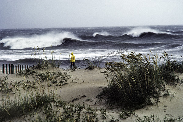
Charley was a minimal hurricane that went up the Pamlico Sound in August of 1986. Hatteras Island was evacuated and the sound tide rose to a moderately high level. It wasn’t devastating at all. But like many storms it gave me an opportunity to shoot a series of photographs, hoping to get at least one that might be memorable for me.

As Charley passed, I hit the Rodanthe oceanfront to encounter a strolling beachcomber. He didn’t notice me and I waited for a good set of waves to record a moment in passing.

Belle Swell

The first week of August 1976, as a tropical system was approaching Hatteras, I was living in a flimsy mobile home behind the dunes in Salvo. By the 8th, the storm had developed into a major hurricane with winds peaking at 120 mph. Hurricane Belle was the first storm, since I’d moved to Hatteras Island, that had people suddenly evacuating.

My neighbors, Johnny and Linda Hooper, welcomed me into their brick home where I spent the night as the center passed within 60 miles offshore. The next day as Belle sped northward, winds shifted more westerly as huge swells poured ashore. Conditions were favorable for some great surf.

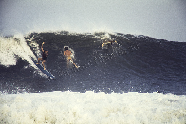
With a board and photography equipment in the microbus, I headed to the lighthouse, the only spot to handle such radical conditions. It was tumultuous and defied my skill as a surfer. Not many were able to paddle out past the giant breaking waves. Discouraged surfers washed in on the beach and only watched. Not many were successful in making waves at all.

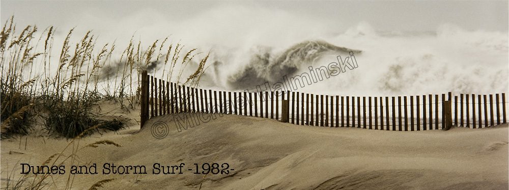
From the dunes I took a few pictures with a 650mm Century lens attached to a tripod-mounted Nikon.  The best ride I saw was when Terry Metts of Frisco, dropped in on, what some would call, a solid ten-footer. Tall and lanky, he was barely halfway down the face and it was still well over his head. He had the skill, stamina and the board to pull it off. Brian Jones also a Frisco surfer, lay prone on the face of the wave, hoping for the best, while another paddler punched through the cresting lip. It was chaotic with constant, relentless swells. By the end of the day, Belle swells were pretty much gone.

Two Storms One Tide

As Florence changed course and battered other portions of North Carolina, many here thought that we’d escaped its power. In the meantime, torrential rain flooded inland rivers that would eventually feed into the sounds along the coast.

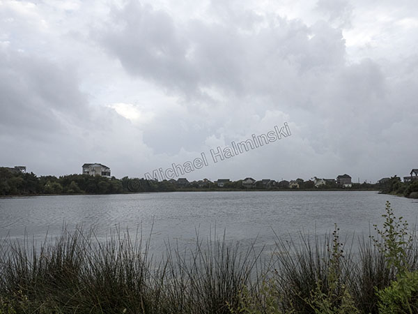
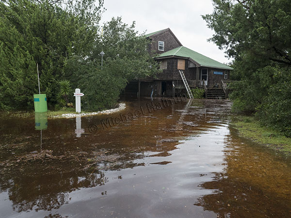
For the three weeks after Florence, I noticed a salinity drop and a higher tide level in Pamlico Sound behind my house. In fact it was 2 feet higher than normal, and stayed that way as Hurricane Michael steamed into the gulf coast of Florida.

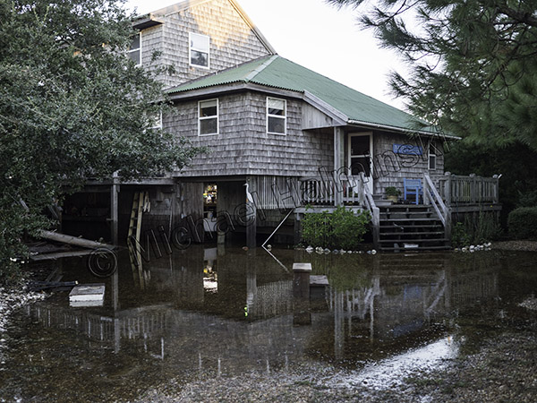
When Michael’s path steered more to the west with winds of about 50, our prospects were looking better, although I recalled other storms taking a similar course, pushing the sound waters eastward. I expected tide so prepared for some rise. By eight o’clock on the night of the 11th the wind began shifting southwest and picking up. My barometer read 990 millibars and then the water began coming in. It rose until after midnight, and was 3 feet deep in the yard. Then as fast as it came up, it receded by early morning.

My house has another water line notch on it.

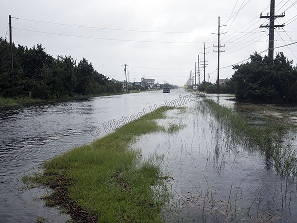
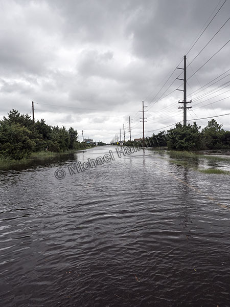
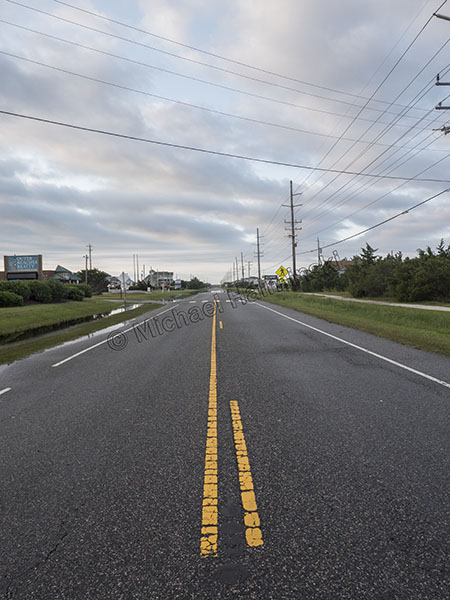
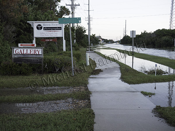
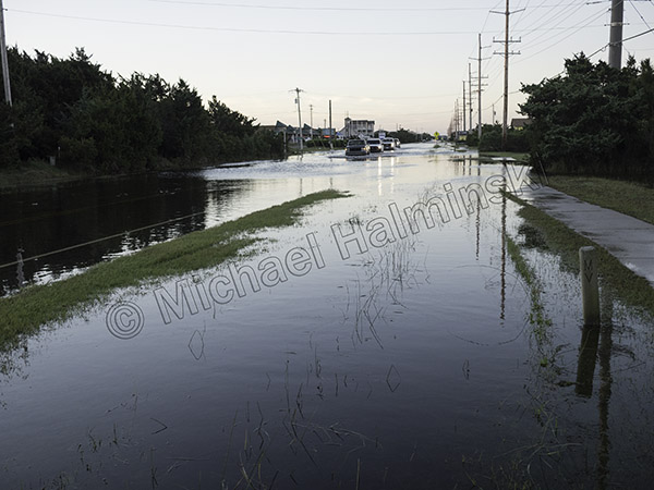
By sunup most of the water had drained off, but Route 12 still had issues with standing water.

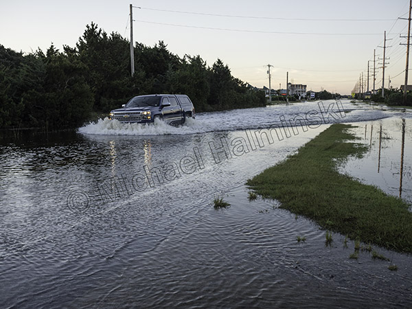
Driving through it is hazardous to your vehicle’s health.

Driving through the tide is even worse when you navigate on the deeper side of the road at a higher rate of speed. That was a nice new truck!

The stories of stranded and flooded vehicles were numerous. To compound matters there was no evacuation order. The campgrounds were a mess. Flotsam and jetsam were everywhere within the water’s reach.

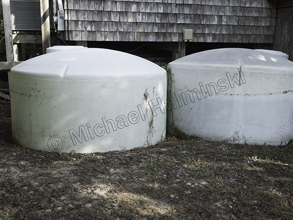
Cisterns next to my house have waterlines to show the flood depth. Being filled with fresh water, they tend to float as the more dense seawater gets deeper. The tank on the right was only three quarters full and came up a foot off the ground.

By my count, this was the 4th highest tide that I’ve seen here in 45 years. It was 32 inches below Irene, our highest with a ten foot storm surge. Right in between at 16 inches below Irene, there’s Arthur 2014 and the March storm of 93.

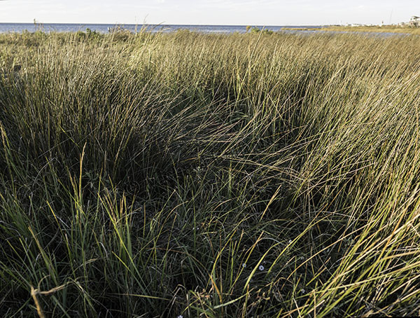
I’m always amazed at the resiliency of the salt marsh, particularly after a flood.

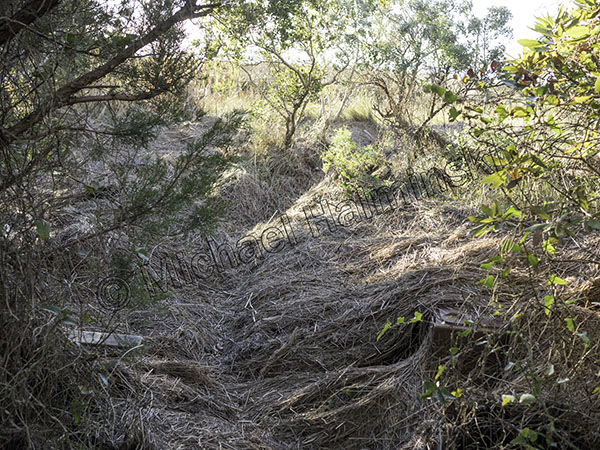
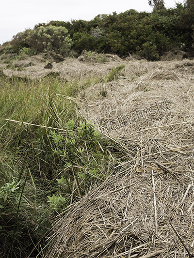
A rack line of debris shows forces at work. In six months it will be completely decomposed with tall thriving marsh grasses in its place.

The wetland looks healthier for it and flourishes come drought or high water. This section is composed of mostly black needle rush, sometimes called juncus grass. In adverse conditions it provides great shoreline protection for my property. It’s also a desirable habitat for clapper rails and seaside sparrows.

About the size of a dime, the marsh aster is still beautiful after being inundated with wind, waves and sea water.

Florence

A week ago I sat at the Tiki-Ti bar in Los Angeles watching a bartender making tropical drinks, like Hurricanes.

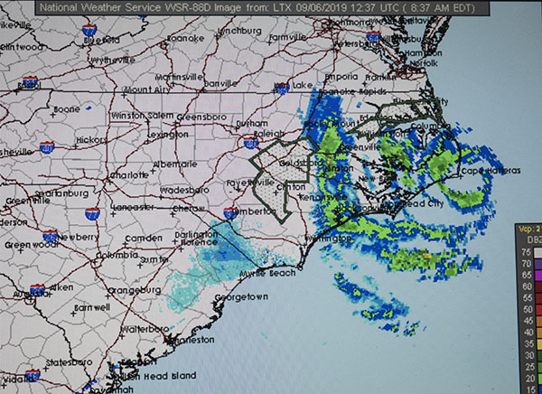
Today I’m sitting in my house in the fringes of Hurricane Florence. What a difference. Real hurricanes spawn emotions like no other. Preparation is tedious and keeping updated on the storm essential. But at some point one must cross the line of either staying or evacuating. It’s a serious decision to make. Based on all the information I could process on Florence, I decided to stay.

Yesterday was gorgeous with big puffy clouds and building surf.

Today is much different as weather rapidly deteriorates.

Highway 12 has no traffic and almost everyone’s gone.

At noon the eye of Florence was right below Cape Hatteras and moving in on Wilmington.

By the end of the day, strong winds from the east had lowered the Pamlico Sound behind my place by about 4 feet.

Overnight was wet and windy, though not extremely so. Barometric pressure never went below 1008 millibars. The bullet dodged us. Next morning the first place to look is Rodanthe Pier. It always was the go-to spot and still is. I hope this isn’t last legs for our local hangout. It’s a constant maintenance pit.

This swirling environment is also tough on a new Leica lens.

The erosion around the fishing pier has accelerated in the last few years, and it doesn’t resemble anything like it was 30 or 40 years ago.

It appears the pier itself has basically been spared this time.

Meanwhile in North Rodanthe the beach continues its retreat.

The beach in Salvo remains broad and more able to sustain nature’s onslaught.

What’s next, take down the plywood already?


It’s a Gift

Early March is known for stormy weather. Notorious  examples of this on the Outer Banks are the Ash Wednesday storm of 1962, the hundred mile an hour blizzard northeaster of 1980, and the 1993 white hurricane that brought substantial flooding.

This year back to back northeasters took yet another bite out of the island. Route 12 was highly compromised in several spots, and weather conditions were generally cold, windy and wet. Rather than documenting it with my camera, I spent much of that time painting the walls inside my studio.

At one point, I peered outside as rainy skies cleared about half an hour before sunset. Anticipating dramatic light, I took the hint to grab my Nikon and head to the beach. I was rewarded with a brilliantly lit sea under a colorful rainbow.

I had a 20mm lens to shoot a turbulent ocean framed by the rainbow.

I couldn’t resist shooting the ends with a 200mm lens.

The telephoto effect brought the seas closer for impact.

As the light dimmed, I caught one last glimpse.

With the perceived negative aspects of coastal storms, there are always some gifts that come with them.