Author Archives: j0jgvm89bj

Shelly Island and the Great Power Outage

When the bridge to Hatteras Island at Oregon Inlet was opened in 1962, it changed the way people live here. Road access and electricity made life easier for the locals and boosted the economy.

The recent power outage reminded me again that we’re living on an island and dependent upon on  mainland conveniences. Disruptions in electric service have been commonplace historically, but less common as transmission lines got updated.

After years of living here I’ve learned to expect the unexpected. The recent power outage is a good example. It came as a surprise and unlike numerous other events was due to a manmade error. Once the island was evacuated of visitors there was an immediate quietness from the busy peak-summer noises, and streets became eerily deserted.

For two days, a portable generator kept our freezer and refrigerator from spoilage and kept some lights on, until the electric co-op could bring in the generators to give us needed relief.

Luckily, during the outage we experienced the best weather of the entire summer. Temperatures moderated and humidity was minimal.

On a gorgeous evening, I rode my bike down the center of highway 12 without a car in sight.

To help in the repair, huge bucket trucks were staged on the road to the Rodanthe Pier.

Normally packed with fishermen, the pier was empty.

Throughout the Summer we kept hearing about the newly formed island off of Cape Point. This constantly changing location has always been a geographic phenomenon. There have been island shoals there before, but I haven’t witnessed one as large as the new Shelly Island.

It became wildly popular and made national news. The crowds out there made me want to avoid it. But when the lights went out, and the evacuation order came, I changed my mind.

That’s when I decided it was a perfect time to check it out.

Upon arrival we could see Shelly Island across the waves in the distance. There were a few people out there and perhaps 2 dozen vehicles parked along the Cape Point shoreline.

I saw children and adults frolicking in an ultimate water park. Tide pools created big spas and everyone was clearly having a wonderful time.

I was taken by a little girl happily playing with a doll.

My friends Chris and Chandra were paddling back after exploring the island.

Another paddle boarder was on his way over with his dog behind him.

People walked to and from the island on a shallow sandbar.

Once I waded to the island, I could understand it’s namesake, as a nice small wave rolled along shore.

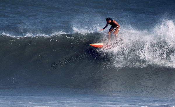
A surfer cruised by on his long board.

Shelly Island is a shell seeker’s paradise.

Mike Bigney found and old piece of a shipwreck timber.

By some estimates, Shelly Island is a mile long.

In an unscheduled day off, the whole crew from Lisa’s Pizza was on hand to make a good time of it.

At the far end of Shelly is the shoal were north and south swells converge. It’s also been an area of numerous shark sightings. I expect to make more visits to Shelly Island.


Vintage

The way photography is today, you can’t believe every picture you see. Images can be enhanced or altered relatively easy. My photography has been pretty straight forward. I’ve always tried to make prints how I shot them. In the real darkroom tools were fairly limited compared to digitized versions.

Last year I had a commission to work on a book cover with the Cape Hatteras Lighthouse and Keepers Quarters as it’s main theme. It needed to look like it could have been the early 1900’s. The historical fiction book entitled Seaspell was written by local author Bronwyn Williams and published by Chapel Hill Press.

I scoured through thousands of images before I came up with a working concept. In 1996 I was using a medium format camera producing negatives measuring 2 ¼ x 2 ¾ inches. The larger negatives yielded some pretty sharp prints compared to 35mm.

The main shot I used was taken from an unusual northwest angle near the old coast guard base. Visible to the right was the original keepers quarters. To make it look more dated, I removed a utility pole, some shrubs and the boardwalk extending from the lighthouse over to the beach.

Other items needed to be added though. In the original photo, the sky was clear and featureless. I had taken another photo as Hurricane Edouard passed offshore on September 1 that same year. It showed the lighthouse from another angle, but displayed gorgeous clouds as a result of the nearby storm.

I selected those clouds and pasted them into the featureless sky, and it made a dramatic difference. To give a little more depth to the composition, a strip of blue ocean was added between the dunes from a third photograph. The publisher later added a figure walking down the path.

It took some time to throw it all together and still appear genuine, but it illustrates you just can’t believe everything you see.

Down Under Down

Over the years I’ve seen restaurants here come and go. Some fail faster than others, and it’s not an easy business to achieve success. It’s about quality, quantity and customer satisfaction, among other things.

One of the most successful restaurants in our town was started at a location where several other restaurants had come and gone. The Rodanthe pier complex had reincarnations of restaurants in the same building with names like Cross Currents, Under Currents, JL Seagull and Down Under. There were others prior whose names have escaped me.

Undoubtedly the most successful was the Down Under, founded by Skip and Sheila Skiperdene. The name was coined by Australian ex-pat surfer Skip, who married Sheila a North Carolinian, and they began the Aussie-themed restaurant. It took a year or so to catch on, but with planning and hospitality it became hugely popular. Most summer evenings had dozens of patrons lined up outside the front door waiting to be seated. This went on for about ten years, when personal circumstances ended the epic run of Down Under circa 1999.

This 1989 aerial photograph shows the pier complex, including the restaurant building under the arrow. The proximity to the ocean made a dramatic venue for diners, but also contributed to it’s demise.

An aspiring restauranteur then bought the trademarked name and stepped in to continue to operate the business. Something however was missing and the restaurant was not quite the same. A few years later, things really went south when Hurricane Isabel pummeled the property.

After continuous battering from high seas, storm surge from Hurricane Isabel finally took it out in 2003. This photograph taken by my wife, was probably the last shot ever taken from the upper deck of the restaurant. It was a harrowing experience.

An aerial image shows the newly built Gallery restaurant circa late 1980’s. It featured local art, and a home-grown herb garden. The Gallery made national news when a man died from eating bad tuna there, ending that venture.

The Gallery was sold to a new owner and renamed Waves Edge. They employed local chefs preparing great meals. This 1991 photo was taken during their hey-day. It was popular with locals and visitors alike. That lasted until personal issues forced another sale, this time it was changed to Blue Water Grill, featuring an upstairs wine bar.

The new Down Under owner wanting to sustain the business, bought the building in Waves that had previous lives as The GalleryWaves Edge, and Blue Water Grill.

The new Down Under struggled for several years and eventually landed in foreclosure. It sat vacant and unmaintained a few years until it was bought by an adjacent property owner then demolished on June 27, 2017.

Going, going… pretty much gone!

Down Under is history. And it all began with Skip.

Mac Midgett

Hatteras Island has produced a unique breed of people. The isolation, especially before a bridge was built, required residents to be particularly resilient. To say they are interesting folks is an understatement. Among the most colorful characters I ever met was Mac Midgett. He was a big man with a heart of gold.

His stature could intimidate people, but once you got to know him those feelings faded. Born and bred in the village of Rodanthe, he was a part of the place. Everyone knew or knew of him.

With his wife Marilyn, he built a business that was essential for providing goods and services to locals and visitors alike. He was a caring person and that became more evident when he ran for county commissioner and won a seat on the board. He got things done because he put his heart into it.

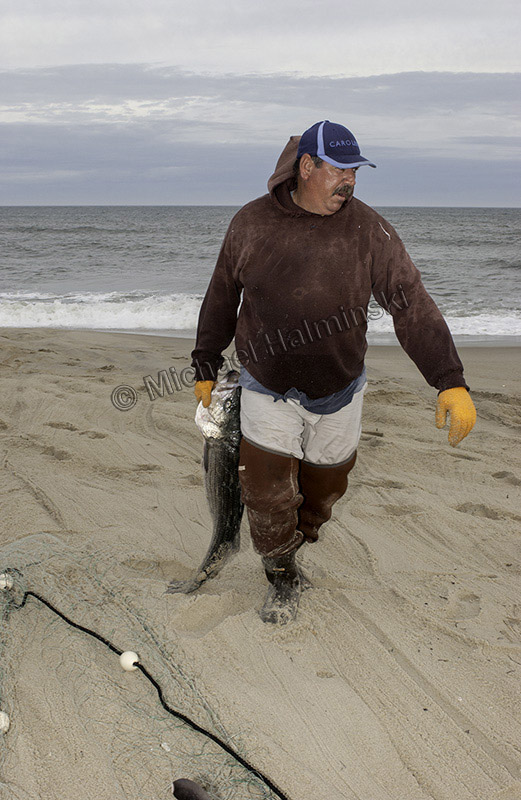
I took this picture in 1978 when Mac had been fishing his nets with Dalton O’Neal. They were just arriving at the Creek in Rodanthe to unload their catch.

In 1984 I caught him taking a break in his dory after beach fishing.

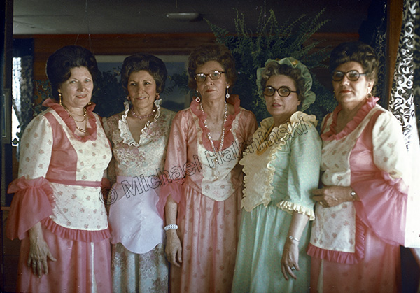
                                The Old Christmas celebration in January of 2000 found Mac leading Ole Buck around the dance floor. It was unusual in that Ole Buck’s normal caretaker John Edgar, was indisposed that night.

It was a sad day in 2006 when Mac passed away. He was iconic. I thought he’d be here forever. In a way, he’s still around, because he was so much larger than life.


Hurricane Hunters

Reading the new issue of CoastWatch, I noticed an announcement that the NOAA Hurricane Awareness Tour is stopping in Raleigh at the RDU airport on May 10th. Two Hurricane Hunter aircraft are open to the public from 2 to 5PM, along with technical specialists and air crews to explain their jobs. The planes for viewing will be a US Air Force Reserve WC-130J and a NOAA G-IV. Staff from the National Weather Service Office in Raleigh, emergency management personel, American Red Cross, and North Carolina Sea Grant will also be on hand.

In 2007, I went to the Coast Guard Air Station in Elizabeth City to check out a similar “open house”. A crew had just landed one of two existing Lockheed WP-3D Orion aircraft used in weather reconnaissance. It was fascinating to see everything up close, personal, and learn from the scientists, pilots and technicians that fly these machines into powerful storms. The experience must be exhilarating yet perilous, but I think I’d go up in a heartbeat.

The Orion is powered by four Allison T56-A-14 turboprop engines rated at 4,600 shp each. The striped pole on the nose is a sample collector. The nose is also equipped with radar.Doppler radar is built into the tail section.

Additional radar is located on the bottom of the aircraft. Radar scans the storm vertically and horizontally for real-time analysis.

Underneath are launching tubes that fire out buoys with transmitters to record ocean temperatures at different depths.

Missions are documented on the fuselage, and I noticed quite a few familiar names. Two in the top row were Australian cyclones Rosa and Kerry in 1979. Occurring in the southern hemisphere, they rotate the opposite way ours do.

Before I entered the aircraft, Cdr. Tom Strong explained the workings of a dropsonde.

The receiving end of the dropsonde tube extends well into the plane.

Inside is a flying science lab for gathering vital information.

Then there’s the cockpit!

These P-3 aircraft, first introduced in the 60’s, have been upgraded and highly modified.

The service they provide makes a difference in public preparedness, and it’s information I’ve used numerous times on Hatteras Island.