Category Archives: buildings

Jim Henry

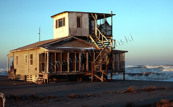
In the late 70’s, when I moved to a house in North Rodanthe, there wasn’t much around at the time… only a few beach boxes with several old family homesteads scattered about. Most prominent in the neighborhood was the Chicamacomico Lifesaving Station complex. I used to wander over and take a lot of pictures of the buildings and surroundings. Part of the allure for me was the dilapidated state of the place. It was a palette for some wonderful photography.
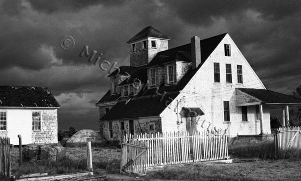
Restoration had not yet begun and it was wide open. It was there that I met an older, gray-haired man who also had an appreciation for the place. He was a federal employee working as an economist for the Civil Aeronautics Board, and was nearing the end of his career in Washington, DC. Jim Henry had been visiting the area for years and purchased a tract of land from ocean to sound in 1953 for $3000. His dream was to build a nice house there and live out his retirement.
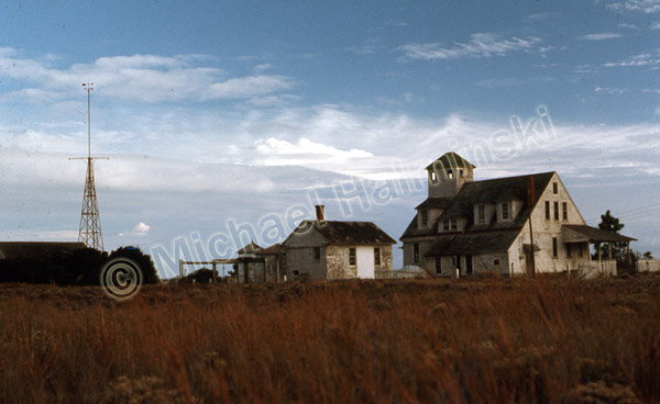
Meanwhile the Chicamacomico Historical Association, the non-profit incorporated in 1974 to promote and restore the old station, was having problems with a lack of good leadership. Long story made short, Jim was suddenly thrust with taking charge of that responsibility. In 1982 he was elected to manage the organization as it’s president. He had an appreciation for the finer things in life, was well-traveled, educated, loved opera and a martini. At the same time he enjoyed the simple life that the villages had to offer.

One of his first tasks was to rehabilitate and open up the main 1911 building to the public. That included getting it weathered in. Through a series of state and federal matching grants, Jim raised $44,000 to finance a new cedar shingled roof and other exterior projects.

As a result on May 1, 1984, Jim was invited to Washington to give a presentation before the U.S. Department of Transportation and the Advisory Council on Historic Preservation. It was there that Jim accepted a prestigious award on behalf of the Chicamacomico Historical Association, largely because of his efforts.

Later he gathered historical photographs to mount exhibits. That’s when Jim met with me. My studio was up and running nearby, and he hired me to make printed copies from archived photographs. I mounted hand-made sepia toned prints on foam board, and those became the first exhibits displayed on the station’s first floor.
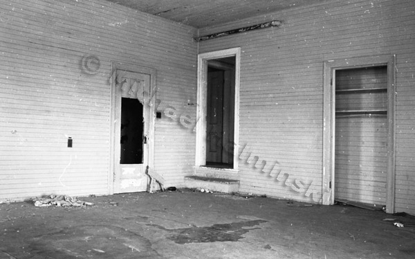
The boatroom of the main building got cleaned up. There was battleship linoleum glued on top of beautiful heart pine flooring, not to mention lead paint covering the walls.

From then on, I was a willing helper to Jim. The Chicamacomico Historical Association rewarded me with a lifetime membership, and subsequently invited me to join the board of directors. I can’t count the number of times that Jim would pull up in my driveway to get some advice or assistance. I’d roll my eyes back and think, “oh, here we go again”. He was somewhat a persistent pain, but I too loved the old station, and always caved in to help.
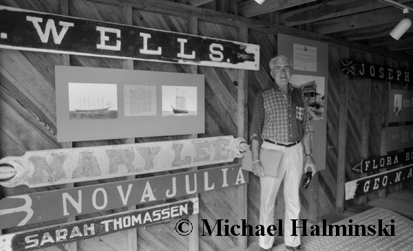
In 1988 we acquired a collection of shipwreck name boards from the Fearing family. An exhibit was mounted in the small boathouse. Jim presided at the grand opening. Fearing family representatives were present along with association members, Coast Guard personnel, historians and media. Jim was really proud of this display to educate the public about shipwrecks.
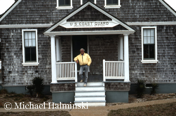
No individual has done so much to save Chicamacomico as Jim Henry. When no one else stepped up to the plate. Jim did. He wanted to tell the station’s history, get it properly restored, and always have free admission to the public. It was a labor of love. He came to the rescue, just in time to save it from falling apart.
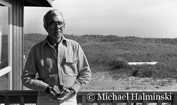
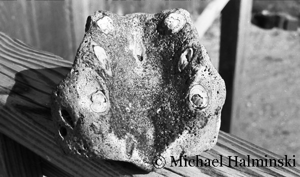
An early morning beach stroller, Jim often came back with what he called “treasures from the sea”. Here he holds a lower jaw from a walrus, deposited thousands of years ago during glacial migration through the Chesapeake Bay.
In 1992, Jim passed away after a short illness, and I was elected to the unenviable position of president for the next 6 years. That’s another story.
Mirlo Madness

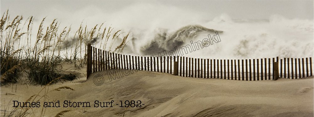
The road conditions at Mirlo Beach continue to plague NCDOT, as well as residents of Hatteras Island. It’s an issue that has been ongoing during the decades that I’ve lived here, and longer.

In the past several years the problem has accelerated and occurs more frequently. NCDOT’s reaction has been to perform the same repairs over and over again. They dig overwashed sand from the road surface, and pile it seaward to build a dune. Storms wash over the dune, moving the sand back onto the road.

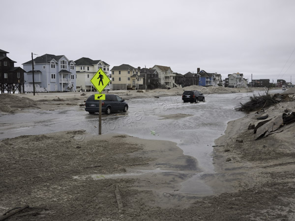
The recent storm that moved off the coast buried the road and left standing water on the surface. I put my boots on and walked there to document the scene in photographs… again.

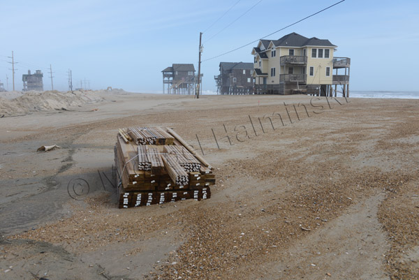
A number of homeowners in the Mirlo Beach subdivision have been trying to repair their condemned rental properties in hopes generating income. A pile of newly delivered lumber lies washed up in the sand. The approach taken to save Mirlo and highway 12 is not working.

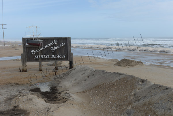
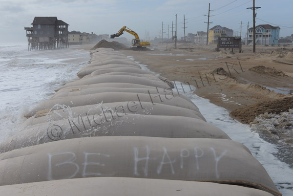
The sign at Mirlo has become a contradiction.

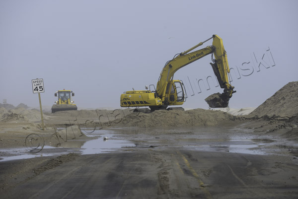
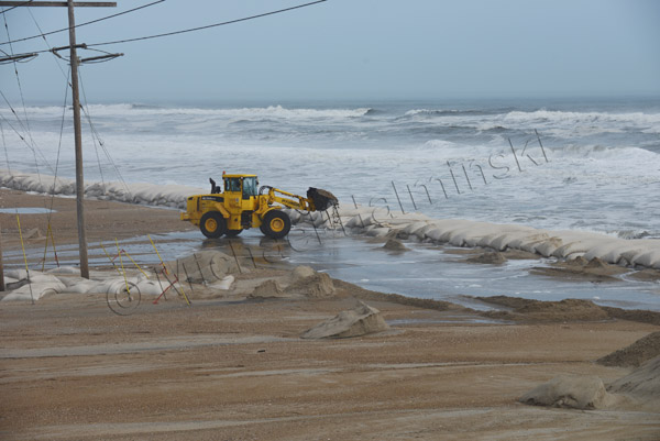
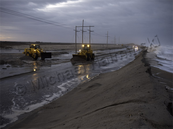
NCDOT’s tools of preference for a fix is heavy equipment, but it’s no match against the power of the sea.

A front end loader is dwarfed in the environment.

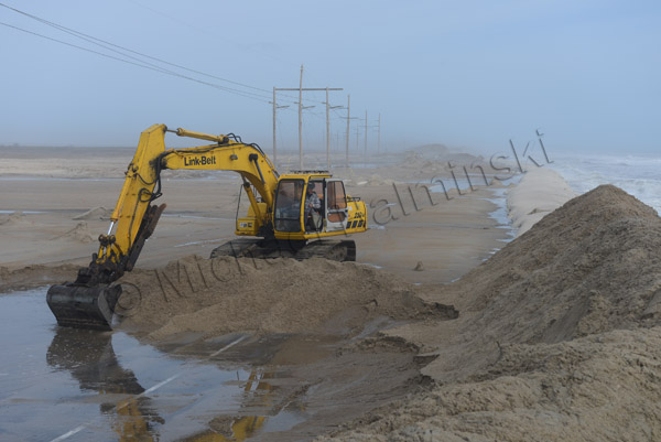
An excavator removes sand from the road surface, and piles it on top of a huge sandbag barrier.

A bit of optimism is expressed in adversity.

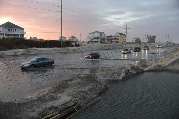
Vehicles endure the salt water to access the island. During periods of high storm tides, the road is impassable.

The loosing battle continues.

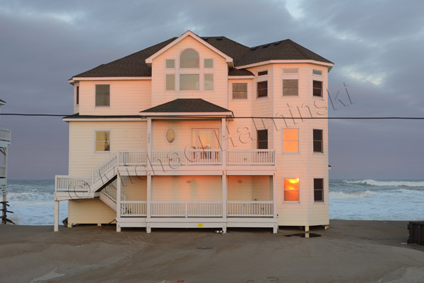
A fixer upper stands tall in a setting sun.


Toes in the Sand

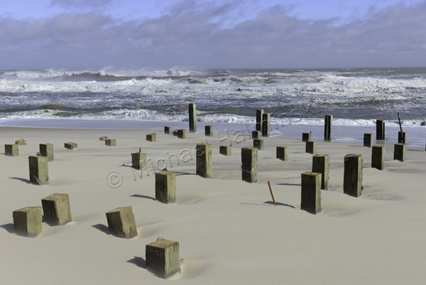
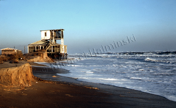
This almost looks like the remains of a relic village from a past civilization. The sands of Cape Hatteras hide many old secrets, like the Lost Colony, shipwrecks and ancient forests. In reality, this is the severed foundation of the first house built on the oceanfront at Mirlo Beach.

As I recall, it was constructed around 1985 and was named East Wind Station. There was a healthy dune in place, and life was good.

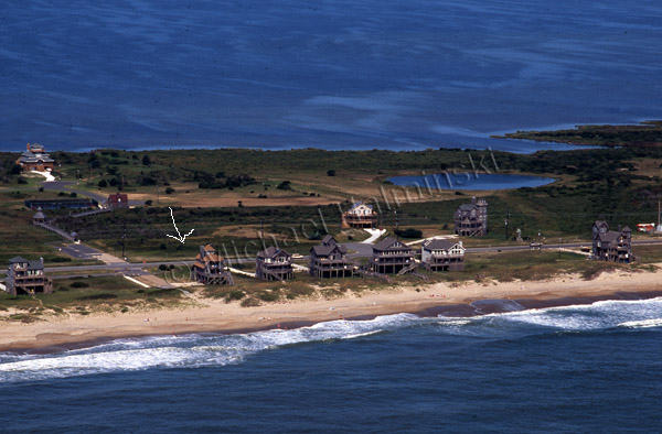
It was renamed Toes in the Sand when it was sold recently to a new owner. My 1991 aerial photograph shows East Wind Station sitting behind a lush dune. It’s the house with the brown roof, just left of center.

Today, life is not so good at Mirlo Beach. Property continues to wash away, and Toes in the Sand is being prepared to be pulled to a location that is a little more secure. It’s fate rests on steel I-beams with wheels, on the side of highway 12 .

In the meantime, stormy seas sweep over the beach with regularity. The road is often impassable at times of high water. So when you drive down, it’s best to come at low tide.

A House on Dean Street

Mirlo Beach isn’t the only area around here loosing houses. Over the years, dozens have gone in from Rodanthe Pier, all the way north through Mirlo. In recent months, the entire oceanfront has seen even more dramatic changes. The road at s-curve is an ongoing battle, and houses on the beach at Rodanthe are more at risk than ever. Nature has an uncanny ability to find a weak spot, and wash it away.

Years ago, when things were less developed, it wasn’t a big issue. But since then, Rodanthe has been significantly built up. Now it’s causing problems.

Right after Christmas, I walked south from East Point to Dean Street. It used to be my neck of the woods, my old back yard. Now many landmarks are gone, claimed by the sea, and I can hardly recognize the place by those standards any more.

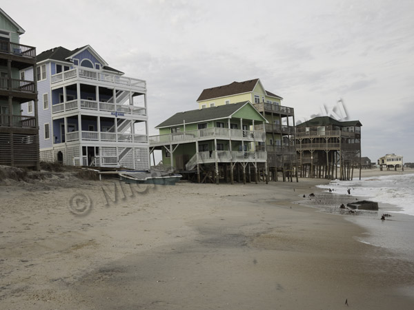
Buildings that used to be three or four lots back from the water, are now derelict on the beach…. or even gone. They are getting caught in the grip of a geologic process that won’t stop.

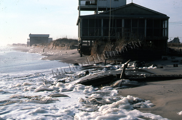
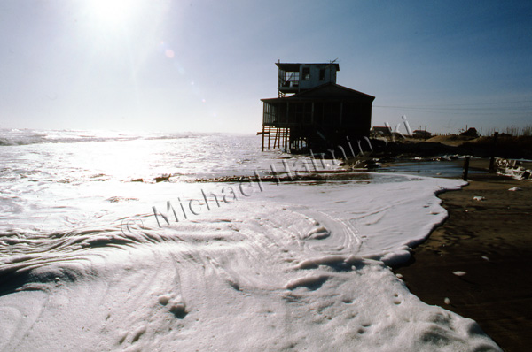
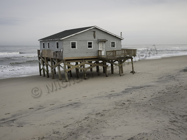
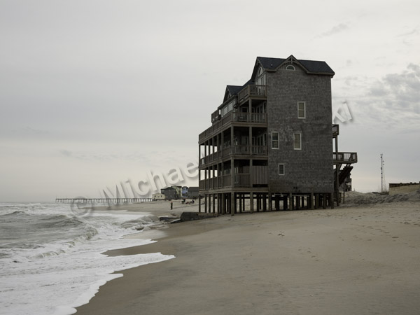
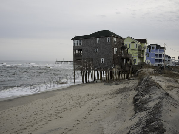
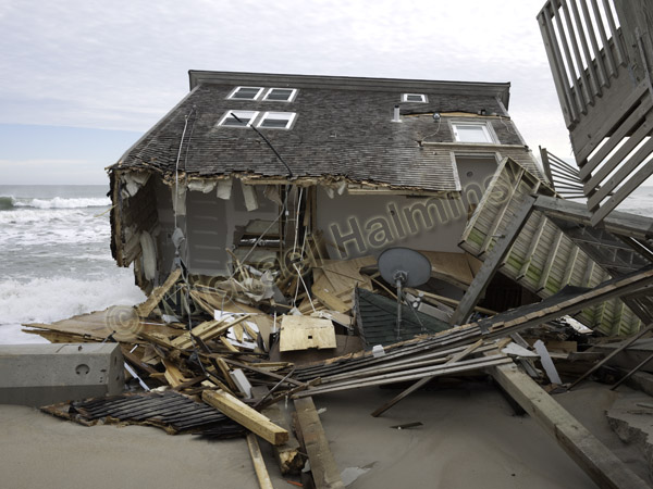
A relatively new house sits precariously on the beach behind Chicamacomico Lifesaving Station.

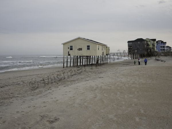
A condemned yellow beach box is north of Dean Street.

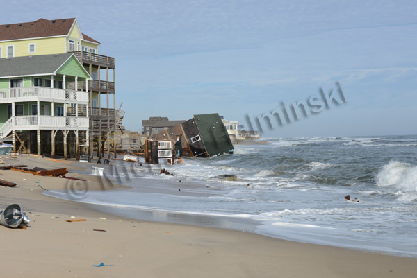
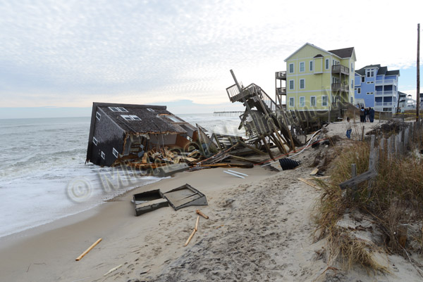
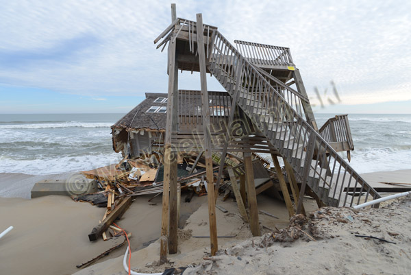
Walking up to this structure at the end of Dean Street, I could tell it wouldn’t stand much longer. Tons of sand have been washed away, greatly compromising the foundation. I’m told that it was built about 5 years ago.

Viewing from the south, this has a “domino effect” look.

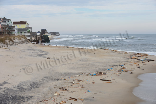
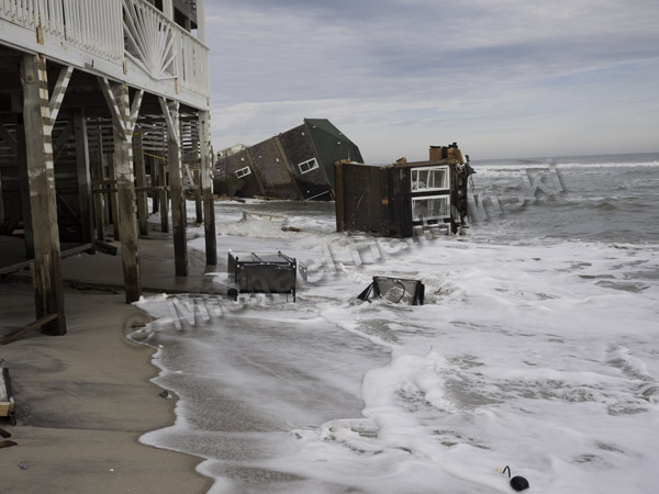
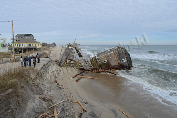
Two days later, it collapsed into the ocean.

Debris is strewn all over the beach, like a shipwreck.

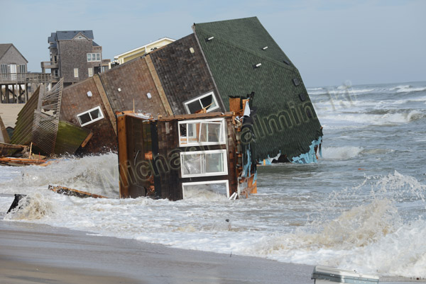
The building continues to break apart.

The Graveyard of the Atlantic claims yet another victim.


Mirlo Beach Today

Two weeks ago I left Hatteras Island for a job in the Florida Keys. The road was washed out so Denise and I rode the ferry to Stumpy Point, a two hour transit to the mainland. It was blowing, and ferry service nearly shut down.

Goodbye Rodanthe!

View on the port side, with a Rodanthe bound ferry passing by.

Seas splash against the starboard side of the ferry.
Upon returning nine days later, we heard the 4×4 road was open, so we made our way south of Oregon Inlet, under police escort at 9 o’clock at night. With moderately brisk winds, the sea was rolling right up to our tire tracks, but we made it. I was amazed in the escalating deterioration of highway 12, compared to a few weeks earlier.
With another low pressure winding by today, I decided to have another look.

Mirlo’s broad side takes another beating.

A property owner’s defense seems fruitless.

The most photographed truck on the island lies abandoned.

The cottage on the right, Toes in the Sand, was the original house built on the oceanfront at Mirlo Beach in the late 80’s. Back then, it was called East Wind.

I just hope the electricity stays on.